28629 – Blk 266 Bus Stop, Routes, Bus Schedule | Singapore
Bus Stop 28629 – Blk 266
Bus Stop 28629 – Blk 266 include routes 176, 187, 188, 188e, 868e, 990
Routes from Blk 266 going to Boon Lay Interchange, Bukit Batok Interchange, Bukit Merah Interchange, Choa Chu Kang Interchange, Harbourfront Interchange
Other routes from Blk 266 include Seventh-Day Advent Church, Bukit Batok West Avenue 5
Travelling today or planning for a commute from Bus Stop Code 28629 – Blk 266? Learn more about Bus Schedule, Route Map and MRT from Blk 266.
NOTICE: The fares and schedules listed here may subject to change without prior notice. Pls check with the companies for the updated details.
CommuteTour is in no way affiliated with any of the buses / trains / tourist spots listed on any of its pages.
Subscribe: youtube.com/@commutetour
28629 – Blk 266 Map
Bus Stop 28629 – Blk 266
Blk 266 Bus Stop Routes
SMRT Bus 176 Details
Bus 176 Schedule
SMRT Bus 176 schedule from Bukit Panjang Interchange to Bukit Merah Interchange is from 05:30 to 23:35 from Monday to Saturday, and 05:45 to 23:35 every Sunday and Holidays while the bus schedule from Bukit Merah Interchange is from 05:45 to 23:30 from Monday to Sunday / Holidays.
| From | Monday to Friday | Saturday | Sunday / Holiday |
|---|---|---|---|
| Bt Panjang Int | 05:30 to 23:35 | 05:30 to 23:35 | 05:45 to 23:35 |
| Bt Merah Int | 05:45 to 23:30 | 05:45 to 23:30 | 05:45 to 23:30 |
| Frequency | Before 8:30 | 08:31 – 16:59 | 17:00 – 19:00 | After 19:00 |
|---|---|---|---|---|
| From Bukit Panjang | 6 – 9 minutes | 6 – 11 minutes | 10 – 11 minutes | 9 – 15 minutes |
| From Bukit Merah | 8 – 9 minutes | 7 – 12 minutes | 7 – 8 minutes | 8 – 13 minutes |
SG Bus 176 Route Map
Bus 176 Route Map
Tap the top right of the map for full screen view. You can return to this page by clicking on the link on the google map description
SMRT Bus 176 Bus Stops
The Bus Stops along SMRT Bus 176 Route include: Angliss Building, Assumption Eng School, Assumption Pathway School, Bukit Batok Polyclinic, Bukit Merah Central, Commonwealth Secondary School, German Center, Glendale Park Condominium, Harbourside Building 2, Hazel Park Terrace, Hillbrooks, Hillington Green Condominium, Hillview Apts, Hillview Hts, International Business Park, Jurong East Library, Jurong Town Hall, Mapletree Business City, Min of Defence, Pandan Gardens, Pasir View Park, Seventh-Day Advent Church, Singapore Food Industries Building, Telok Blangah Hts, The Japanese Secondary School, The Linear, The Petals Condominium, Tien Wah Press Building, West Coast Link, West Coast Park, West Coast View, Wharves Building, Wholesale Center and Yeo’s Building.
Bus 176 passes along Blk 1, Blk 109, Blk 124, Blk 127, Blk 134, Blk 144, Blk 146, Blk 183, Blk 185, Blk 190, Blk 207, Blk 209, Blk 240, Blk 241, Blk 242, Blk 258, Blk 266, Blk 298, Blk 408, Blk 411, Blk 503, Blk 518, Blk 54, Blk 55, Blk 628, Blk 705, Blk 716 and Blk 801c.
MRT Stations along Bus 176 Route include: Bukit Batok, Bukit Panjang, Cashew, Haw Par Villa, Hillview, Labrador Park, Pasir Panjang, Telok Blangah and connects with Bukit Merah Interchange, Bukit Panjang Interchange.
Bukit Panjang Interchange (45009)
Road: Petir Road
Station Code: DT1 BP6
Train Line/s: Downtown Line MRT Bukit Panjang LRT
Terminal: Bukit Panjang InterchangeBlk 183 (44259)
Road: Bukit Panjang RoadBukit Panjang Station Exit A/LRT (44029)
Road: Upper Bukit Timah Road
Station Code: DT1 BP6
Train Line/s: Downtown Line MRT Bukit Panjang LRTThe Linear (44019)
Road: Upper Bukit Timah RoadBefore Hazel Park Terrace (43119)
Road: Upper Bukit Timah RoadCashew Station (43109)
Road: Upper Bukit Timah Road
Station Code: DT2
Train Line/s: Downtown Line MRTAssumption Pathway School (43099)
Road: Upper Bukit Timah RoadAfter Assumption Eng School (43089)
Road: Upper Bukit Timah RoadAfter Hillview Station (43279)
Road: Hillview Road
Station Code: DT3
Train Line/s: Downtown Line MRTHillington Green Condominium (43268)
Road: Hillview AvenueOpposite Hillbrooks (43259)
Road: Hillview AvenueHillview Apts (43249)
Road: Hillview AvenueThe Petals Condominium (43239)
Road: Hillview AvenueBlk 258 (43449)
Road: Bukit Batok East Avenue 2Blk 242 (43439)
Road: Bukit Batok East Avenue 2Blk 240 (43429)
Road: Bukit Batok East Avenue 2After Bukit Batok Station/Blk 628 (43419)
Road: Bukit Batok Central
Station Code: NS2
Train Line/s: North-South Line MRTBukit Batok Polyclinic (43401)
Road: Bukit Batok West Avenue 3Opposite Blk 144 (43321)
Road: Bukit Batok West Avenue 6Blk 109 (43371)
Road: Bukit Batok West Avenue 6Blk 298 (43699)
Road: Bukit Batok Avenue 1Blk 266 (28629)
Road: Jurong East CentralBlk 207 (28319)
Road: Jurong East CentralBefore Seventh-Day Advent Church (28449)
Road: Jurong East CentralBlk 134 (28431)
Road: Jurong East CentralJurong East Library (28249)
Road: Jurong Town Hall RoadOpposite Jurong Town Hall (28239)
Road: Jurong Town Hall RoadGerman Center (28229)
Road: Jurong Town Hall RoadBefore Pandan Gardens (20269)
Road: Jurong Town Hall RoadCommonwealth Secondary School (20259)
Road: Jurong Town Hall RoadBlk 411 (20159)
Road: West Coast RoadBlk 408 (20149)
Road: West Coast RoadOpposite Angliss Building (20139)
Road: West Coast RoadThe Japanese Secondary School (20289)
Road: West Coast HighwayBlk 518 (17339)
Road: West Coast HighwayBlk 705 (17329)
Road: West Coast HighwayBlk 716 (17319)
Road: West Coast HighwayAfter West Coast Link (17369)
Road: West Coast HighwayWest Coast View (17309)
Road: West Coast HighwayBefore Clementi Road (17359)
Road: West Coast HighwayOpposite West Coast Park (17299)
Road: West Coast HighwayBefore Wholesale Center (16249)
Road: West Coast HighwayOpposite Wholesale Center (16239)
Road: West Coast HighwayHaw Par Villa Station (16229)
Road: West Coast Highway
Station Code: CC25
Train Line/s: Circle Line MRTOpposite Wharves Building (16219)
Road: West Coast HighwayPasir View Park (15219)
Road: Pasir Panjang RoadBefore Pasir Panjang Station (15209)
Road: Pasir Panjang Road
Station Code: CC26
Train Line/s: Circle Line MRTOpposite Currency House (15199)
Road: Pasir Panjang Road
Station Code: CC26
Train Line/s: Circle Line MRTHarbourside Building 2 (15169)
Road: Pasir Panjang RoadMapletree Business City (15159)
Road: Pasir Panjang RoadOpposite Labrador Park Station (15149)
Road: Pasir Panjang Road
Station Code: CC27
Train Line/s: Circle Line MRTAfter Alexandra Road (14189)
Road: Telok Blangah RoadYeo’s Building (14179)
Road: Telok Blangah RoadOpposite Telok Blangah Station (14169)
Road: Telok Blangah Road
Station Code: CC28
Train Line/s: Circle Line MRTBlk 54 (14041)
Road: Henderson RoadAfter Telok Blangah Hts (14051)
Road: Henderson RoadOpposite Blk 1 (14241)
Road: Henderson RoadBefore Bukit Merah Central (10331)
Road: Henderson RoadBukit Merah Interchange (10009)
Road: Bukit Merah Central
Terminal: Bukit Merah Interchange
Bukit Merah Interchange (10009)
Road: Bukit Merah Central
Terminal: Bukit Merah InterchangeAfter Bukit Merah Central (10339)
Road: Henderson RoadBlk 1 (14249)
Road: Henderson RoadBefore Telok Blangah Hts (14059)
Road: Henderson RoadOpposite Blk 55 (14049)
Road: Henderson RoadTelok Blangah Station (14161)
Road: Telok Blangah Road
Station Code: CC28
Train Line/s: Circle Line MRTOpposite Yeo’s Building (14171)
Road: Telok Blangah RoadLabrador Park Station (15141)
Road: Pasir Panjang Road
Station Code: CC27
Train Line/s: Circle Line MRTOpposite Mapletree Business City (15151)
Road: Pasir Panjang RoadOpposite Harbourside Building 2 (15161)
Road: Pasir Panjang RoadPasir Panjang Station/Fc (15191)
Road: Pasir Panjang Road
Station Code: CC26
Train Line/s: Circle Line MRTAfter Pasir Panjang Station (15201)
Road: Pasir Panjang Road
Station Code: CC26
Train Line/s: Circle Line MRTOpposite Pasir View Park (15211)
Road: Pasir Panjang RoadWharves Building (16211)
Road: West Coast HighwayOpposite Haw Par Villa Station (16221)
Road: West Coast Highway
Station Code: CC25
Train Line/s: Circle Line MRTWholesale Center (16231)
Road: West Coast HighwayBefore West Coast Park (16241)
Road: West Coast HighwayWest Coast Park (17291)
Road: West Coast HighwayAfter Clementi Road (17351)
Road: West Coast HighwayOpposite West Coast View (17301)
Road: West Coast HighwayOpposite West Coast Link (17361)
Road: West Coast HighwayOpposite Blk 801c (17311)
Road: West Coast HighwayTien Wah Press Building (17321)
Road: West Coast HighwayOpposite Blk 518 (17331)
Road: West Coast HighwayOpposite The Japanese Secondary School (20281)
Road: West Coast HighwaySingapore Food Industries Building (20131)
Road: West Coast RoadOpposite Blk 408 (20141)
Road: West Coast RoadOpposite Blk 411 (20151)
Road: West Coast RoadBefore Teban Gardens Road (20251)
Road: Jurong Town Hall RoadAfter Pandan Gardens (20261)
Road: Jurong Town Hall RoadOpposite German Center (20271)
Road: Jurong Town Hall RoadOpposite International Business Park (28221)
Road: Jurong Town Hall RoadJurong Town Hall (28231)
Road: Jurong Town Hall RoadOpposite Jurong East Library (28241)
Road: Jurong Town Hall RoadBlk 124 (28439)
Road: Jurong East CentralSeventh-Day Advent Church (28441)
Road: Jurong East CentralBlk 209 (28311)
Road: Jurong East CentralBlk 241 (28621)
Road: Jurong East CentralBlk 190 (43691)
Road: Bukit Batok Avenue 1Blk 185 (43379)
Road: Bukit Batok West Avenue 6Blk 146 (43329)
Road: Bukit Batok West Avenue 6Opposite Blk 127 (43409)
Road: Bukit Batok West Avenue 3Opposite Blk 628 (43411)
Road: Bukit Batok Central
Station Code: NS2
Train Line/s: North-South Line MRTBlk 503 (43421)
Road: Bukit Batok East Avenue 2Opposite Blk 242 (43431)
Road: Bukit Batok East Avenue 2Opposite Blk 258 (43441)
Road: Bukit Batok East Avenue 2Opposite The Petals Condominium (43231)
Road: Hillview AvenueOpposite Hillview Apts (43241)
Road: Hillview AvenueHillbrooks (43251)
Road: Hillview AvenueOpposite Hillview Hts (43261)
Road: Hillview AvenueGlendale Park Condominium (43271)
Road: Hillview RoadHillview Station (43061)
Road: Upper Bukit Timah Road
Station Code: DT3
Train Line/s: Downtown Line MRTOpposite Dairy Farm Road (43071)
Road: Upper Bukit Timah RoadOpposite Assumption Eng School (43081)
Road: Upper Bukit Timah RoadBefore Cashew Station (43091)
Road: Upper Bukit Timah Road
Station Code: DT2
Train Line/s: Downtown Line MRTMin of Defence (43111)
Road: Upper Bukit Timah RoadOpposite The Linear (44011)
Road: Upper Bukit Timah RoadBukit Panjang Station Exit B (44021)
Road: Upper Bukit Timah Road
Station Code: DT1 BP6
Train Line/s: Downtown Line MRT Bukit Panjang LRTBukit Panjang Station/Blk 604 (44251)
Road: Bukit Panjang Road
Station Code: DT1 BP6
Train Line/s: Downtown Line MRT Bukit Panjang LRTBukit Panjang Interchange (45009)
Road: Petir Road
Station Code: DT1 BP6
Train Line/s: Downtown Line MRT Bukit Panjang LRT
Terminal: Bukit Panjang Interchange
Feel Free to click any of the Terminal, Transport links above
SMRT Bus 187 Details
Bus 187 Schedule
SMRT Bus 187 schedule from Woodlands Interchange to Boon Lay Interchange is from 05:20 to 23:30 from Monday to Saturday, and 05:30 to 23:45 every Sunday and Holidays while the bus schedule from Boon Lay Interchange is from 05:40 to 24:00 from Monday to Saturday, and 06:00 to 24:00 every Sunday and Holidays.
| From | Monday to Friday | Saturday | Sunday / Holiday |
|---|---|---|---|
| Woodlands Int | 05:20 to 23:30 | 05:20 to 23:30 | 05:30 to 23:45 |
| Boon Lay Int | 05:40 to 24:00 | 05:40 to 24:00 | 06:00 to 24:00 |
| Frequency | Before 8:30 | 08:31 – 16:59 | 17:00 – 19:00 | After 19:00 |
|---|---|---|---|---|
| From Woodlands | 7 – 9 minutes | 5 – 11 minutes | 7 – 13 minutes | 9 – 13 minutes |
| From Boon Lay | 6 – 8 minutes | 6 – 10 minutes | 6 – 9 minutes | 7 – 13 minutes |
SG Bus 187 Route Map
Bus 187 Route Map
Tap the top right of the map for full screen view. You can return to this page by clicking on the link on the google map description
SMRT Bus 187 Bus Stops
The Bus Stops along SMRT Bus 187 Route include: Bukit Batok Driving Center, Bukit Batok Fire Station, Hometeamns, Jurong Polyclinic, Marsiling Mall, Parc Oasis, Summerdale and Zhenghua Primary School.
Bus 187 passes along Blk 102, Blk 173, Blk 174, Blk 183, Blk 190, Blk 200, Blk 223, Blk 225, Blk 229, Blk 239, Blk 241, Blk 246, Blk 252, Blk 26, Blk 266, Blk 270, Blk 298, Blk 305, Blk 306, Blk 315, Blk 316, Blk 320, Blk 331, Blk 334, Blk 336, Blk 347, Blk 402, Blk 419, Blk 422, Blk 425, Blk 441, Blk 457, Blk 458, Blk 463, Blk 490, Blk 501, Blk 515, Blk 628, Blk 644, Blk 662c and Blk 662d.
SMRT Bus 187 Route also connects with the following stations: Boon Lay, Bukit Batok, Bukit Panjang, Lakeside, Marsiling, Phoenix, Teck Whye, Woodlands and the following terminals: Boon Lay Interchange, Woodlands Interchange
Woodlands Interchange (46009)
Road: Woodlands Square
Station Code: NS9 TE2
Train Line/s: North-South Line MRT Thomson-East Coast Line MRT
Terminal: Woodlands InterchangeBlk 347 (46549)
Road: Woodlands Avenue 3Blk 320 (46539)
Road: Woodlands Avenue 3Opposite Marsiling Station (46529)
Road: Woodlands Avenue 3
Station Code: NS8
Train Line/s: North-South Line MRTBlk 402 (46491)
Road: Woodlands Avenue 3Blk 223 (44269)
Road: Bukit Panjang RoadOpposite Zhenghua Primary School (44239)
Road: Bukit Panjang RoadBlk 174 (44249)
Road: Bukit Panjang RoadBlk 183 (44259)
Road: Bukit Panjang RoadOpposite Phoenix Station (44149)
Road: Choa Chu Kang Road
Station Code: BP5
Train Line/s: Bukit Panjang LRTOpposite Blk 26 (44139)
Road: Choa Chu Kang Road
Station Code: BP4
Train Line/s: Bukit Panjang LRTBukit Batok Fire Station (44159)
Road: Bukit Batok RoadBefore Bukit Batok West Avenue 5 (44169)
Road: Bukit Batok RoadOpposite Bukit Batok Driving Center (43529)
Road: Bukit Batok West Avenue 5Opposite Hometeamns (43641)
Road: Bukit Batok West Avenue 7Blk 334 (43831)
Road: Bukit Batok West Avenue 7Blk 331 (43491)
Road: Bukit Batok West Avenue 4Blk 315 (43481)
Road: Bukit Batok West Avenue 2Blk 306 (43471)
Road: Bukit Batok West Avenue 2After Bukit Batok West Avenue 5 (43461)
Road: Bukit Batok West Avenue 2Opposite Blk 628 (43411)
Road: Bukit Batok Central
Station Code: NS2
Train Line/s: North-South Line MRTBlk 225 (43701)
Road: Bukit Batok CentralOpposite Blk 102 (43389)
Road: Bukit Batok Avenue 1Blk 298 (43699)
Road: Bukit Batok Avenue 1Blk 266 (28629)
Road: Jurong East CentralBlk 239 (28321)
Road: Jurong East Avenue 1Blk 229 (28331)
Road: Jurong East Avenue 1Parc Oasis (28451)
Road: Jurong East Avenue 1Blk 347 (28461)
Road: Jurong East Avenue 1Opposite Jurong Polyclinic (28491)
Road: Jurong East Avenue 1Blk 490 (28501)
Road: Jurong West Avenue 1Blk 463 (28511)
Road: Jurong West Avenue 1Blk 457 (28521)
Road: Jurong West Avenue 1Blk 458 (28399)
Road: Jurong West Street 51Opposite Blk 515 (28389)
Road: Jurong West Street 51Lakeside Station (28091)
Road: Boon Lay Way
Station Code: EW26
Train Line/s: East-West Line MRTOpposite Blk 200 (21681)
Road: Boon Lay WayOpposite Summerdale (21691)
Road: Boon Lay WayBlk 662d (22491)
Road: Jurong West Street 64
Station Code: EW27
Train Line/s: East-West Line MRTBoon Lay Interchange (22009)
Road: Jurong West Central 3
Station Code: EW27
Train Line/s: East-West Line MRT
Terminal: Boon Lay Interchange
Boon Lay Interchange (22009)
Road: Jurong West Central 3
Station Code: EW27
Train Line/s: East-West Line MRT
Terminal: Boon Lay InterchangeOpposite Blk 662c (22499)
Road: Jurong West Street 64
Station Code: EW27
Train Line/s: East-West Line MRTSummerdale (21699)
Road: Boon Lay WayBlk 200 (21689)
Road: Boon Lay WayOpposite Lakeside Station (28099)
Road: Boon Lay Way
Station Code: EW26
Train Line/s: East-West Line MRTBlk 515 (28381)
Road: Jurong West Street 51Blk 501 (28391)
Road: Jurong West Street 51Blk 441 (28529)
Road: Jurong West Avenue 1Blk 425 (28519)
Road: Jurong West Avenue 1Blk 422 (28509)
Road: Jurong West Avenue 1Jurong Polyclinic (28499)
Road: Jurong East Avenue 1Blk 316 (28469)
Road: Jurong East Avenue 1Opposite Parc Oasis (28459)
Road: Jurong East Avenue 1Blk 252 (28339)
Road: Jurong East Avenue 1Blk 246 (28329)
Road: Jurong East Avenue 1Blk 241 (28621)
Road: Jurong East CentralBlk 190 (43691)
Road: Bukit Batok Avenue 1Blk 102 (43381)
Road: Bukit Batok Avenue 1Blk 644 (43709)
Road: Bukit Batok CentralAfter Bukit Batok Station/Blk 628 (43419)
Road: Bukit Batok Central
Station Code: NS2
Train Line/s: North-South Line MRTBefore Bukit Batok West Avenue 5 (43469)
Road: Bukit Batok West Avenue 2Opposite Blk 305 (43479)
Road: Bukit Batok West Avenue 2Opposite Blk 315 (43489)
Road: Bukit Batok West Avenue 2Blk 419 (43499)
Road: Bukit Batok West Avenue 4Opposite Blk 336 (43839)
Road: Bukit Batok West Avenue 7Hometeamns (43649)
Road: Bukit Batok West Avenue 7Bukit Batok Driving Center (43521)
Road: Bukit Batok West Avenue 5After Bukit Batok West Avenue 5 (44161)
Road: Bukit Batok RoadOpposite Bukit Batok Fire Station (44151)
Road: Bukit Batok RoadBlk 26 (44131)
Road: Choa Chu Kang Road
Station Code: BP4
Train Line/s: Bukit Panjang LRTPhoenix Station (44141)
Road: Choa Chu Kang Road
Station Code: BP5
Train Line/s: Bukit Panjang LRTBukit Panjang Station/Blk 604 (44251)
Road: Bukit Panjang Road
Station Code: DT1 BP6
Train Line/s: Downtown Line MRT Bukit Panjang LRTOpposite Lompang Road (44241)
Road: Bukit Panjang RoadZhenghua Primary School (44231)
Road: Bukit Panjang RoadBlk 270 (44261)
Road: Bukit Panjang RoadOpposite Blk 402 (46499)
Road: Woodlands Avenue 3Marsiling Station (46521)
Road: Woodlands Avenue 3
Station Code: NS8
Train Line/s: North-South Line MRTBlk 173 (46531)
Road: Woodlands Avenue 3Marsiling Mall (46541)
Road: Woodlands Avenue 3Woodlands Interchange (46009)
Road: Woodlands Square
Station Code: NS9 TE2
Train Line/s: North-South Line MRT Thomson-East Coast Line MRT
Terminal: Woodlands Interchange
Feel Free to click any of the Terminal, Transport links above
SMRT Bus 188 Details
Bus 188 Schedule
SMRT Bus 188 schedule from Choa Chu Kang Interchange to HarbourFront Interchange is from 05:30 to 23:00 from Monday to Sunday / Holidays while the bus schedule from HarbourFront Interchange is from 06:00 to 23:30 from Monday to Saturday, and 06:30 to 23:30 every Sunday and Holidays.
| From | Monday to Friday | Saturday | Sunday / Holiday |
|---|---|---|---|
| Choa Chu Kang Int | 05:30 to 23:00 | 05:30 to 23:00 | 05:30 to 23:00 |
| HarbourFront Int | 06:00 to 23:30 | 06:00 to 23:30 | 06:30 to 23:30 |
| Frequency | Before 8:30 | 08:31 – 16:59 | 17:00 – 19:00 | After 19:00 |
|---|---|---|---|---|
| From Choa Chu Kang | 5 – 10 minutes | 7 – 16 minutes | 7 – 13 minutes | 13 – 14 minutes |
| From HarbourFront | 9 – 14 minutes | 7 – 16 minutes | 7 – 8 minutes | 8 – 14 minutes |
SG Bus 188 Route Map
Bus 188 Route Map
Tap the top right of the map for full screen view. You can return to this page by clicking on the link on the google map description
SMRT Bus 188 Bus Stops
The Bus Stops along SMRT Bus 188 Route include: 8 @ Tradehub 21, 8 @tradehub 21, Barossa Gardens, Boon Lay Sub Stn, Bukit Batok Driving Center, Bukit Batok Fire Station, Bukit Batok Polyclinic, Caribbean At Keppel Bay, Christian Community Chapel, Clementi Flyover, Clementi Stadium, Clementi Swim Complex, Gloria Mansion, Harbourside Building 2, Heng Mui Keng Terrace, Hometeamns, Horizon Residences, Imm Building, Jamiyah Halfway House, Luxe Ville, Mapletree Business City, Nan Hua Primary School, Nus Fac of Architecture, Nus Fac of Engineering, Nus High School, Palm Green Condominium, Pasir Panjang Po, Pasir View Park, Regent Park, Singapore Science Park Ii, Tentera Diraja Mosque, The Crystal Tabernacle Church, The Japanese Primary School, The Synergy, Whitehaven and Yeo’s Building.
Bus 188 passes along Blk 109, Blk 113, Blk 127, Blk 144, Blk 146, Blk 185, Blk 190, Blk 203, Blk 239, Blk 241, Blk 266, Blk 284, Blk 286a, Blk 288d, Blk 288e, Blk 298, Blk 305, Blk 306, Blk 315, Blk 331, Blk 334, Blk 336, Blk 352, Blk 414, Blk 419, Blk 426, Blk 431, Blk 610 and Blks 237/239.
MRT Stations along Bus 188 Route include: Choa Chu Kang, Harbourfront, Haw Par Villa, Keat Hong, Labrador Park, Pasir Panjang, South View, Telok Blangah, Vivo City and connects with Choa Chu Kang Interchange, Harbourfront Interchange, Kent Ridge Terminal.
Choa Chu Kang Interchange (44009)
Road: Choa Chu Kang Loop
Station Code: NS4
Train Line/s: North-South Line MRT
Terminal: Choa Chu Kang InterchangeBlk 352 (44461)
Road: Choa Chu Kang WayBefore South View Station (44451)
Road: Choa Chu Kang Way
Station Code: BP2
Train Line/s: Bukit Panjang LRTBlk 239 (44441)
Road: Choa Chu Kang Way
Station Code: BP3
Train Line/s: Bukit Panjang LRTBlk 113 (44121)
Road: Choa Chu Kang WayBukit Batok Fire Station (44159)
Road: Bukit Batok RoadBefore Bukit Batok West Avenue 5 (44169)
Road: Bukit Batok RoadOpposite Bukit Batok Driving Center (43529)
Road: Bukit Batok West Avenue 5Opposite Hometeamns (43641)
Road: Bukit Batok West Avenue 7Blk 334 (43831)
Road: Bukit Batok West Avenue 7Blk 331 (43491)
Road: Bukit Batok West Avenue 4Blk 315 (43481)
Road: Bukit Batok West Avenue 2Blk 306 (43471)
Road: Bukit Batok West Avenue 2After Bukit Batok West Avenue 5 (43461)
Road: Bukit Batok West Avenue 2Bukit Batok Polyclinic (43401)
Road: Bukit Batok West Avenue 3Opposite Blk 144 (43321)
Road: Bukit Batok West Avenue 6Blk 109 (43371)
Road: Bukit Batok West Avenue 6Blk 298 (43699)
Road: Bukit Batok Avenue 1Blk 266 (28629)
Road: Jurong East CentralOpposite Blk 288d (28631)
Road: Toh Guan RoadBlk 284 (28641)
Road: Toh Guan RoadOpposite Imm Building (28651)
Road: Toh Guan RoadOpposite The Synergy (28049)
Road: Boon Lay WayAfter Boon Lay Sub Stn (28039)
Road: Boon Lay Way8 @ Tradehub 21 (28029)
Road: Boon Lay WayAfter Toh Tuck Avenue (28019)
Road: Commonwealth Avenue WestBlk 203 (20109)
Road: Commonwealth Avenue WestOpposite Regent Park (17051)
Road: Clementi Avenue 6Blk 431 (20019)
Road: AYEBlk 426 (17149)
Road: AYEAfter Clementi Swim Complex (17139)
Road: AYENus High School (17191)
Road: Clementi RoadNus Fac of Engineering (16159)
Road: Clementi RoadNus Fac of Architecture (16149)
Road: Clementi RoadBefore Kent Ridge Terminal (16139)
Road: Clementi Road
Terminal: Kent Ridge TerminalAfter Clementi Road (16089)
Road: Pasir Panjang RoadBefore Pasir Panjang Po (16079)
Road: Pasir Panjang RoadHeng Mui Keng Terrace (16069)
Road: Pasir Panjang RoadJamiyah Halfway House (16059)
Road: Pasir Panjang RoadWhitehaven (16049)
Road: Pasir Panjang RoadSingapore Science Park Ii (16039)
Road: Pasir Panjang RoadGloria Mansion (16029)
Road: Pasir Panjang RoadHaw Par Villa Station (16019)
Road: Pasir Panjang Road
Station Code: CC25
Train Line/s: Circle Line MRTHorizon Residences (16209)
Road: Pasir Panjang RoadBefore South Buona Vista Road (15229)
Road: Pasir Panjang RoadPasir View Park (15219)
Road: Pasir Panjang RoadBefore Pasir Panjang Station (15209)
Road: Pasir Panjang Road
Station Code: CC26
Train Line/s: Circle Line MRTOpposite Currency House (15199)
Road: Pasir Panjang Road
Station Code: CC26
Train Line/s: Circle Line MRTHarbourside Building 2 (15169)
Road: Pasir Panjang RoadMapletree Business City (15159)
Road: Pasir Panjang RoadOpposite Labrador Park Station (15149)
Road: Pasir Panjang Road
Station Code: CC27
Train Line/s: Circle Line MRTAfter Alexandra Road (14189)
Road: Telok Blangah RoadYeo’s Building (14179)
Road: Telok Blangah RoadOpposite Telok Blangah Station (14169)
Road: Telok Blangah Road
Station Code: CC28
Train Line/s: Circle Line MRTBefore Christian Community Chapel (14159)
Road: Telok Blangah RoadBefore Seah Im Road (14139)
Road: Telok Blangah RoadHarbourfront Interchange (14009)
Road: Seah Im Road
Station Code: CC29 NE1 S1
Train Line/s: Circle Line MRT North East Line MRT Sentosa Express Monorail
Terminal: Harbourfront Interchange
Harbourfront Interchange (14009)
Road: Seah Im Road
Station Code: CC29 NE1 S1
Train Line/s: Circle Line MRT North East Line MRT Sentosa Express Monorail
Terminal: Harbourfront InterchangeCaribbean At Keppel Bay (14131)
Road: Telok Blangah RoadOpposite Christian Community Chapel (14151)
Road: Telok Blangah RoadTelok Blangah Station (14161)
Road: Telok Blangah Road
Station Code: CC28
Train Line/s: Circle Line MRTOpposite Yeo’s Building (14171)
Road: Telok Blangah RoadLabrador Park Station (15141)
Road: Pasir Panjang Road
Station Code: CC27
Train Line/s: Circle Line MRTOpposite Mapletree Business City (15151)
Road: Pasir Panjang RoadOpposite Harbourside Building 2 (15161)
Road: Pasir Panjang RoadPasir Panjang Station/Fc (15191)
Road: Pasir Panjang Road
Station Code: CC26
Train Line/s: Circle Line MRTAfter Pasir Panjang Station (15201)
Road: Pasir Panjang Road
Station Code: CC26
Train Line/s: Circle Line MRTAfter South Buona Vista Road (15221)
Road: Pasir Panjang RoadBarossa Gardens (16201)
Road: Pasir Panjang RoadOpposite Haw Par Villa Station (16011)
Road: Pasir Panjang Road
Station Code: CC25
Train Line/s: Circle Line MRTOpposite Gloria Mansion (16021)
Road: Pasir Panjang RoadOpposite Singapore Science Park Ii (16031)
Road: Pasir Panjang RoadOpposite Luxe Ville (16041)
Road: Pasir Panjang RoadThe Crystal Tabernacle Church (16051)
Road: Pasir Panjang RoadOpposite Heng Mui Keng Terrace (16061)
Road: Pasir Panjang RoadOpposite Pasir Panjang Po (16071)
Road: Pasir Panjang RoadAfter Palm Green Condominium (16081)
Road: Pasir Panjang RoadOpposite Kent Ridge Terminal (16131)
Road: Clementi Road
Terminal: Kent Ridge TerminalTentera Diraja Mosque (16141)
Road: Clementi RoadThe Japanese Primary School (16151)
Road: Clementi RoadBlk 610 (17121)
Road: AYEClementi Flyover (17131)
Road: AYEClementi Stadium (17141)
Road: AYERegent Park (17059)
Road: Clementi Avenue 6Nan Hua Primary School (20101)
Road: Commonwealth Avenue WestBefore Toh Tuck Avenue (28011)
Road: Commonwealth Avenue WestOpposite 8 @tradehub 21 (28021)
Road: Boon Lay WayBefore The Synergy (28031)
Road: Boon Lay WayThe Synergy (28041)
Road: Boon Lay WayImm Building (28659)
Road: Toh Guan RoadBlk 286a (28649)
Road: Toh Guan RoadBlk 288e (28639)
Road: Toh Guan RoadBlk 241 (28621)
Road: Jurong East CentralBlk 190 (43691)
Road: Bukit Batok Avenue 1Blk 185 (43379)
Road: Bukit Batok West Avenue 6Blk 146 (43329)
Road: Bukit Batok West Avenue 6Opposite Blk 127 (43409)
Road: Bukit Batok West Avenue 3Before Bukit Batok West Avenue 5 (43469)
Road: Bukit Batok West Avenue 2Opposite Blk 305 (43479)
Road: Bukit Batok West Avenue 2Opposite Blk 315 (43489)
Road: Bukit Batok West Avenue 2Blk 419 (43499)
Road: Bukit Batok West Avenue 4Opposite Blk 336 (43839)
Road: Bukit Batok West Avenue 7Hometeamns (43649)
Road: Bukit Batok West Avenue 7Bukit Batok Driving Center (43521)
Road: Bukit Batok West Avenue 5After Bukit Batok West Avenue 5 (44161)
Road: Bukit Batok RoadOpposite Bukit Batok Fire Station (44151)
Road: Bukit Batok RoadOpposite Blk 113 (44129)
Road: Choa Chu Kang WayOpposite Blks 237/239 (44449)
Road: Choa Chu Kang Way
Station Code: BP3
Train Line/s: Bukit Panjang LRTOpposite South View Station (44459)
Road: Choa Chu Kang Way
Station Code: BP2
Train Line/s: Bukit Panjang LRTBlk 414 (44469)
Road: Choa Chu Kang WayChoa Chu Kang Interchange (44009)
Road: Choa Chu Kang Loop
Station Code: NS4
Train Line/s: North-South Line MRT
Terminal: Choa Chu Kang Interchange
Feel Free to click any of the Terminal, Transport links above
SMRT Bus 188e Details
Bus 188e Schedule
SMRT Bus 188e schedule from Choa Chu Kang Interchange to HarbourFront Interchange is from 07:08 to 07:23 from Monday to Friday.
| From | Monday to Friday | Saturday | Sunday / Holiday |
|---|---|---|---|
| Choa Chu Kang Int | 07:08 to 07:23 |
| Frequency | Before 8:30 | 08:31 – 16:59 | 17:00 – 19:00 | After 19:00 |
|---|---|---|---|---|
| From Choa Chu Kang | 15 minutes |
SG Bus 188e Route Map
Bus 188e Route Map
Tap the top right of the map for full screen view. You can return to this page by clicking on the link on the google map description
SMRT Bus 188e Bus Stops
The Bus Stops along SMRT Bus 188e Route include: Bukit Batok Polyclinic, Harbourside Building 2, Hometeamns, Imm Building, Mapletree Business City, Nus Fac of Architecture and Nus Fac of Engineering.
Bus 188e passes along Blk 109, Blk 113, Blk 144, Blk 239, Blk 266, Blk 284, Blk 288d, Blk 298, Blk 306, Blk 315, Blk 331, Blk 334, Blk 352 and Blk 431.
SMRT Bus 188E Route also connects with the following stations: Choa Chu Kang, Harbourfront, Keat Hong, Labrador Park, Pasir Panjang, South View, Vivo City and the following terminals: Choa Chu Kang Interchange, Harbourfront Interchange, Kent Ridge Terminal
Choa Chu Kang Interchange (44009)
Road: Choa Chu Kang Loop
Station Code: NS4
Train Line/s: North-South Line MRT
Terminal: Choa Chu Kang InterchangeBlk 352 (44461)
Road: Choa Chu Kang WayBefore South View Station (44451)
Road: Choa Chu Kang Way
Station Code: BP2
Train Line/s: Bukit Panjang LRTBlk 239 (44441)
Road: Choa Chu Kang Way
Station Code: BP3
Train Line/s: Bukit Panjang LRTBlk 113 (44121)
Road: Choa Chu Kang WayOpposite Hometeamns (43641)
Road: Bukit Batok West Avenue 7Blk 334 (43831)
Road: Bukit Batok West Avenue 7Blk 331 (43491)
Road: Bukit Batok West Avenue 4Blk 315 (43481)
Road: Bukit Batok West Avenue 2Blk 306 (43471)
Road: Bukit Batok West Avenue 2After Bukit Batok West Avenue 5 (43461)
Road: Bukit Batok West Avenue 2Bukit Batok Polyclinic (43401)
Road: Bukit Batok West Avenue 3Opposite Blk 144 (43321)
Road: Bukit Batok West Avenue 6Blk 109 (43371)
Road: Bukit Batok West Avenue 6Blk 298 (43699)
Road: Bukit Batok Avenue 1Blk 266 (28629)
Road: Jurong East CentralOpposite Blk 288d (28631)
Road: Toh Guan RoadBlk 284 (28641)
Road: Toh Guan RoadOpposite Imm Building (28651)
Road: Toh Guan RoadBlk 431 (20019)
Road: AYENus Fac of Engineering (16159)
Road: Clementi RoadNus Fac of Architecture (16149)
Road: Clementi RoadBefore Kent Ridge Terminal (16139)
Road: Clementi Road
Terminal: Kent Ridge TerminalOpposite Currency House (15199)
Road: Pasir Panjang Road
Station Code: CC26
Train Line/s: Circle Line MRTHarbourside Building 2 (15169)
Road: Pasir Panjang RoadMapletree Business City (15159)
Road: Pasir Panjang RoadOpposite Labrador Park Station (15149)
Road: Pasir Panjang Road
Station Code: CC27
Train Line/s: Circle Line MRTHarbourfront Interchange (14009)
Road: Seah Im Road
Station Code: CC29 NE1 S1
Train Line/s: Circle Line MRT North East Line MRT Sentosa Express Monorail
Terminal: Harbourfront Interchange
SMRT Bus 868e Details
Bus 868E Schedule
SMRT Bus 868E schedule from Bukit Batok West Avenue 5 to Promenade Station is from 07:30 to 07:45 from Monday to Friday.
| From | Monday to Friday | Saturday | Sunday / Holiday |
|---|---|---|---|
| Bt Batok West Ave 5 | 07:30 to 07:45 |
| Frequency | Before 6:30 AM | 8:31 to 16:59 | 17:00 –19:00 | After 19:01 |
|---|---|---|---|---|
| Weekdays | ||||
| Saturdays | ||||
| Sundays / Public Holidays |
SG Bus 868e Route Map
Bus 868E Route Map
Tap the top right of the map for full screen view. You can return to this page by clicking on the link on the google map description
SMRT Bus 868e Bus Stops
The Bus Stops along SMRT Bus 868E Route include: Bukit Batok Polyclinic, Capital Tower, Esplanade Bridge, German Center, Hometeamns, Hub Synergy Point and So Sofitel Singapore.
Bus 868E passes along Blk 109, Blk 144, Blk 266, Blk 284, Blk 288d, Blk 298, Blk 306, Blk 315, Blk 331, Blk 334 and Blk 347.
SMRT Bus 868E Route also connects with the following stations: Esplanade, Promenade, Raffles Place
Blk 347 (43581)
Road: Bukit Batok West Avenue 5Opposite Hometeamns (43641)
Road: Bukit Batok West Avenue 7Blk 334 (43831)
Road: Bukit Batok West Avenue 7Blk 331 (43491)
Road: Bukit Batok West Avenue 4Blk 315 (43481)
Road: Bukit Batok West Avenue 2Blk 306 (43471)
Road: Bukit Batok West Avenue 2Bukit Batok Polyclinic (43401)
Road: Bukit Batok West Avenue 3Opposite Blk 144 (43321)
Road: Bukit Batok West Avenue 6Blk 109 (43371)
Road: Bukit Batok West Avenue 6Blk 298 (43699)
Road: Bukit Batok Avenue 1Blk 266 (28629)
Road: Jurong East CentralOpposite Blk 288d (28631)
Road: Toh Guan RoadBlk 284 (28641)
Road: Toh Guan RoadGerman Center (28229)
Road: Jurong Town Hall RoadHub Synergy Point (03222)
Road: Anson RoadAfter Capital Tower (03111)
Road: Robinson RoadOpposite So Sofitel Singapore (03071)
Road: Robinson RoadRaffles Place Station Exit F (03031)
Road: Robinson Road
Station Code: EW14 NS26
Train Line/s: East-West Line MRT North-South Line MRTFullerton Square (03011)
Road: Fullerton Road
Station Code: EW14 NS26
Train Line/s: East-West Line MRT North-South Line MRTEsplanade Bridge (02111)
Road: Esplanade DriveSuntec Convention Center (02151)
Road: Temasek Boulevard
Station Code: CC3
Train Line/s: Circle Line MRTPromenade Station (02161)
Road: Temasek Avenue
Station Code: DT15 CC4
Train Line/s: Downtown Line MRT Circle Line MRT
Tower Transit Bus 990 Details
| Category | Information |
|---|---|
| Bus Route | 990 |
| Operator | Tower Transit |
| Dir 1 # of Stops | 28 |
| Origin | Bukit Batok Interchange |
| Destination | Jurong Gateway Road |
| Direction | Loop |
Bus 990 Schedule
Tower Transit Bus 990 schedule from Bukit Batok Interchange to Jurong Gateway Road is from 05:45 to 24:00 from Monday to Sunday / Holidays.
| From | Monday to Friday | Saturday | Sunday / Holiday |
|---|---|---|---|
| Bt Batok Int | 05:45 to 24:00 | 05:45 to 24:00 | 05:45 to 24:00 |
| Frequency | Before 8:30 | 08:31 – 16:59 | 17:00 – 19:00 | After 19:00 |
|---|---|---|---|---|
| From Bukit Batok | 11 minutes | 13 – 15 minutes | 12 – 14 minutes | 12 – 14 minutes |
SG Bus 990 Route Map
Bus 990 Route Map
Tap the top right of the map for full screen view. You can return to this page by clicking on the link on the google map description
Tower Transit Bus 990 Bus Stops
The Bus Stops along Tower Transit Bus 990 Route include: Bukit Batok Swim Complex, Bukit View Secondary School, Imm Building, Keming Primary School, Ng Teng Fong Gen Hospital, Ng Teng Fong General Hospital and Seventh-Day Advent Church.
Bus 990 passes along Blk 190, Blk 229, Blk 231, Blk 241, Blk 266, Blk 283, Blk 284, Blk 286a, Blk 288d, Blk 288e, Blk 291a and Blk 298.
Tower Transit Bus 990 Route also connects with the following stations: Bukit Batok, Jurong East and terminal: Bukit Batok Interchange
Bukit Batok Interchange (43009)
Road: Bukit Batok Central
Station Code: NS2
Train Line/s: North-South Line MRT
Terminal: Bukit Batok InterchangeBlk 231 (43179)
Road: Bukit Batok East Avenue 3Blk 283 (43189)
Road: Bukit Batok East Avenue 3Blk 291a (43149)
Road: Bukit Batok East Avenue 6Opposite Bukit View Secondary School (43591)
Road: Bukit Batok East Avenue 6Bukit Batok Swim Complex (43511)
Road: Bukit Batok East Avenue 6Blk 298 (43699)
Road: Bukit Batok Avenue 1Blk 266 (28629)
Road: Jurong East CentralOpposite Blk 288d (28631)
Road: Toh Guan RoadBlk 284 (28641)
Road: Toh Guan RoadOpposite Imm Building (28651)
Road: Toh Guan RoadOpposite Ng Teng Fong Gen Hospital (28051)
Road: Boon Lay WayJ Gateway (28061)
Road: Boon Lay Way
Station Code: EW24 NS1
Train Line/s: East-West Line MRT North-South Line MRTBefore Seventh-Day Advent Church (28449)
Road: Jurong East CentralBefore Jurong East Station (28211)
Road: Jurong Gateway Road
Station Code: EW24 NS1
Train Line/s: East-West Line MRT North-South Line MRTOpposite The Jtc Summit (28201)
Road: Jurong Gateway Road
Station Code: EW24 NS1
Train Line/s: East-West Line MRT North-South Line MRTNg Teng Fong General Hospital (28059)
Road: Boon Lay WayImm Building (28659)
Road: Toh Guan RoadBlk 286a (28649)
Road: Toh Guan RoadBlk 288e (28639)
Road: Toh Guan RoadBlk 241 (28621)
Road: Jurong East CentralBlk 190 (43691)
Road: Bukit Batok Avenue 1Opposite Bukit Batok Swim Complex (43519)
Road: Bukit Batok East Avenue 6Bukit View Secondary School (43599)
Road: Bukit Batok East Avenue 6Opposite Blk 291a (43141)
Road: Bukit Batok East Avenue 6Keming Primary School (43181)
Road: Bukit Batok East Avenue 3Blk 229 (43171)
Road: Bukit Batok East Avenue 3Bukit Batok Interchange (43009)
Road: Bukit Batok Central
Station Code: NS2
Train Line/s: North-South Line MRT
Terminal: Bukit Batok Interchange
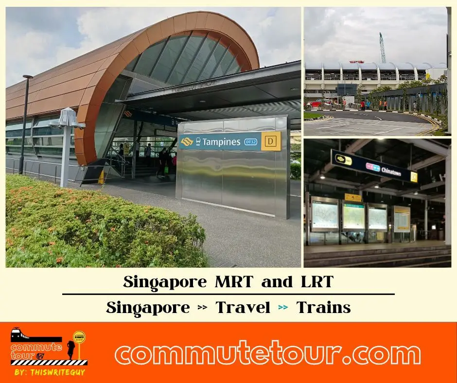
Singapore MRT / LRT Map
Singapore MRT / LRT Map. You can remove the other lines by tapping the top left corner of the map with arrow and unchecking the box/es.
Click here to search for MRT / LRT Station
Singapore MRT / LRT Map
Click the MRT / LRT Line below for more details.
MRT
LRT
Monorail
Cross Border
Featured
Click the time stamps below