SG Bus Route 93 Schedule, Bus Stops and Route Map from HarbourFront Interchange to Eunos Interchange | Singapore
Bus Route 93
Singapore Bus Route 93 from HarbourFront Interchange to Eunos Interchange operated by SBS Transit passes along Adam Road, Airport Road, Alexandra Road, Bartley Road, Braddell Road, Changi Road, Eunos Link, Eunos Road 2, Farrer Road, Jalan Eunos, Jalan Turi, Lornie Highway, Lornie Road, Queensway, Seah Im Road, Sims Avenue, Telok Blangah Road, Thomson Road, Upper Paya Lebar Road.
Bus Service 93 also connects with East West MRT Line EW7; Circle Line MRT CC11, CC12, CC20, CC28, CC29 and North East MRT Line NE1.
Travelling today or planning for a commute via SBS Transit Route code 93? Learn more about the SG Bus Route 93 Bus Schedule, Bus Stops and Route Map and Fare.
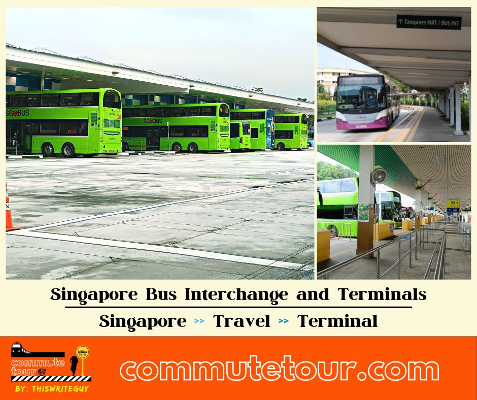
All Terminals
- Ang Mo Kio Interchange
- Beach Station Terminal
- Bedok Interchange
- Bishan Interchange
- Boon Lay Interchange
- Bukit Batok Interchange
- Bukit Merah Interchange
- Bukit Panjang Interchange
- Buona Vista Terminal
- Changi Business Park Terminal
- Changi Village Terminal
- Choa Chu Kang
- Clementi Interchange
- Compassvale Interchange
- Eunos Interchange
- Ghim Moh Terminal
- Golden Mile Complex
- Harbourfront Interchange
- Hougang Central Interchange
- Johor Bahru Sentral Bus Terminal
- Joo Koon Interchange
- Jurong East Interchange
- Kampong Bahru Terminal
- Kent Ridge Terminal
- Larkin Terminal
- Lor 1 Geylang Terminal
- Pasir Ris Interchange
- Punggol Temp Interchange
- Queen Street Terminal
- Sembawang Interchange
- Sengkang Interchange
- Serangoon Interchange
- Shenton Way Terminal
- Sims Place Terminal
- St. Michael’s Terminal
- Tampines Concourse Interchange
- Tampines Interchange
- Toa Payoh Interchange
- Tuas Link Terminal
- Upper East Coast Terminal
- Woodlands Interchange
- Yio Chu Kang Interchange
- Yishun Interchange
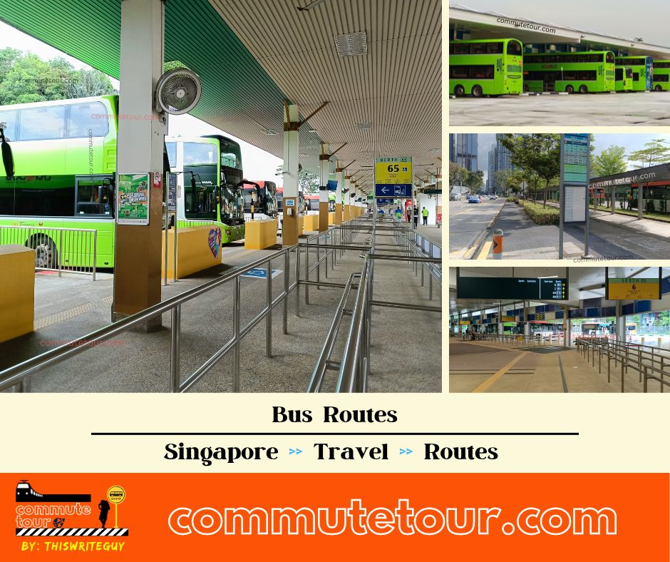
All Routes
Cross Border Routes
Malaysia
- Bus Terminals
- Berjanya Times Square
- Genting
- Johor Bahru JB Sentral
- Johor Bahru JB Larkin
- KL Sentral
- Klang Sentral
- Malacca
- TBS
- Train
- KTM
- Shuttle Tebrau
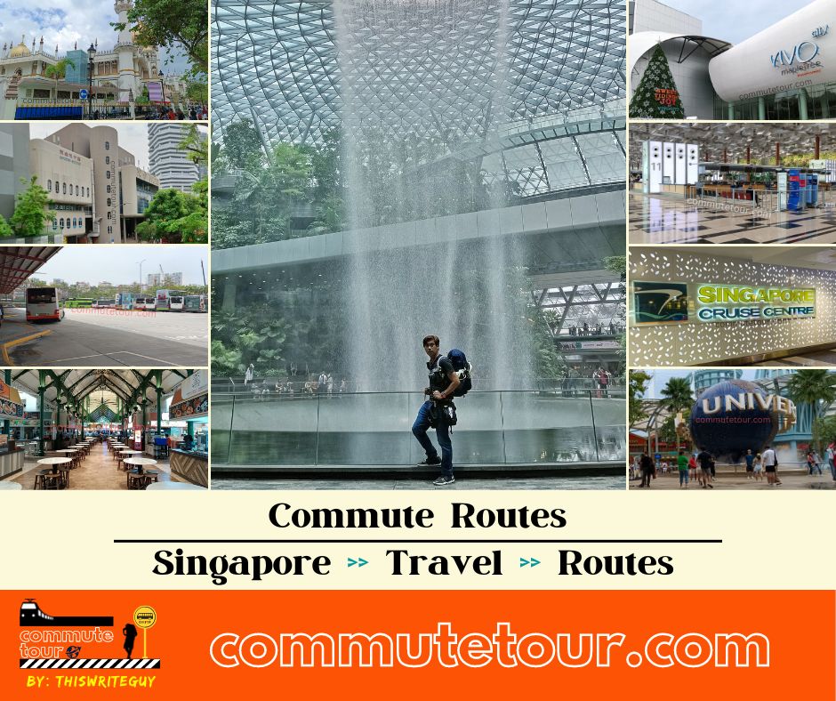
Commute Routes
- Changi Airport
- Chinatown
- City Hall
- Dhoby Ghaut
- Gardens by the Bay
- National Stadium
- Orchard Road
- Sentosa
- Resorts World Sentosa to Malaysia
- Woodlands
How to go to
Train Lines
Bus
NOTICE: The fares and schedules listed here may subject to change without prior notice. Pls check with the companies for the updated details.
CommuteTour is in no way affiliated with any of the buses / trains / tourist spots listed on any of its pages.
Subscribe: youtube.com/@commutetour
SG Bus Route 93 Bus Schedule
Service Route 93 bus schedule from HarbourFront Interchange to Eunos Interchange is from 05:15 to 24:00 from Monday to Friday, 05:20 to 24:00 on Saturdays, and 05:30 to 24:00 every Sunday / Holiday while the bus schedule from Eunos Interchange is from 05:50 to 23:45 from Monday to Sunday / Holidays.
| From | Monday to Friday | Saturday | Sunday / Holiday |
|---|---|---|---|
| HarbourFront Int | 05:15 to 24:00 | 05:20 to 24:00 | 05:30 to 24:00 |
| Eunos Int | 05:50 to 23:45 | 05:50 to 23:45 | 05:50 to 23:45 |
| Frequency | Before 8:30 | 08:31 – 16:59 | 17:00 – 19:00 | After 19:00 |
|---|---|---|---|---|
| From HarbourFront | 12 – 13 minutes | 11 – 16 minutes | 12 – 14 minutes | 15 – 23 minutes |
| From Eunos | 11 – 13 minutes | 12 – 17 minutes | 14 – 15 minutes | 14 – 24 minutes |
SG Bus Route 93 Route Map
Tap the top right of the map for full screen view. You can return to this page by clicking on the link on the google map description
SG Bus Route 93 Bus Stops
Bus Route 93 bus stops include: Alexandra Hospital, Alexandra Pt, Alexandra Retail Center, Asiawide Ind Building, Bartley Chr Church, BCA Academy, Blessed Sacrament Church, Braddell Flyover, Braddell View, Caribbean at Keppel Bay, Chr Community Chapel, Comfort Driving Center, Comfort Test Center, Comfortdelgro Corp Ltd, Commonwealth Drive, Eunos Technolink, Gambir Ridge, Holland Hill Lodge, Hortpark, Leedon Green, Lorong 106 Changi, Lutheran Towers, Lynwood Gr, Macritchie Reservoir, Muhajirin Mosque, Paya Lebar St, PUB Recreation Club, Queen’s Cl, Queenstown NPC HQ, Queenstown Polyclinic, Queensway Secondary School, Queensway Shop Center, Raffles Girls’ School, Scdf Hq, Singapore Bible College, Singapore Power Training Inst, Spanish Village, St. Margaret’s Secondary School, Telok Blangah Hill Park, The Japanese Assn, Viz Holland, Yeo’s Building.
Bus Route 93 passes along Blk 1004, Blk 147, Blk 16, Blk 166, Blk 17, Blk 19, Blk 219, Blk 311, Blk 322, Blk 3A, Blk 637, Blk 95, Blk 97, Blk 998.
MRT Stations along Bus Route 93 include: Bartley Station CC12, Eunos Station EW7, Farrer Road Station CC20, Harbourfront Station CC29 NE1, Tai Seng Station CC11, Telok Blangah Station CC28 and connects with Eunos Interchange, Harbourfront Interchange.
Caribbean at Keppel Bay (14131)
Telok Blangah RdOpp Chr Community Chapel (14151)
Telok Blangah RdOpp Yeo’s Bldg (14171)
Telok Blangah RdAlexandra Retail Ctr (15041)
Alexandra RdAlexandra Pt (15051)
Alexandra RdAft Hortpark (18011)
Alexandra RdAlexandra Hosp (11511)
Alexandra RdAft Queenstown NPC HQ (11021)
QueenswayOpp Queen’s Cl (11031)
QueenswayAft C’wealth Dr (11041)
QueenswayOpp Queenstown Polyclinic (11051)
QueenswayOpp Queensway Sec Sch (11061)
QueenswayBlk 97 (11071)
QueenswayViz Holland (11081)
QueenswayLeedon Green (11091)
Farrer RdFarrer Rd Mkt (11101)
Farrer RdSt. Margaret’s Sec Sch (41101)
Farrer RdLutheran Twrs (41111)
Farrer RdS’Pore Bible Coll (41121)
Adam RdAft Kheam Hock Rd (41161)
Lornie HighwayOpp Andrew Rd (51111)
Lornie RdMacritchie Reservoir (51071)
Thomson RdOpp Braddell View (51131)
Braddell RdOpp Raffles Girls’ Sch (52011)
Braddell RdOpp Blk 1004 (52021)
Braddell RdOpp Blk 998 (52031)
Braddell RdBlk 147 (52051)
Braddell RdBCA Academy (52061)
Braddell RdAft Lynwood Gr (66061)
Braddell RdOpp PUB Recreation Club (66071)
Braddell RdOpp S’pore Power Trg Inst (66081)
Braddell RdAft Upp Serangoon Rd (62109)
Bartley RdGambir Ridge (62099)
Bartley RdBef Upp Paya Lebar Rd (62069)
Bartley RdOpp Paya Lebar St (70309)
Upp Paya Lebar RdOpp Asiawide Ind Bldg (70299)
Upp Paya Lebar RdAft Paya Lebar Rd (71011)
Airport RdOpp Scdf Hq (71171)
Airport RdOpp Comfort Test Ctr (71021)
Airport RdOpp Comfort Driving Ctr (71071)
Eunos LinkEunos Technolink (71081)
Eunos LinkBlk 637 (71091)
Eunos LinkOpp Blk 322 (72019)
Jln EunosOpp Blk 16 (83119)
Jln EunosAft Lor 106 Changi (82069)
Changi RdBlk 3A (82221)
Jln Turi
Blk 17 (83111)
Jln EunosBlk 322 (72011)
Jln EunosBlk 311 (71099)
Eunos LinkOpp Eunos Technolink (71089)
Eunos LinkComfort Driving Ctr (71079)
Eunos LinkComfort Test Ctr (71029)
Airport RdAft Scdf Hq (71179)
Airport RdAsiawide Ind Bldg (70291)
Upp Paya Lebar RdAft Paya Lebar St (70301)
Upp Paya Lebar RdAft Upp Paya Lebar Rd (62061)
Bartley RdOpp Bartley Chr Ch (62081)
Bartley RdOpp Gambir Ridge (62091)
Bartley RdBef Upp Serangoon Rd (62101)
Bartley RdS’pore Power Trg Inst (66089)
Braddell RdPUB Recreation Club (66079)
Braddell RdBef Braddell Flyover (66069)
Braddell RdComfortdelgro Corp Ltd (52069)
Braddell RdBlk 219 (52059)
Braddell RdAft Muhajirin Mque (52039)
Braddell RdBlk 1004 (52029)
Braddell RdRaffles Girls’ Sch (52019)
Braddell RdBraddell View (51139)
Braddell RdOpp Macritchie Reservoir (51079)
Thomson RdBef Andrew Rd (51119)
Lornie RdBef Kheam Hock Rd (41169)
Lornie HighwayOpp Lutheran Twrs (41119)
Farrer RdOpp St. Margaret’s Sec Sch (41109)
Farrer RdSpanish Village (11109)
Farrer RdOpp Leedon Green (11099)
Farrer RdOpp Holland Hill Lodge (11089)
QueenswayOpp Blk 95 (11079)
QueenswayQueensway Sec Sch (11069)
QueenswayQueenstown Polyclinic (11059)
QueenswayOpp Blessed Sacrament Ch (11049)
QueenswayBlk 19 (11039)
QueenswayBlk 166 (11029)
QueenswayOpp Queensway Shop Ctr (11519)
Alexandra RdBef Telok Blangah Hill Pk (18019)
Alexandra RdOpp Alexandra Pt (15059)
Alexandra RdOpp Alexandra Retail Ctr (15049)
Alexandra RdAft Alexandra Rd (14189)
Telok Blangah RdYeo’s Bldg (14179)
Telok Blangah RdBef Chr Community Chapel (14159)
Telok Blangah RdBef Seah Im Rd (14139)
Telok Blangah Rd
Feel Free to click any of the Terminal, Transport links above
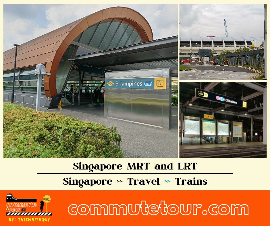
Singapore MRT / LRT Map
Singapore MRT / LRT Map. You can remove the other lines by tapping the top left corner of the map with arrow and unchecking the box/es.
Click here to search for MRT / LRT Station
Singapore MRT / LRT Map
Click the MRT / LRT Line below for more details.
MRT
Featured
Itinerary
- 1 day Singapore Itinerary
- 2 Days Singapore with Universal Studios Sentosa
- 3 Days Itinerary with Singapore Tourist Pass
- 5 Days
- Budget Friendly Singapore Itinerary
- Family Friendly Singapore Itinerary
- Sample Budget
- ATM
- Maybank
- Beach
- Changi Beach
- Sentosa Beach
- Bus
- Changi Airport
- Prepaid Sim Card
- Sentosa
- Harbourfront
- Sentosa Beach
- Universal Studios Singapore
- Vivo City
- Singapore Sim Cards
- Singapore to Malaysia
- Boon Lay
- Jurong East
- Queen Street Terminal / Ban San Street
- Resorts World Sentosa
- Woodlands Interchange
- Woodlands Checkpoint / Immigration
- Woodlands Train Checkpoint
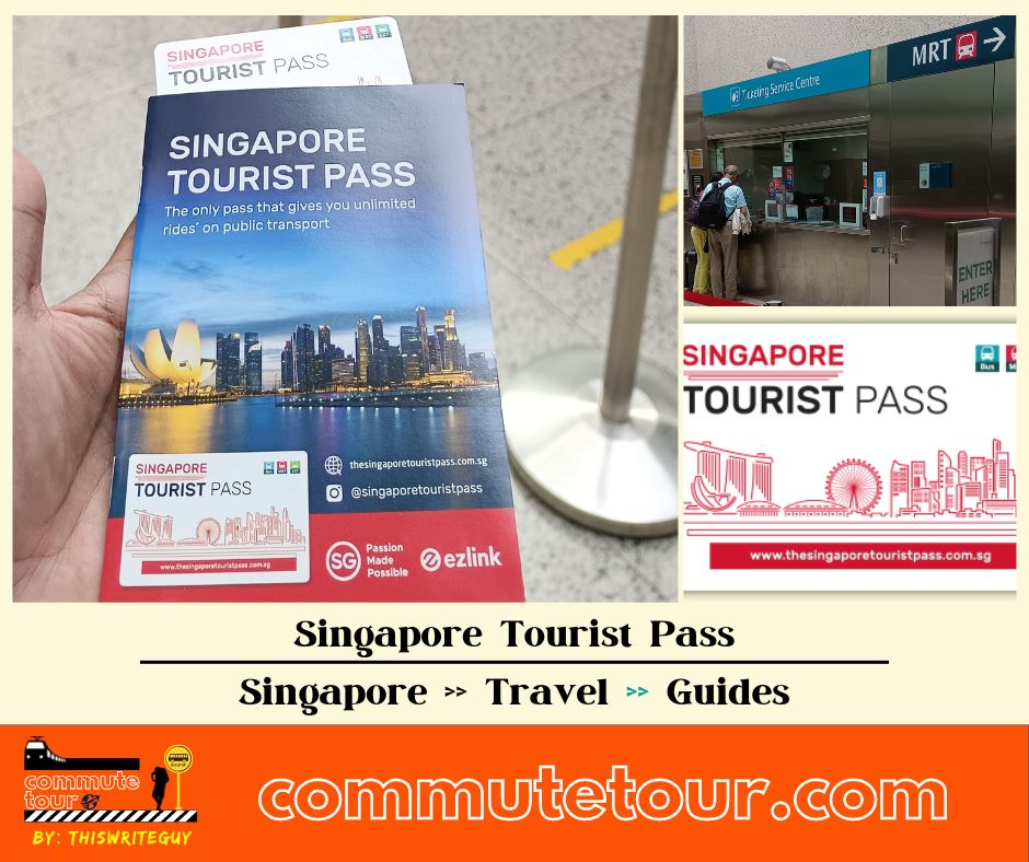
- Singapore Tourist Pass
- EZ Link
- Where to buy and return for refund
- Singapore Trains
- Tourist Spots
- Click Here for full list
- Art Science Museum
- Arab Street / Kampong Glam
- Bugis Street
- Jewel @ Changi Airport
- Fort Canning
- Gardens by the Bay
- Old Hill Police Station
- Marina Bay Sands
- National Gallery Museum
- Parliament
- Sentosa Island
- Singapore Merlion
- Singapore Stadium
- Universal Studios Singapore
- Walking Tour
- Chinatown to Little India
- Fort Canning to Marina Bay
- Singapore Merlion to Lau Pa Sat
- Vivo City to Resorts World Sentosa
Commute Routes
- Changi Airport
- Chinatown
- City Hall
- Dhoby Ghaut
- Gardens by the Bay
- National Stadium
- Orchard Road
- Sentosa
- Resorts World Sentosa to Malaysia
- Woodlands
How to go to
Train Lines
Bus
All Terminals
- Ang Mo Kio Interchange
- Beach Station Terminal
- Bedok Interchange
- Bishan Interchange
- Boon Lay Interchange
- Bukit Batok Interchange
- Bukit Merah Interchange
- Bukit Panjang Interchange
- Buona Vista Terminal
- Changi Business Park Terminal
- Changi Village Terminal
- Choa Chu Kang
- Clementi Interchange
- Compassvale Interchange
- Eunos Interchange
- Ghim Moh Terminal
- Golden Mile Complex
- Harbourfront Interchange
- Hougang Central Interchange
- Johor Bahru Sentral Bus Terminal
- Joo Koon Interchange
- Jurong East Interchange
- Kampong Bahru Terminal
- Kent Ridge Terminal
- Larkin Terminal
- Lor 1 Geylang Terminal
- Pasir Ris Interchange
- Punggol Temp Interchange
- Queen Street Terminal
- Sembawang Interchange
- Sengkang Interchange
- Serangoon Interchange
- Shenton Way Terminal
- Sims Place Terminal
- St. Michael’s Terminal
- Tampines Concourse Interchange
- Tampines Interchange
- Toa Payoh Interchange
- Tuas Link Terminal
- Upper East Coast Terminal
- Woodlands Interchange
- Yio Chu Kang Interchange
- Yishun Interchange
All Routes
Cross Border Routes
Malaysia
- Bus Terminals
- Berjanya Times Square
- Genting
- Johor Bahru JB Sentral
- Johor Bahru JB Larkin
- KL Sentral
- Klang Sentral
- Malacca
- TBS
- Train
- KTM
- Shuttle Tebrau