10201 – Opposite Redhill Station Bus Stop, Routes, Bus Schedule | Singapore
Bus Stop 10201 – Opposite Redhill Station
Bus Stop 10201 – Opposite Redhill Station include routes 32, 33, 64, 120, 132, 145
Routes from Opposite Redhill Station going to Buona Vista Terminal, Hougang Central Interchange, Kampong Bahru Terminal, Kent Ridge Terminal, Sims Place Terminal
Opposite Redhill Station bus stop also connects with Redhill Station EW18 East-West Line MRT (EWL)
Other routes from Redhill Station include Blk 157, Blk 67
Travelling today or planning for a commute from Bus Stop Code 10201 – Opposite Redhill Station? Learn more about Bus Schedule, Route Map and MRT from Opposite Redhill Station.
NOTICE: The fares and schedules listed here may subject to change without prior notice. Pls check with the companies for the updated details.
CommuteTour is in no way affiliated with any of the buses / trains / tourist spots listed on any of its pages.
Subscribe: youtube.com/@commutetour
10201 – Opposite Redhill Station Map
Bus Stop 10201 – Opposite Redhill Station
Opposite Redhill Station Bus Stop Routes
SBS Transit Bus 32 Details
| Category | Information |
|---|---|
| Bus Route | 32 |
| Operator | SBS Transit |
| Dir 1 # of Stops | 60 |
| Dir 2 # of Stops | 59 |
| Origin | Bedok Interchange |
| Destination | Buona Vista Terminal |
| Direction | Two Way |
Bus 32 Schedule
SBS Transit Bus 32 schedule from Bedok Interchange to Buona Vista Terminal is from 05:30 to 23:30 from Monday to Sunday / Holidays while the bus schedule from Buona Vista Terminal is from 06:00 to 24:00 from Monday to Sunday / Holidays.
| From | Monday to Friday | Saturday | Sunday / Holiday |
|---|---|---|---|
| Bedok Int | 05:30 to 23:30 | 05:30 to 23:30 | 05:30 to 23:30 |
| Buona Vista Ter | 06:00 to 24:00 | 06:00 to 24:00 | 06:00 to 24:00 |
| Frequency | Before 8:30 | 08:31 – 16:59 | 17:00 – 19:00 | After 19:00 |
|---|---|---|---|---|
| From Bedok | 11 – 17 minutes | 12 – 18 minutes | 14 – 18 minutes | 17 – 23 minutes |
| From Buona Vista Ter | 11 – 13 minutes | 11 – 19 minutes | 12 – 13 minutes | 17 – 25 minutes |
SG Bus 32 Route Map
Bus 32 Route Map
Tap the top right of the map for full screen view. You can return to this page by clicking on the link on the google map description
SBS Transit Bus 32 Bus Stops
The Bus Stops along SBS Transit Bus 32 Route include: Ar-Rabitah Mosque, Armenian Church, Bethesda Frankel Church, Bugis Cube, Caltex Station, Chai Chee Industrial Park, Christ Meth Church, Clarke Quay, Crawford Bridge, Crescent Girls’ School, Delta Swim Complex, Dunbar Walk, Frankel Drive, Frankel Place, Frankel Terrace, High Street Center, Hotel Grand Pacific, Jalan Buloh Perindu, Kampong Bugis, Katong Po, Katong Shop Center, Lorong 1 Geylang, Margaret Drive, Nafa Arts Kindergarten, National Library, One Amber, Padang Jeringau, Parkview Square, Perpetual Succour Church, Queenstown Library, Queenstown Primary School, Queensway Secondary School, Roxy Square, Rv Residences, S.A. Deaf, Siglap Drive, Siglap Plain, Sims Way, St. Patrick’s Green, St. Patrick’s School, St. Thomas Walk, Stamford Primary School, Stellar Rv, Sultan Mosque, Tanjong Katong Girls’ School, The Buddhist Union, The Fisherman Church, The Holy Family Church, Tiong Bahru Park and Valley Point.
Bus 32 passes along Blk 104a, Blk 22, Blk 30, Blk 32, Blk 39, Blk 4, Blk 43, Blk 46, Blk 461, Blk 48, Blk 78, Blk 7b and Blk 8.
MRT Stations along Bus 32 Route include: Bedok, Bugis, City Hall, Commonwealth, Dakota, Fort Canning, Great World, Kallang, Lavender, Mountbatten, Redhill and connects with Bedok Interchange, Buona Vista Terminal, Lorong 1 Geylang Terminal.
Bedok Interchange (84009)
Road: Bedok North Drive
Station Code: EW5
Train Line/s: East-West Line MRT
Terminal: Bedok InterchangeOpposite Blk 32 (84029)
Road: New Upper Changi RoadOpposite Chai Chee Industrial Park (84019)
Road: New Upper Changi RoadAfter Perpetual Succour Church (83099)
Road: Changi RoadBefore Siglap Plain (83079)
Road: Changi RoadAfter Frankel Terrace (83209)
Road: Frankel AvenueAfter Frankel Drive (83199)
Road: Frankel AvenueBefore Bethesda Frankel Church (83189)
Road: Frankel AvenueAfter Siglap Drive (83179)
Road: Frankel AvenueBefore Frankel Place (93109)
Road: Frankel AvenueAfter Jalan Buloh Perindu (93059)
Road: East Coast RoadSt. Patrick’s School (92159)
Road: East Coast RoadSt. Patrick’s Green (92149)
Road: East Coast RoadOpposite Caltex Station (92139)
Road: East Coast RoadThe Holy Family Church (92129)
Road: East Coast RoadRoxy Square (92119)
Road: East Coast RoadOpposite Katong Shop Center (92109)
Road: Mountbatten RoadOne Amber (92099)
Road: Mountbatten RoadAfter Katong Po (92161)
Road: Tanjong Katong RoadOpposite Tanjong Katong Girls’ School (82071)
Road: Tanjong Katong RoadBefore Old Airport Road (81199)
Road: Dunman RoadDakota Station Exit B/Blk 60 (81189)
Road: Old Airport Road
Station Code: CC8
Train Line/s: Circle Line MRTBlk 22 (81179)
Road: Old Airport Road
Station Code: CC7
Train Line/s: Circle Line MRTOpposite S.A. Deaf (80141)
Road: Mountbatten RoadBefore Geylang Road (80111)
Road: Sims WayAfter Sims Way (80049)
Road: Geylang RoadOpposite Lorong 1 Geylang Terminal (80039)
Road: Geylang Road
Station Code: EW10
Train Line/s: East-West Line MRT
Terminal: Lor 1 Geylang TerminalBefore Kampong Bugis (80029)
Road: Kallang RoadBefore Crawford Bridge (01339)
Road: Crawford StreetBlk 8 (01329)
Road: North Bridge RoadBefore Sultan Mosque (01229)
Road: North Bridge RoadParkview Square (01139)
Road: North Bridge RoadBugis Cube (01039)
Road: North Bridge RoadOpposite National Library (01029)
Road: North Bridge RoadAfter City Hall Station Exit B (04168)
Road: North Bridge Road
Station Code: EW13 NS25
Train Line/s: East-West Line MRT North-South Line MRTOpposite High Street Center (04251)
Road: North Boat QuayClarke Quay (04211)
Road: River Valley RoadBefore Fort Canning Station (04331)
Road: River Valley Road
Station Code: DT20
Train Line/s: Downtown Line MRTUE Sq/Before Mohd Sultan Road (13109)
Road: River Valley RoadBefore Kim Yam Road (13099)
Road: River Valley RoadOpposite St. Thomas Walk (13089)
Road: River Valley RoadThe Cosmopolitan (13079)
Road: River Valley Road
Station Code: TE15
Train Line/s: Thomson-East Coast Line MRTRv Residences (13069)
Road: River Valley RoadValley Point (13059)
Road: River Valley RoadBlk 4 (10519)
Road: Delta RoadBlk 48 (10389)
Road: Lower Delta RoadOpposite Tiong Bahru Park (10171)
Road: Tiong Bahru RoadBefore Ar-Rabitah Mosque (10181)
Road: Tiong Bahru RoadBlk 78 (10191)
Road: Tiong Bahru RoadOpposite Redhill Station (10201)
Road: Tiong Bahru Road
Station Code: EW18
Train Line/s: East-West Line MRTAfter Margaret Drive (10321)
Road: Tanglin RoadAfter Tanglin Road (10479)
Road: Kay Siang RoadBefore Margaret Drive (10469)
Road: Kay Siang RoadQueenstown Primary School (11499)
Road: Margaret DriveBlk 30 (11489)
Road: Margaret DriveQueensway Secondary School (11469)
Road: Margaret DriveCommonwealth Station Exit A/D (11161)
Road: Commonwealth Avenue
Station Code: EW20
Train Line/s: East-West Line MRTOpposite Blk 7b (11171)
Road: Commonwealth AvenueBlk 46 (11389)
Road: Holland DriveBuona Vista Terminal (11379)
Road: North Buona Vista Road
Terminal: Buona Vista Terminal
Buona Vista Terminal (11379)
Road: North Buona Vista Road
Terminal: Buona Vista TerminalBlk 43 (11189)
Road: Commonwealth AvenueBlk 8 (11179)
Road: Commonwealth AvenueCommonwealth Station Exit B/C (11169)
Road: Commonwealth Avenue
Station Code: EW20
Train Line/s: East-West Line MRTOpposite The Fisherman Church (11471)
Road: Margaret DriveQueenstown Library (11481)
Road: Margaret DriveOpposite Queenstown Primary School (11491)
Road: Margaret DriveAfter Margaret Drive (10461)
Road: Kay Siang RoadBefore Tanglin Road (10471)
Road: Kay Siang RoadCrescent Girls’ School (10329)
Road: Tanglin RoadRedhill Station (10209)
Road: Tiong Bahru Road
Station Code: EW18
Train Line/s: East-West Line MRTDelta Swim Complex (10199)
Road: Tiong Bahru RoadBlk 104a Carpark (10189)
Road: Tiong Bahru RoadTiong Bahru Park (10179)
Road: Tiong Bahru RoadOpposite Blk 48 (10381)
Road: Lower Delta RoadOpposite Valley Point (13051)
Road: River Valley RoadStellar Rv (13062)
Road: River Valley RoadRiva Lodge (13071)
Road: River Valley Road
Station Code: TE15
Train Line/s: Thomson-East Coast Line MRTSt. Thomas Walk (13081)
Road: River Valley RoadAfter Kim Yam Road (13091)
Road: River Valley RoadOpposite Mohd Sultan Road (13101)
Road: River Valley RoadFort Canning Station Exit B (04339)
Road: River Valley Road
Station Code: DT20
Train Line/s: Downtown Line MRTOpposite Clarke Quay (04219)
Road: River Valley RoadArmenian Church (04142)
Road: Hill StreetHotel Grand Pacific (01012)
Road: Victoria StreetBugis Station Exit A (01113)
Road: Victoria Street
Station Code: EW12 DT14
Train Line/s: East-West Line MRT Downtown Line MRTStamford Primary School (01121)
Road: Victoria StreetOpposite Blk 461 (01211)
Road: Victoria StreetLavender Station Exit B (01311)
Road: Kallang Road
Station Code: EW11
Train Line/s: East-West Line MRTAfter Padang Jeringau (80011)
Road: Kallang RoadKallang Station (80031)
Road: Sims Avenue
Station Code: EW10
Train Line/s: East-West Line MRTAfter Lorong 1 Geylang (80051)
Road: Sims AvenueAfter Geylang Road (80119)
Road: Sims WayS.A. Deaf (80149)
Road: Mountbatten RoadBlk 39 (81171)
Road: Old Airport Road
Station Code: CC7
Train Line/s: Circle Line MRTDakota Station Exit A/Blk 99 (81181)
Road: Old Airport Road
Station Code: CC8
Train Line/s: Circle Line MRTAfter Old Airport Road (81191)
Road: Dunman RoadTanjong Katong Girls’ School (82079)
Road: Tanjong Katong RoadBefore Katong Po (92169)
Road: Tanjong Katong RoadOpposite One Amber (92091)
Road: Mountbatten RoadKatong Shop Center (92101)
Road: Mountbatten RoadOpposite Roxy Square (92111)
Road: East Coast RoadOpposite The Holy Family Church (92121)
Road: East Coast RoadCaltex Station (92131)
Road: East Coast RoadNafa Arts Kindergarten (92141)
Road: East Coast RoadChrist Meth Church (92151)
Road: East Coast RoadAfter Dunbar Walk (93051)
Road: East Coast RoadAfter Coldstream Avenue (93101)
Road: Frankel AvenueBefore Roseburn Avenue (83171)
Road: Frankel AvenueAfter Bethesda Frankel Church (83181)
Road: Frankel AvenueBefore Frankel Drive (83191)
Road: Frankel AvenueBefore Frankel Terrace (83201)
Road: Frankel AvenueThe Buddhist Union (83063)
Road: Sims Avenue EastOpposite Perpetual Succour Church (83081)
Road: Sims Avenue EastChai Chee Industrial Park (84011)
Road: New Upper Changi RoadBlk 32 (84021)
Road: New Upper Changi RoadBedok Interchange (84009)
Road: Bedok North Drive
Station Code: EW5
Train Line/s: East-West Line MRT
Terminal: Bedok Interchange
Feel Free to click any of the Terminal, Transport links above
SBS Transit Bus 33 Details
| Category | Information |
|---|---|
| Bus Route | 33 |
| Operator | SBS Transit |
| Dir 1 # of Stops | 64 |
| Dir 2 # of Stops | 63 |
| Origin | Bedok Interchange |
| Destination | Kent Ridge Terminal |
| Direction | Two Way |
Bus 33 Schedule
SBS Transit Bus 33 schedule from Bedok Interchange to Kent Ridge Terminal is from 05:45 to 23:45 from Monday to Friday, 05:50 to 23:45 on Saturdays, and 06:00 to 23:45 every Sunday / Holiday while the bus schedule from Kent Ridge Terminal is from 06:00 to 23:45 from Monday to Sunday / Holidays.
| From | Monday to Friday | Saturday | Sunday / Holiday |
|---|---|---|---|
| Bedok Int | 05:45 to 23:45 | 05:50 to 23:45 | 06:00 to 23:45 |
| Kent Ridge Ter | 06:00 to 23:45 | 06:00 to 23:45 | 06:00 to 23:45 |
| Frequency | Before 8:30 | 08:31 – 16:59 | 17:00 – 19:00 | After 19:00 |
|---|---|---|---|---|
| From Bedok | 10 – 15 minutes | 09 – 15 minutes | 14 – 15 minutes | 14 – 17 minutes |
| From Kent Ridge Ter | 14 – 14 minutes | 10 – 18 minutes | 09 – 11 minutes | 11 – 17 minutes |
SG Bus 33 Route Map
Bus 33 Route Map
Tap the top right of the map for full screen view. You can return to this page by clicking on the link on the google map description
SBS Transit Bus 33 Bus Stops
The Bus Stops along SBS Transit Bus 33 Route include: Acs Boarding School, Acs Independent, Alexandra Hospital, Anchorpoint, Ar-Rabitah Mosque, Armenian Church, Ayer Rajah Industrial Estate, Ayer Rajah Telecoms, Bras Basah Complex, Central Green Condominium, Chai Chee Industrial Park, Chijmes, Delta Swim Complex, Dover Court International School, Dunman View, Fairfield Meth Primary School, Flora East, Grand Park City Hall, High Street Center, Hong Lim Park, Hong San Si Temple, Hotel Grand Pacific, Ikea Industrial Building, Joo Chiat Place, Kampong Bugis, Lea Hin Hardware Factory, Lorong 1 Geylang, Lorong 110 Changi, Lorong G Telok Kurau, Lorong H Telok Kurau, Maranatha Hall, New Bridge Center, New Town Secondary School, Normanton Park, Nus Fac of Architecture, Nus Fac of Engineering, Outram Flyover, Padang Jeringau, Parkway East Hospital, Perpetual Succour Church, Psb Science Park Building, Queensway Shop Center, S.A. Deaf, Science Park, Siglap Plain, Sims Way, Sis Building, Stamford Primary School, Tanjong Katong Secondary School, Tentera Diraja Mosque, The Japanese Primary School, Tiong Bahru Park, University Town and Yale-Nus College.
Bus 33 passes along Blk 1, Blk 104a, Blk 18, Blk 22, Blk 32, Blk 39, Blk 461, Blk 55 and Blk 78.
MRT Stations along Bus 33 Route include: Bedok, Bugis, Chinatown, Clarke Quay, Dakota, Kallang, Kembangan, Lavender, Mountbatten, Outram Park, Redhill, Tiong Bahru and connects with Bedok Interchange, Kent Ridge Terminal, Lorong 1 Geylang Terminal.
Bedok Interchange (84009)
Road: Bedok North Drive
Station Code: EW5
Train Line/s: East-West Line MRT
Terminal: Bedok InterchangeOpposite Blk 32 (84029)
Road: New Upper Changi RoadOpposite Chai Chee Industrial Park (84019)
Road: New Upper Changi RoadAfter Perpetual Succour Church (83099)
Road: Changi RoadBefore Siglap Plain (83079)
Road: Changi RoadMasjid Kassim (83059)
Road: Changi Road
Station Code: EW6
Train Line/s: East-West Line MRTBefore Lorong 110 Changi (83049)
Road: Changi RoadAfter Changi Road (83149)
Road: Telok Kurau RoadOpposite Parkway East Hospital (83159)
Road: Joo Chiat PlaceBefore Still Road (83169)
Road: Joo Chiat PlaceAfter Rambutan Road (82179)
Road: Joo Chiat PlaceAfter Tembeling Road (82159)
Road: Joo Chiat PlaceBefore Koon Seng Road (82149)
Road: Joo Chiat RoadMaranatha Hall (82139)
Road: Dunman RoadTanjong Katong Secondary School (82129)
Road: Dunman RoadBefore Old Airport Road (81199)
Road: Dunman RoadDakota Station Exit B/Blk 60 (81189)
Road: Old Airport Road
Station Code: CC8
Train Line/s: Circle Line MRTBlk 22 (81179)
Road: Old Airport Road
Station Code: CC7
Train Line/s: Circle Line MRTOpposite S.A. Deaf (80141)
Road: Mountbatten RoadBefore Geylang Road (80111)
Road: Sims WayAfter Sims Way (80049)
Road: Geylang RoadOpposite Lorong 1 Geylang Terminal (80039)
Road: Geylang Road
Station Code: EW10
Train Line/s: East-West Line MRT
Terminal: Lor 1 Geylang TerminalBefore Kampong Bugis (80029)
Road: Kallang RoadLavender Station Exit A/Ica (01319)
Road: Kallang Road
Station Code: EW11
Train Line/s: East-West Line MRTBlk 461 (01219)
Road: Victoria StreetOpposite Stamford Primary School (01129)
Road: Victoria StreetBugis Station Exit B (01059)
Road: Victoria Street
Station Code: EW12 DT14
Train Line/s: East-West Line MRT Downtown Line MRTAfter Bugis Station Exit C (01119)
Road: Victoria Street
Station Code: EW12 DT14
Train Line/s: East-West Line MRT Downtown Line MRTBras Basah Complex (01019)
Road: Victoria StreetAfter Chijmes (04159)
Road: Victoria StreetGrand Park City Hall (04149)
Road: Hill StreetHigh Street Center (04229)
Road: Hill StreetOpposite Clarke Quay Station (04239)
Road: New Bridge Road
Station Code: NE5
Train Line/s: North East Line MRTHong Lim Park (05059)
Road: New Bridge Road
Station Code: NE5
Train Line/s: North East Line MRTChinatown Station Exit E (05049)
Road: New Bridge Road
Station Code: DT19 NE4
Train Line/s: Downtown Line MRT North East Line MRTNew Bridge Center (05039)
Road: New Bridge RoadAfter Duxton Plain Park (05019)
Road: New Bridge Road
Station Code: EW16 NE3 TE17
Train Line/s: East-West Line MRT North East Line MRT Thomson-East Coast Line MRTOpposite Outram Park Station (06011)
Road: Outram Road
Station Code: EW16 NE3 TE17
Train Line/s: East-West Line MRT North East Line MRT Thomson-East Coast Line MRTBlk 55 (06051)
Road: Tiong Bahru RoadBlk 18 (10141)
Road: Tiong Bahru RoadCentral Green Condominium (10151)
Road: Tiong Bahru RoadOpposite Tiong Bahru Station (10161)
Road: Tiong Bahru Road
Station Code: EW17
Train Line/s: East-West Line MRTOpposite Tiong Bahru Park (10171)
Road: Tiong Bahru RoadBefore Ar-Rabitah Mosque (10181)
Road: Tiong Bahru RoadBlk 78 (10191)
Road: Tiong Bahru RoadOpposite Redhill Station (10201)
Road: Tiong Bahru Road
Station Code: EW18
Train Line/s: East-West Line MRTSis Building (10281)
Road: Alexandra RoadBefore Dawson Road (10291)
Road: Alexandra RoadLea Hin Hardware Factory (11539)
Road: Alexandra RoadBefore Ikea Industrial Building (11529)
Road: Alexandra RoadOpposite Queensway Shop Center (11519)
Road: Alexandra RoadNormanton Park (18041)
Road: AYEScience Park (18131)
Road: AYEPsb Science Park Building (18101)
Road: Buona Vista FlyoverOpposite Ayer Rajah Industrial Estate (18121)
Road: Buona Vista FlyoverOpposite Fairfield Meth Primary School (18119)
Road: Dover RoadAcs Independent (19089)
Road: Dover RoadDover Court International School (19079)
Road: Dover RoadOpposite Ayer Rajah Telecoms (19069)
Road: Dover RoadUniversity Town (19059)
Road: Dover RoadYale-Nus College (17099)
Road: Clementi RoadNus Fac of Engineering (16159)
Road: Clementi RoadNus Fac of Architecture (16149)
Road: Clementi RoadKent Ridge Terminal (16009)
Road: Clementi Road
Terminal: Kent Ridge Terminal
Kent Ridge Terminal (16009)
Road: Clementi Road
Terminal: Kent Ridge TerminalOpposite Kent Ridge Terminal (16131)
Road: Clementi Road
Terminal: Kent Ridge TerminalTentera Diraja Mosque (16141)
Road: Clementi RoadThe Japanese Primary School (16151)
Road: Clementi RoadNew Town Secondary School (19051)
Road: Dover RoadAyer Rajah Telecoms (19061)
Road: Dover RoadOpposite Acs Independent (19071)
Road: Dover RoadOpposite Acs Boarding School (19081)
Road: Dover RoadFairfield Meth Primary School (18111)
Road: Dover RoadAyer Rajah Industrial Estate (18129)
Road: Buona Vista FlyoverOpposite Psb Science Park Building (18109)
Road: Buona Vista FlyoverOpposite Science Park (18049)
Road: AYEAlexandra Hospital (11511)
Road: Alexandra RoadAnchorpoint (11521)
Road: Alexandra RoadOpposite Lea Hin Hardware Factory (11531)
Road: Alexandra RoadAfter Dawson Road (10299)
Road: Alexandra RoadRedhill Station (10209)
Road: Tiong Bahru Road
Station Code: EW18
Train Line/s: East-West Line MRTDelta Swim Complex (10199)
Road: Tiong Bahru RoadBlk 104a Carpark (10189)
Road: Tiong Bahru RoadTiong Bahru Park (10179)
Road: Tiong Bahru RoadTiong Bahru Station (10169)
Road: Tiong Bahru Road
Station Code: EW17
Train Line/s: East-West Line MRTBlk 1 (10149)
Road: Tiong Bahru RoadBefore Outram Flyover (06049)
Road: Outram RoadOutram Park Station (06029)
Road: Outram Road
Station Code: EW16 NE3 TE17
Train Line/s: East-West Line MRT North East Line MRT Thomson-East Coast Line MRTChinatown Station Exit C (05013)
Road: Eu Tong Sen Street
Station Code: DT19 NE4
Train Line/s: Downtown Line MRT North East Line MRTOpposite Hong Lim Park (05023)
Road: Eu Tong Sen StreetClarke Quay Station Exit E (04222)
Road: Eu Tong Sen Street
Station Code: NE5
Train Line/s: North East Line MRTArmenian Church (04142)
Road: Hill StreetHotel Grand Pacific (01012)
Road: Victoria StreetBugis Station Exit A (01113)
Road: Victoria Street
Station Code: EW12 DT14
Train Line/s: East-West Line MRT Downtown Line MRTStamford Primary School (01121)
Road: Victoria StreetOpposite Blk 461 (01211)
Road: Victoria StreetLavender Station Exit B (01311)
Road: Kallang Road
Station Code: EW11
Train Line/s: East-West Line MRTAfter Padang Jeringau (80011)
Road: Kallang RoadKallang Station (80031)
Road: Sims Avenue
Station Code: EW10
Train Line/s: East-West Line MRTAfter Lorong 1 Geylang (80051)
Road: Sims AvenueAfter Geylang Road (80119)
Road: Sims WayS.A. Deaf (80149)
Road: Mountbatten RoadBlk 39 (81171)
Road: Old Airport Road
Station Code: CC7
Train Line/s: Circle Line MRTDakota Station Exit A/Blk 99 (81181)
Road: Old Airport Road
Station Code: CC8
Train Line/s: Circle Line MRTAfter Old Airport Road (81191)
Road: Dunman RoadDunman View (82121)
Road: Dunman RoadOpposite Maranatha Hall (82131)
Road: Dunman RoadAfter Koon Seng Road (82141)
Road: Tembeling RoadBefore Joo Chiat Place (82151)
Road: Tembeling RoadBefore Mangis Road (82171)
Road: Joo Chiat PlaceFlora East (82181)
Road: Joo Chiat PlaceParkway East Hospital (83151)
Road: Joo Chiat PlaceAfter Lorong H Telok Kurau (83131)
Road: Telok Kurau RoadAfter Lorong G Telok Kurau (83141)
Road: Telok Kurau RoadOpposite Hong San Si Temple (83031)
Road: Sims Avenue EastKembangan Station (83062)
Road: Sims Avenue East
Station Code: EW6
Train Line/s: East-West Line MRTOpposite Perpetual Succour Church (83081)
Road: Sims Avenue EastChai Chee Industrial Park (84011)
Road: New Upper Changi RoadBlk 32 (84021)
Road: New Upper Changi RoadBedok Interchange (84009)
Road: Bedok North Drive
Station Code: EW5
Train Line/s: East-West Line MRT
Terminal: Bedok Interchange
Feel Free to click any of the Terminal, Transport links above
SBS Transit Bus 64 Details
| Category | Information |
|---|---|
| Bus Route | 64 |
| Operator | SBS Transit |
| Dir 1 # of Stops | 81 |
| Origin | Sims Place Terminal |
| Destination | Mei Ling Street |
| Direction | Loop |
Bus 64 Schedule
SBS Transit Bus 64 schedule from Sims Place Terminal to Mei Ling St is from 05:30 to 23:30 from Monday to Sunday / Holidays.
| From | Monday to Friday | Saturday | Sunday / Holiday |
|---|---|---|---|
| Sims Pl Ter | 05:30 to 23:30 | 05:30 to 23:30 | 05:30 to 23:30 |
| Frequency | Before 8:30 | 08:31 – 16:59 | 17:00 – 19:00 | After 19:00 |
|---|---|---|---|---|
| From Sims Ter | 12 – 13 minutes | 10 – 17 minutes | 14 – 16 minutes | 14 – 15 minutes |
SG Bus 64 Route Map
Bus 64 Route Map
Tap the top right of the map for full screen view. You can return to this page by clicking on the link on the google map description
SBS Transit Bus 64 Bus Stops
The Bus Stops along SBS Transit Bus 64 Route include: Aljunied Park, Anchorpoint, Ar-Rabitah Mosque, Bendemeer Primary School, Canossa Catholic Primary, Cencon Building, Delta Swim Complex, Ganges Center, Gulab Building, Harvest Mansions, Haw Par Glass Tower, Hoa Nam Building, Hotel Miramar, Ibis Singapore On Bencoolen, Jalan Wangi, Kwong Wai Shiu Hospital, Lavender Street, Lea Hin Hardware Factory, Mom Svcs Center, Peace Center, Queens, River Place Condominium, School of The Arts, Selegie Center, Siemens Center, Sims Urban Oasis, Sis Building, Sri Vadapathira K Temple, St. Michael’s Place, Tai Thong Crescent, Tekka Center, Tiong Bahru Park, Tiong Ghee Temple, UE Square and YMCA.
Bus 64 passes along Blk 104a, Blk 125, Blk 153, Blk 157, Blk 158, Blk 163, Blk 166, Blk 2, Blk 44, Blk 45, Blk 48, Blk 49 Market/Fc, Blk 51, Blk 53, Blk 54, Blk 78 and Blk 79.
SBS Transit Bus 64 Route also connects with the following stations: Bencoolen, Boon Keng, Dhoby Ghaut, Farrer Park, Havelock, Jalan Besar, Redhill and terminals: Sims Pl Terminal
Sims Place Terminal (80289)
Road: Sims Place
Terminal: Sims Pl TerminalBlk 49 Market/Fc (80249)
Road: Sims PlaceOpposite Blk 53 (80231)
Road: Sims DriveSims Urban Oasis (81091)
Road: Aljunied RoadOpposite Blk 125 (70011)
Road: Aljunied RoadOpposite Canossa Catholic Primary (70021)
Road: Aljunied RoadOpposite Aljunied Park (70031)
Road: Aljunied RoadCencon Building (70119)
Road: MacPherson RoadGulab Building (70109)
Road: MacPherson RoadBefore Siemens Center (60219)
Road: MacPherson RoadMom Svcs Center (60179)
Road: Bendemeer RoadBlk 54 (60159)
Road: Bendemeer RoadBlk 44 (60139)
Road: Bendemeer RoadOpposite Boon Keng Station (60119)
Road: Bendemeer Road
Station Code: NE9
Train Line/s: North East Line MRTBefore Lavender Street (60099)
Road: Bendemeer RoadHoa Nam Building (07329)
Road: Jalan BesarAfter Allenby Road (07319)
Road: Jalan BesarOpposite Veerasamy Road (07419)
Road: Jalan BesarJalan Besar Station Exit A (07529)
Road: Jalan Besar
Station Code: DT22
Train Line/s: Downtown Line MRTIbis Singapore On Bencoolen (07517)
Road: Bencoolen StreetBefore Bencoolen Station Exit A (04029)
Road: Bencoolen Street
Station Code: DT21
Train Line/s: Downtown Line MRTYMCA (08041)
Road: Orchard RoadAfter Haw Par Glass Tower (08019)
Road: Clemenceau AvenueOpposite UE Square (04329)
Road: Clemenceau AvenueBlk 2 (06161)
Road: Havelock RoadHotel Miramar (06151)
Road: Havelock RoadHoliday Inn Atrium (06141)
Road: Havelock Road
Station Code: TE16
Train Line/s: Thomson-East Coast Line MRTGanges Center (10221)
Road: Ganges AvenueBlk 51 Carpark (10231)
Road: Ganges AvenueBlk 48 (10389)
Road: Lower Delta RoadOpposite Tiong Bahru Park (10171)
Road: Tiong Bahru RoadBefore Ar-Rabitah Mosque (10181)
Road: Tiong Bahru RoadBlk 78 (10191)
Road: Tiong Bahru RoadOpposite Redhill Station (10201)
Road: Tiong Bahru Road
Station Code: EW18
Train Line/s: East-West Line MRTSis Building (10281)
Road: Alexandra RoadBefore Dawson Road (10291)
Road: Alexandra RoadOpposite Queens (11541)
Road: Stirling RoadTiong Ghee Temple (11551)
Road: Stirling RoadBlk 166 (11561)
Road: Stirling RoadBlk 158 (11579)
Road: Mei Ling StreetBlk 157 (11589)
Road: Mei Ling StreetBlk 153 (11599)
Road: Mei Ling StreetBlk 163 (11609)
Road: Mei Chin RoadBlk 166 (11029)
Road: QueenswayAnchorpoint (11521)
Road: Alexandra RoadOpposite Lea Hin Hardware Factory (11531)
Road: Alexandra RoadAfter Dawson Road (10299)
Road: Alexandra RoadRedhill Station (10209)
Road: Tiong Bahru Road
Station Code: EW18
Train Line/s: East-West Line MRTDelta Swim Complex (10199)
Road: Tiong Bahru RoadBlk 104a Carpark (10189)
Road: Tiong Bahru RoadTiong Bahru Park (10179)
Road: Tiong Bahru RoadOpposite Blk 48 (10381)
Road: Lower Delta RoadBlk 79 (10239)
Road: Ganges AvenueOpposite Harvest Mansions (10229)
Road: Ganges AvenueOpposite Holiday Inn Atrium (06149)
Road: Havelock Road
Station Code: TE16
Train Line/s: Thomson-East Coast Line MRTOpposite Hotel Miramar (06159)
Road: Havelock RoadRiver Place Condominium (06169)
Road: Havelock RoadUE Square (04321)
Road: Clemenceau AvenueAfter River Valley Road (04311)
Road: Clemenceau AvenueOpposite Haw Par Glass Tower (08011)
Road: Clemenceau AvenueAfter Dhoby Ghaut Station (08058)
Road: Orchard Road
Station Code: CC1 NE6 NS24
Train Line/s: Circle Line MRT North East Line MRT North-South Line MRTSchool of The Arts (08079)
Road: Prinsep StreetPeace Center (07011)
Road: Selegie RoadSelegie Center (07021)
Road: Selegie RoadTekka Center (07031)
Road: Serangoon RoadBroadway Hotel (07111)
Road: Serangoon RoadAfter Farrer Park Station Exit G (07211)
Road: Serangoon Road
Station Code: NE8
Train Line/s: North East Line MRTSri Vadapathira K Temple (07221)
Road: Serangoon RoadKwong Wai Shiu Hospital (60101)
Road: Serangoon RoadBoon Keng Station/Blk 102 (60121)
Road: Serangoon Road
Station Code: NE9
Train Line/s: North East Line MRTOpposite Bendemeer Primary School (60141)
Road: Serangoon RoadSt. Michael’s Place (60161)
Road: Serangoon RoadAfter Tai Thong Crescent (60211)
Road: MacPherson RoadBefore Jalan Wangi (70101)
Road: MacPherson RoadOpposite Cencon Building (70111)
Road: MacPherson RoadAljunied Park (70039)
Road: Aljunied RoadCanossa Catholic Primary (70029)
Road: Aljunied RoadBlk 125 (70019)
Road: Aljunied RoadBefore Blk 53 (80239)
Road: Sims DriveBlk 45 (80229)
Road: Sims DriveSims Place Terminal (80289)
Road: Sims Place
Terminal: Sims Pl Terminal
SBS Transit Bus 120 Details
| Category | Information |
|---|---|
| Bus Route | 120 |
| Operator | SBS Transit |
| Dir 1 # of Stops | 48 |
| Origin | Kampong Bahru Terminal |
| Destination | Telok Blangah Heights |
| Direction | Loop |
Bus 120 Schedule
SBS Transit Bus 120 schedule from Kampong Bahru Terminal to Telok Blangah Heights is from 05:55 to 23:30 from Monday to Sunday / Holidays.
| From | Monday to Friday | Saturday | Sunday / Holiday |
|---|---|---|---|
| Kampong Bahru Ter | 05:55 to 23:30 | 05:55 to 23:30 | 05:55 to 23:30 |
| Frequency | Before 8:30 | 08:31 – 16:59 | 17:00 – 19:00 | After 19:00 |
|---|---|---|---|---|
| From Kampong Bahru Ter | 11 – 12 minutes | 12 – 14 minutes | 12 – 13 minutes | 12 – 15 minutes |
SG Bus 120 Route Map
Bus 120 Route Map
Tap the top right of the map for full screen view. You can return to this page by clicking on the link on the google map description
SBS Transit Bus 120 Bus Stops
The Bus Stops along SBS Transit Bus 120 Route include: Alexandra Hospital, Alexandra Point, Alexandra Retail Center, Anchorpoint, Ar-Rabitah Mosque, Delta Swim Complex, Hortpark, Ikea Industrial Building, Lea Hin Hardware Factory, Queensway Shop Center, Sis Building, Telok Blangah Hill Park, Telok Blangah Market/Fc, Tiong Bahru Park and Yeo’s Building.
Bus 120 passes along Blk 104a, Blk 111, Blk 129, Blk 140, Blk 149, Blk 201, Blk 25b, Blk 54, Blk 55, Blk 59, Blk 67, Blk 70a, Blk 70b, Blk 78, Blk 85 and Blk 91a.
SBS Transit Bus 120 Route also connects with the following stations: Redhill, Telok Blangah and terminal: Kampong Bahru Terminal
Kampong Bahru Terminal (10499)
Road: Spooner Road
Terminal: Kampong Bahru TerminalBlk 149 (10051)
Road: Jalan Bukit MerahBlk 140 (10061)
Road: Jalan Bukit MerahBlk 111 (10071)
Road: Jalan Bukit MerahBlk 129 (10371)
Road: Lower Delta RoadOpposite Tiong Bahru Park (10171)
Road: Tiong Bahru RoadBefore Ar-Rabitah Mosque (10181)
Road: Tiong Bahru RoadBlk 78 (10191)
Road: Tiong Bahru RoadOpposite Redhill Station (10201)
Road: Tiong Bahru Road
Station Code: EW18
Train Line/s: East-West Line MRTSis Building (10281)
Road: Alexandra RoadBefore Dawson Road (10291)
Road: Alexandra RoadLea Hin Hardware Factory (11539)
Road: Alexandra RoadBefore Ikea Industrial Building (11529)
Road: Alexandra RoadOpposite Queensway Shop Center (11519)
Road: Alexandra RoadBefore Telok Blangah Hill Park (18019)
Road: Alexandra RoadOpposite Alexandra Point (15059)
Road: Alexandra RoadOpposite Alexandra Retail Center (15049)
Road: Alexandra RoadAfter Alexandra Road (14189)
Road: Telok Blangah RoadYeo’s Building (14179)
Road: Telok Blangah RoadOpposite Telok Blangah Station (14169)
Road: Telok Blangah Road
Station Code: CC28
Train Line/s: Circle Line MRTBlk 54 (14041)
Road: Henderson RoadBlk 59 (14349)
Road: Telok Blangah HtsBlk 70a (14339)
Road: Telok Blangah HtsBlk 67 (14329)
Road: Telok Blangah Street 32Opposite Telok Blangah Market/Fc (14491)
Road: Telok Blangah DriveOpposite Blk 91a (14501)
Road: Telok Blangah Street 31Opposite Blk 85 (14391)
Road: Telok Blangah HtsOpposite Blk 70b (14331)
Road: Telok Blangah HtsOpposite Blk 59 (14341)
Road: Telok Blangah HtsOpposite Blk 55 (14049)
Road: Henderson RoadTelok Blangah Station (14161)
Road: Telok Blangah Road
Station Code: CC28
Train Line/s: Circle Line MRTOpposite Yeo’s Building (14171)
Road: Telok Blangah RoadAlexandra Retail Center (15041)
Road: Alexandra RoadAlexandra Point (15051)
Road: Alexandra RoadAfter Hortpark (18011)
Road: Alexandra RoadAlexandra Hospital (11511)
Road: Alexandra RoadAnchorpoint (11521)
Road: Alexandra RoadOpposite Lea Hin Hardware Factory (11531)
Road: Alexandra RoadAfter Dawson Road (10299)
Road: Alexandra RoadRedhill Station (10209)
Road: Tiong Bahru Road
Station Code: EW18
Train Line/s: East-West Line MRTDelta Swim Complex (10199)
Road: Tiong Bahru RoadBlk 104a Carpark (10189)
Road: Tiong Bahru RoadTiong Bahru Park (10179)
Road: Tiong Bahru RoadBlk 25b (10379)
Road: Lower Delta RoadBlk 201 (10079)
Road: Jalan Bukit MerahOpposite Blk 140 (10069)
Road: Jalan Bukit MerahOpposite Blk 149 (10059)
Road: Jalan Bukit MerahKampong Bahru Terminal (10499)
Road: Spooner Road
Terminal: Kampong Bahru Terminal
SBS Transit Bus 132 Details
| Category | Information |
|---|---|
| Bus Route | 132 |
| Operator | SBS Transit |
| Dir 1 # of Stops | 56 |
| Dir 2 # of Stops | 55 |
| Origin | Hougang Central Interchange |
| Destination | Bukit Merah Interchange |
| Direction | Two Way |
Bus 132 Schedule
SBS Transit Bus 132 schedule from Hougang Central Interchange to Bukit Merah Interchange is from 05:30 to 23:30 from Monday to Sunday / Holidays while the bus schedule from Bukit Merah Interchange is from 05:45 to 23:45 from Monday to Sunday / Holidays.
| From | Monday to Friday | Saturday | Sunday / Holiday |
|---|---|---|---|
| Hougang Ctrl Int | 05:30 to 23:30 | 05:30 to 23:30 | 05:30 to 23:30 |
| Bt Merah Int | 05:45 to 23:45 | 05:45 to 23:45 | 05:45 to 23:45 |
| Frequency | Before 8:30 | 08:31 – 16:59 | 17:00 – 19:00 | After 19:00 |
|---|---|---|---|---|
| From Hougang Centerl | 10 – 16 minutes | 10 – 19 minutes | 10 – 19 minutes | 14 – 19 minutes |
| From Bukit Merah | 13 – 14 minutes | 10 – 19 minutes | 12 – 15 minutes | 14 – 16 minutes |
SG Bus 132 Route Map
Bus 132 Route Map
Tap the top right of the map for full screen view. You can return to this page by clicking on the link on the google map description
SBS Transit Bus 132 Bus Stops
The Bus Stops along SBS Transit Bus 132 Route include: Ang Mo Kio Primary School, Ar-Rabitah Mosque, British High Commission, British High Comsn, Catholic Junior College (JC), Chelsea Gardens Condominium, Crescent Girls’ School, Daikin Singapore, Delfi Orchard, Delta Swim Complex, Draycott Park, Faber Garden, Far East Plaza, Flame Tree Park, Macritchie Resvr, Margaret Drive, Mayflower Secondary School, Met YMCA, Mt Alvernia Hospital, Naung Residence, Novotel Mercure @ Stevens, Old Police Acad, Rochalie Drive, Royal Thailand Embassy, Shunfu Estate, Singapore Polo Club, Slf Complex, St. Joseph’s Institution, St. Theresa’s Home, Thomson Community Club (Cc), Thomson Flyover, Thong Teck Building and Toa Payoh Rise.
Bus 132 passes along Blk 101, Blk 104a, Blk 116, Blk 129, Blk 151, Blk 209, Blk 244, Blk 25, Blk 302, Blk 324, Blk 427, Blk 452, Blk 5022, Blk 516, Blk 554, Blk 564, Blk 565, Blk 570, Blk 586, Blk 615, Blk 627, Blk 634, Blk 700b, Blk 708, Blk 709 and Blk 78.
MRT Stations along Bus 132 Route include: Ang Mo Kio, Hougang, Orchard, Orchard Boulevard, Redhill, Stevens, Upper Thomson and connects with Bukit Merah Interchange, Hougang Central Interchange.
Hougang Central Interchange (64009)
Road: Hougang Central
Station Code: NE14
Train Line/s: North East Line MRT
Terminal: Hougang Ctrl InterchangeBlk 302 (64019)
Road: Upper Serangoon RoadBlk 708 (63349)
Road: Hougang Avenue 2Opposite Blk 615 (63339)
Road: Hougang Avenue 2Opposite Blk 627 (63329)
Road: Hougang Avenue 2Opposite Blk 634 (63319)
Road: Hougang Avenue 2Blk 151 (66109)
Road: Ang Mo Kio Avenue 3Blk 101 (66339)
Road: Ang Mo Kio Avenue 3Opposite Daikin Singapore (66349)
Road: Ang Mo Kio Avenue 3Opposite Blk 5022 (54309)
Road: Ang Mo Kio Avenue 3Opposite Blk 565 (54299)
Road: Ang Mo Kio Avenue 3Blk 452 (54289)
Road: Ang Mo Kio Avenue 3Blk 427 (54279)
Road: Ang Mo Kio Avenue 3Opposite Ang Mo Kio Station (54269)
Road: Ang Mo Kio Avenue 3
Station Code: NS16
Train Line/s: North-South Line MRTBlk 324 (54248)
Road: Ang Mo Kio Avenue 3Blk 209 (54239)
Road: Ang Mo Kio Avenue 3Ang Mo Kio Primary School (54229)
Road: Ang Mo Kio Avenue 3Opposite Mayflower Secondary School (54219)
Road: Ang Mo Kio Avenue 3Opposite Blk 244 (54069)
Road: Ang Mo Kio Avenue 1Before Ang Mo Kio Avenue 2 (56269)
Road: Ang Mo Kio Avenue 1After Ang Mo Kio Avenue 1 (53099)
Road: Upper Thomson RoadFaber Garden (53089)
Road: Upper Thomson RoadFlame Tree Park (53079)
Road: Upper Thomson RoadAfter Windsor Park Road (53069)
Road: Upper Thomson RoadUpper Thomson Station Exit 2 (53059)
Road: Upper Thomson Road
Station Code: TE8
Train Line/s: Thomson-East Coast Line MRTBefore Jalan Todak (53049)
Road: Upper Thomson Road
Station Code: TE8
Train Line/s: Thomson-East Coast Line MRTThomson Community Club (Cc) (53039)
Road: Upper Thomson RoadShunfu Estate (53029)
Road: Upper Thomson RoadOpposite St. Theresa’s Home (53019)
Road: Upper Thomson RoadMt Alvernia Hospital (51069)
Road: Thomson RoadAfter Toa Payoh Rise (51059)
Road: Thomson RoadSlf Complex (51049)
Road: Thomson RoadOpposite Singapore Polo Club (51039)
Road: Thomson RoadOpposite Old Police Acad (51029)
Road: Thomson RoadOpposite Old Police Acad (51109)
Road: Whitley RoadCatholic Junior College (JC) (51099)
Road: Whitley RoadSt. Joseph’s Institution (40249)
Road: Whitley RoadAfter Tanglin Community Club (Cc) (40239)
Road: Whitley Road
Station Code: DT10 TE11
Train Line/s: Downtown Line MRT Thomson-East Coast Line MRTAfter Stevens Station (40229)
Road: Stevens Road
Station Code: DT10 TE11
Train Line/s: Downtown Line MRT Thomson-East Coast Line MRTBefore Met YMCA (40219)
Road: Stevens RoadNovotel Mercure @ Stevens (40209)
Road: Stevens RoadAfter Balmoral Road (40199)
Road: Stevens RoadFar East Plaza (09219)
Road: Scotts RoadOpposite Four Seasons Hotel (09111)
Road: Orchard Boulevard
Station Code: NS22 TE14
Train Line/s: North-South Line MRT Thomson-East Coast Line MRTBefore Tomlinson Road (09121)
Road: Orchard Boulevard
Station Code: TE13
Train Line/s: Thomson-East Coast Line MRTGrange Residences (09131)
Road: Grange Road
Station Code: TE13
Train Line/s: Thomson-East Coast Line MRTOpposite British High Comsn (13209)
Road: Tanglin RoadBefore Rochalie Drive (13049)
Road: Tanglin RoadBefore Chatsworth Road (13039)
Road: Tanglin RoadCrescent Girls’ School (10329)
Road: Tanglin RoadRedhill Station (10209)
Road: Tiong Bahru Road
Station Code: EW18
Train Line/s: East-West Line MRTDelta Swim Complex (10199)
Road: Tiong Bahru RoadBlk 104a Carpark (10189)
Road: Tiong Bahru RoadAfter Tiong Bahru Road (10359)
Road: Henderson RoadBlk 116 (10349)
Road: Henderson RoadBukit Merah Interchange (10009)
Road: Bukit Merah Central
Terminal: Bukit Merah Interchange
Bukit Merah Interchange (10009)
Road: Bukit Merah Central
Terminal: Bukit Merah InterchangeOpposite Blk 116 (10341)
Road: Henderson RoadBefore Tiong Bahru Road (10351)
Road: Henderson RoadBefore Ar-Rabitah Mosque (10181)
Road: Tiong Bahru RoadBlk 78 (10191)
Road: Tiong Bahru RoadOpposite Redhill Station (10201)
Road: Tiong Bahru Road
Station Code: EW18
Train Line/s: East-West Line MRTAfter Margaret Drive (10321)
Road: Tanglin RoadOpposite Chatsworth Road (13031)
Road: Tanglin RoadAfter Camp Road (13041)
Road: Tanglin RoadBritish High Commission (13201)
Road: Tanglin RoadAfter Tomlinson Road (09159)
Road: Tanglin RoadDelfi Orchard (09169)
Road: Orchard RoadRoyal Thailand Embassy (09179)
Road: Orchard RoadThong Teck Building (09213)
Road: Scotts RoadAfter Draycott Park (40191)
Road: Stevens RoadChelsea Gardens Condominium (40201)
Road: Stevens RoadOpposite Met YMCA (40211)
Road: Stevens RoadOpposite Stevens Station (40221)
Road: Stevens Road
Station Code: DT10 TE11
Train Line/s: Downtown Line MRT Thomson-East Coast Line MRTRaffles Town Club (40231)
Road: Whitley Road
Station Code: DT10 TE11
Train Line/s: Downtown Line MRT Thomson-East Coast Line MRTBefore Thomson Flyover (51101)
Road: PIEOld Police Acad (51021)
Road: Thomson RoadSingapore Polo Club (51031)
Road: Thomson RoadAfter Andrew Road (51051)
Road: Thomson RoadMacritchie Resvr (51071)
Road: Thomson RoadSt. Theresa’s Home (53011)
Road: Upper Thomson RoadOpposite Shunfu Estate (53021)
Road: Upper Thomson RoadBefore Thomson Ridge (53041)
Road: Upper Thomson Road
Station Code: TE8
Train Line/s: Thomson-East Coast Line MRTUpper Thomson Station Exit 5 (53051)
Road: Upper Thomson Road
Station Code: TE8
Train Line/s: Thomson-East Coast Line MRTBefore Windsor Park Road (53061)
Road: Upper Thomson RoadOpposite Flame Tree Park (53071)
Road: Upper Thomson RoadOpposite Faber Garden (53081)
Road: Upper Thomson RoadBefore Ang Mo Kio Avenue 1 (53091)
Road: Upper Thomson RoadAfter Ang Mo Kio Avenue 2 (56261)
Road: Ang Mo Kio Avenue 1Blk 244 (54061)
Road: Ang Mo Kio Avenue 1Mayflower Secondary School (54211)
Road: Ang Mo Kio Avenue 3Opposite Ang Mo Kio Primary School (54221)
Road: Ang Mo Kio Avenue 3Blk 129 (54231)
Road: Ang Mo Kio Avenue 3Blk 700b (54241)
Road: Ang Mo Kio Avenue 3After Ang Mo Kio Station Exit A (54261)
Road: Ang Mo Kio Avenue 3
Station Code: NS16
Train Line/s: North-South Line MRTBlk 586 (54271)
Road: Ang Mo Kio Avenue 3Blk 570 (54281)
Road: Ang Mo Kio Avenue 3Blk 564 (54291)
Road: Ang Mo Kio Avenue 3Blk 5022 (54301)
Road: Ang Mo Kio Avenue 3Daikin Singapore (66341)
Road: Ang Mo Kio Avenue 3Blk 554 (66331)
Road: Ang Mo Kio Avenue 3Blk 516 (66101)
Road: Ang Mo Kio Avenue 3Blk 634 (63311)
Road: Hougang Avenue 2Blk 627 (63321)
Road: Hougang Avenue 2Blk 615 (63331)
Road: Hougang Avenue 2Opposite Blk 709 (63341)
Road: Hougang Avenue 2Opposite Blk 25 (63061)
Road: Upper Serangoon RoadNaung Residence (64011)
Road: Upper Serangoon RoadHougang Central Interchange (64009)
Road: Hougang Central
Station Code: NE14
Train Line/s: North East Line MRT
Terminal: Hougang Ctrl Interchange
Feel Free to click any of the Terminal, Transport links above
SBS Transit Bus 145 Details
| Category | Information |
|---|---|
| Bus Route | 145 |
| Operator | SBS Transit |
| Dir 1 # of Stops | 55 |
| Dir 2 # of Stops | 54 |
| Origin | Toa Payoh Interchange |
| Destination | Buona Vista Terminal |
| Direction | Two Way |
Bus 145 Schedule
SBS Transit Bus 145 schedule from Toa Payoh Interchange to Buona Vista Terminal is from 05:30 to 24:00 from Monday to Sunday / Holidays while the bus schedule from Buona Vista Terminal is from 05:30 to 23:30 from Monday to Friday, 05:30 to 24:00 on Saturdays, and 06:00 to 23:30 every Sunday / Holiday.
| From | Monday to Friday | Saturday | Sunday / Holiday |
|---|---|---|---|
| Toa Payoh Int | 05:30 to 24:00 | 05:30 to 24:00 | 05:30 to 24:00 |
| Buona Vista Ter | 05:30 to 23:30 | 05:30 to 24:00 | 06:00 to 23:30 |
| Frequency | Before 8:30 | 08:31 – 16:59 | 17:00 – 19:00 | After 19:00 |
|---|---|---|---|---|
| From Toa Payoh | 6 – 8 minutes | 6 – 14 minutes | 9 – 11 minutes | 12 – 14 minutes |
| From Buona Vista Ter | 8 – 9 minutes | 6 – 11 minutes | 7 – 12 minutes | 12 – 14 minutes |
SG Bus 145 Route Map
Bus 145 Route Map
Tap the top right of the map for full screen view. You can return to this page by clicking on the link on the google map description
SBS Transit Bus 145 Bus Stops
The Bus Stops along SBS Transit Bus 145 Route include: Ar-Rabitah Mosque, Arc 380, Balestier Plaza, Balestier Point, Boat Quay, Bugis Cube, Bukit Merah Central, Caribbean At Keppel Bay, Christian Community Chapel, Church of Our Saviour, Crawford Bridge, Customs Port Br Headquarters, Delta Swim Complex, Fairfield Meth Church, Former Railway Station, Fuji Xerox Towers, Hong Lim Complex, Jalan Dusun, Kallang Bahru, Keppel Distripark Blk 517, Keppel Workshop, National Library, Northlight School, Old Hill Street Police Station, Parkview Square, Public Mansion, Queens Condominium, Shaw Plaza, Singapore Indian Assn, Singapore Khalsa Assn, Sis Building, St. Joseph’s Church, Stamford Primary School, Sultan Mosque, Tan Tong Meng Tower, Tanjong Pagar Distripark Blk F5, Tanjong Pagar Plaza, Telok Blangah Hts, The Amara, The Treasury, Tower 15, Trellis Towers and Zhongshan Mall.
Bus 145 passes along Blk 1, Blk 104, Blk 104a, Blk 116, Blk 333, Blk 42, Blk 43, Blk 46, Blk 461, Blk 53a, Blk 54, Blk 55, Blk 78, Blk 7b and Blk 8.
MRT Stations along Bus 145 Route include: Bugis, Chinatown, City Hall, Clarke Quay, Commonwealth, Harbourfront, Lavender, Maxwell, Queenstown, Redhill, Toa Payoh, Vivo City and connects with Buona Vista Terminal, Harbourfront Interchange, Toa Payoh Interchange.
Toa Payoh Interchange (52009)
Road: Lorong 6 Toa Payoh
Station Code: NS19
Train Line/s: North-South Line MRT
Terminal: Toa Payoh InterchangeOpposite Trellis Towers (52079)
Road: Jalan Toa PayohBefore Jalan Dusun (50161)
Road: Balestier RoadZhongshan Mall (50171)
Road: Balestier RoadBefore Balestier Plaza (50191)
Road: Balestier RoadShaw Plaza (50201)
Road: Balestier RoadOpposite Balestier Point (50211)
Road: Balestier RoadBefore Blk 104 (50221)
Road: Balestier RoadNorthlight School (50231)
Road: Balestier RoadOpposite Singapore Khalsa Assn (50241)
Road: Balestier RoadAfter Kempas Road (07249)
Road: Lavender StreetOpposite Arc 380 (07359)
Road: Lavender StreetAfter Kallang Bahru (07369)
Road: Lavender StreetAperia/Before Kallang Road (07379)
Road: Lavender StreetBefore Crawford Bridge (01339)
Road: Crawford StreetBlk 8 (01329)
Road: North Bridge RoadBefore Sultan Mosque (01229)
Road: North Bridge RoadParkview Square (01139)
Road: North Bridge RoadBugis Cube (01039)
Road: North Bridge RoadOpposite National Library (01029)
Road: North Bridge RoadCity Hall Station Exit B (04167)
Road: North Bridge Road
Station Code: EW13 NS25
Train Line/s: East-West Line MRT North-South Line MRTOpposite The Treasury (04249)
Road: North Bridge RoadBoat Quay (05029)
Road: South Bridge RoadOpposite Hong Lim Complex (05199)
Road: South Bridge RoadMaxwell Road Fc (05269)
Road: South Bridge Road
Station Code: TE18
Train Line/s: Thomson-East Coast Line MRTBefore Craig Road (05429)
Road: Tanjong Pagar RoadThe Amara (05419)
Road: Tanjong Pagar RoadTower 15 (05431)
Road: Hoe Chiang RoadOpposite Customs Port Br Headquarters (05649)
Road: Keppel RoadOpposite Former Railway Station (14061)
Road: Keppel RoadKeppel Workshop (14071)
Road: Keppel RoadTanjong Pagar Distripark Blk F5 (14081)
Road: Keppel RoadOpposite Keppel Distripark Blk 517 (14101)
Road: Keppel RoadHarbourfront Station/Vivocity (14141)
Road: Telok Blangah Road
Station Code: CC29 NE1 S1
Train Line/s: Circle Line MRT North East Line MRT Sentosa Express MonorailOpposite Harbourfront Interchange (14121)
Road: Telok Blangah Road
Station Code: CC29 NE1 S1
Train Line/s: Circle Line MRT North East Line MRT Sentosa Express Monorail
Terminal: Harbourfront InterchangeCaribbean At Keppel Bay (14131)
Road: Telok Blangah RoadOpposite Christian Community Chapel (14151)
Road: Telok Blangah RoadBlk 54 (14041)
Road: Henderson RoadAfter Telok Blangah Hts (14051)
Road: Henderson RoadOpposite Blk 1 (14241)
Road: Henderson RoadBefore Bukit Merah Central (10331)
Road: Henderson RoadOpposite Blk 116 (10341)
Road: Henderson RoadBefore Tiong Bahru Road (10351)
Road: Henderson RoadBefore Ar-Rabitah Mosque (10181)
Road: Tiong Bahru RoadBlk 78 (10191)
Road: Tiong Bahru RoadOpposite Redhill Station (10201)
Road: Tiong Bahru Road
Station Code: EW18
Train Line/s: East-West Line MRTSis Building (10281)
Road: Alexandra RoadBefore Dawson Road (10291)
Road: Alexandra RoadQueens Condominium (11131)
Road: Commonwealth AvenueQueenstown Station Exit A/D (11141)
Road: Commonwealth Avenue
Station Code: EW19
Train Line/s: East-West Line MRTBlk 42 (11151)
Road: Commonwealth AvenueCommonwealth Station Exit A/D (11161)
Road: Commonwealth Avenue
Station Code: EW20
Train Line/s: East-West Line MRTOpposite Blk 7b (11171)
Road: Commonwealth AvenueBlk 46 (11389)
Road: Holland DriveBuona Vista Terminal (11379)
Road: North Buona Vista Road
Terminal: Buona Vista Terminal
Buona Vista Terminal (11379)
Road: North Buona Vista Road
Terminal: Buona Vista TerminalBlk 43 (11189)
Road: Commonwealth AvenueBlk 8 (11179)
Road: Commonwealth AvenueCommonwealth Station Exit B/C (11169)
Road: Commonwealth Avenue
Station Code: EW20
Train Line/s: East-West Line MRTAfter Church of Our Saviour (11159)
Road: Commonwealth AvenueQueenstown Station Exit B/C (11149)
Road: Commonwealth Avenue
Station Code: EW19
Train Line/s: East-West Line MRTBlk 53a Carpark (11139)
Road: Commonwealth AvenueAfter Dawson Road (10299)
Road: Alexandra RoadRedhill Station (10209)
Road: Tiong Bahru Road
Station Code: EW18
Train Line/s: East-West Line MRTDelta Swim Complex (10199)
Road: Tiong Bahru RoadBlk 104a Carpark (10189)
Road: Tiong Bahru RoadAfter Tiong Bahru Road (10359)
Road: Henderson RoadBlk 116 (10349)
Road: Henderson RoadAfter Bukit Merah Central (10339)
Road: Henderson RoadBlk 1 (14249)
Road: Henderson RoadBefore Telok Blangah Hts (14059)
Road: Henderson RoadOpposite Blk 55 (14049)
Road: Henderson RoadBefore Christian Community Chapel (14159)
Road: Telok Blangah RoadBefore Seah Im Road (14139)
Road: Telok Blangah RoadHarbourfront Station Exit A (14129)
Road: Telok Blangah Road
Station Code: CC29 NE1 S1
Train Line/s: Circle Line MRT North East Line MRT Sentosa Express MonorailOpposite Vivocity (14119)
Road: Telok Blangah Road
Station Code: CC29 NE1 S1
Train Line/s: Circle Line MRT North East Line MRT Sentosa Express MonorailKeppel Distripark Blk 517 (14109)
Road: Keppel RoadOpposite Tanjong Pagar Distripark Blk F5 (14089)
Road: Keppel RoadFormer Railway Station (14069)
Road: Keppel RoadBefore Cantonment Road (05641)
Road: Keppel RoadOpposite Fuji Xerox Towers (05651)
Road: Tanjong Pagar RoadTanjong Pagar Plaza (05411)
Road: Tanjong Pagar RoadAfter Craig Road (05421)
Road: Tanjong Pagar RoadOpposite Fairfield Meth Church (05271)
Road: Tanjong Pagar RoadOpposite Blk 333 (05241)
Road: Kreta Ayer Road
Station Code: TE18
Train Line/s: Thomson-East Coast Line MRTAfter Chinatown Station Exit D (05022)
Road: Eu Tong Sen Street
Station Code: DT19 NE4
Train Line/s: Downtown Line MRT North East Line MRTClarke Quay Station Exit E (04222)
Road: Eu Tong Sen Street
Station Code: NE5
Train Line/s: North East Line MRTOld Hill Street Police Station (04223)
Road: Hill StreetCath of The Good Shepherd (04151)
Road: Victoria Street
Station Code: EW13 NS25
Train Line/s: East-West Line MRT North-South Line MRTSt. Joseph’s Church (01013)
Road: Victoria StreetBugis Station Exit A (01113)
Road: Victoria Street
Station Code: EW12 DT14
Train Line/s: East-West Line MRT Downtown Line MRTStamford Primary School (01121)
Road: Victoria StreetOpposite Blk 461 (01211)
Road: Victoria StreetLavender Station Exit B (01311)
Road: Kallang Road
Station Code: EW11
Train Line/s: East-West Line MRTAfter Kallang Road (07371)
Road: Lavender StreetBefore Kallang Bahru (07361)
Road: Lavender StreetArc 380 (07351)
Road: Lavender StreetBefore Serangoon Road (07241)
Road: Lavender StreetSingapore Khalsa Assn (50249)
Road: Balestier RoadSingapore Indian Assn (50239)
Road: Balestier RoadOpposite Blk 104 (50229)
Road: Balestier RoadAfter Pegu Road (50209)
Road: Balestier RoadOpposite Shaw Plaza (50199)
Road: Balestier RoadOpposite Public Mansion (50189)
Road: Balestier RoadOpposite Zhongshan Mall (50179)
Road: Balestier RoadAfter Irrawaddy Road (50169)
Road: Balestier RoadOpposite Tan Tong Meng Tower (51011)
Road: Thomson RoadTrellis Towers (52071)
Road: Jalan Toa PayohToa Payoh Interchange (52009)
Road: Lorong 6 Toa Payoh
Station Code: NS19
Train Line/s: North-South Line MRT
Terminal: Toa Payoh Interchange
Feel Free to click any of the Terminal, Transport links above
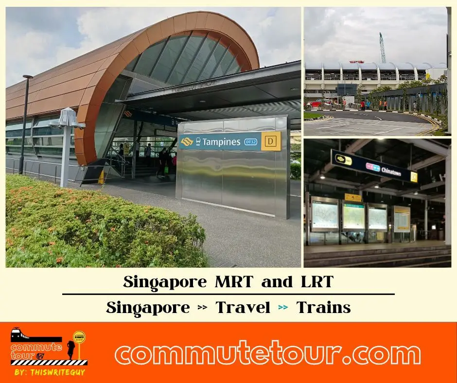
Singapore MRT / LRT Map
Singapore MRT / LRT Map. You can remove the other lines by tapping the top left corner of the map with arrow and unchecking the box/es.
Click here to search for MRT / LRT Station
Singapore MRT / LRT Map
Click the MRT / LRT Line below for more details.
MRT
LRT
Monorail
Cross Border
Featured
Click the time stamps below