07211 – After Farrer Park Station Exit G Bus Stop, Routes, Bus Schedule | Singapore
Bus Stop 07211 – Aft Farrer Pk Stn Exit G
Bus Stop 07211 – After Farrer Park Station Exit G include routes 21, 23, 64, 65, 67, 125, 130, 139, 141, 147, 857
Routes from After Farrer Park Station Exit G going to Ang Mo Kio Interchange, Hougang Central Interchange, Lorong 1 Geylang Terminal, Sims Place Terminal, St. Michael’s Terminal, Tampines Interchange, Toa Payoh Interchange, Yishun Interchange
After Farrer Park Station Exit G bus stop also connects with Farrer Park Station NE8 North East Line MRT (NEL)
Travelling today or planning for a commute from Bus Stop Code 07211 – After Farrer Park Station Exit G? Learn more about Bus Schedule, Route Map and MRT from After Farrer Park Station Exit G.
NOTICE: The fares and schedules listed here may subject to change without prior notice. Pls check with the companies for the updated details.
CommuteTour is in no way affiliated with any of the buses / trains / tourist spots listed on any of its pages.
Subscribe: youtube.com/@commutetour
Bus Stop 07211 – Aft Farrer Pk Stn Exit G Map
Bus Stop 07211 – After Farrer Park Station Exit G
After Farrer Park Station Exit G Bus Stop Routes
| Route | Destination |
|---|---|
| 21 | St. Michael’s Terminal |
| 23 | Tampines Interchange |
| 64 | Sims Place Terminal |
| 65 | Tampines Interchange |
| 67 | Tampines Interchange |
| 125 | St. Michael’s Terminal |
| 130 | Ang Mo Kio Interchange |
| 139 | Toa Payoh Interchange |
| 141 | Lorong 1 Geylang Terminal |
| 147 | Hougang Central Interchange |
| 857 | Yishun Interchange |
SBS Transit Bus 21 Details
| Category | Information |
|---|---|
| Bus Route | 21 |
| Operator | SBS Transit |
| Dir 1 # of Stops | 68 |
| Dir 2 # of Stops | 67 |
| Origin | Pasir Ris Interchange |
| Destination | St. Michael’s Terminal |
| Direction | Two Way |
Bus 21 Schedule
SBS Transit Bus 21 schedule from Pasir Ris Interchange to St. Michael’s Terminal is from 05:30 to 24:00 from Monday to Sunday / Holidays while the bus schedule from St. Michael’s Terminal is from 05:30 to 24:00 from Monday to Sunday / Holidays.
| From | Monday to Friday | Saturday | Sunday / Holiday |
|---|---|---|---|
| Pasir Ris Int | 05:30 to 24:00 | 05:30 to 24:00 | 05:30 to 24:00 |
| St. Michael’s Ter | 05:30 to 24:00 | 05:30 to 24:00 | 05:30 to 24:00 |
| Frequency | Before 8:30 | 08:31 – 16:59 | 17:00 – 19:00 | After 19:00 |
|---|---|---|---|---|
| From Pasir Ris | 07 – 12 minutes | 11 – 14 minutes | 12 – 16 minutes | 14 – 16 minutes |
| From St. Michael’s Ter | 10 – 13 minutes | 08 – 14 minutes | 08 – 16 minutes | 12 – 16 minutes |
SG Bus 21 Route Map
Bus 21 Route Map
Tap the top right of the map for full screen view. You can return to this page by clicking on the link on the google map description
SBS Transit Bus 21 Bus Stops
The Bus Stops along SBS Transit Bus 21 Route include: Balestier Plaza, Balestier Point, Bedok Industrial Park C, Bedok Reform Training Center, Century Square, City Plaza, Downtown East, Hoa Nam Building, Jalan Dusun, Joo Chiat Complex, Kallang Place, Kim Keat Lane, Lavender Street, Lorong 1 Geylang, Lorong 106 Changi, Lorong 18 Geylang, Lorong 23 Geylang, Lorong 28 Geylang, Lorong 34 Geylang, Lorong 39 Geylang, Mohd Salleh Mosque, National Skin Center, Nkf, Northlight School, Novena Lodge, Public Mansion, Revival Center Church, Shaw Plaza, Sims Ville, Sims Way, Singapore Indian Assn, Singapore Khalsa Assn, Sri Vadapathira K Temple, St. Joseph Institution Jnr, Tai Hoe Hotel, Tan Tock Seng Hospital, The Clearwater Condominium, Thomson Medical Center, Uob Tampines Center, Waterfront Isle, Waterfront Key, Waterfront Waves, White Sands Primary School, Yi Xiu Factory Building and Zhongshan Mall.
Bus 21 passes along Blk 104, Blk 107, Blk 114, Blk 121, Blk 122, Blk 133, Blk 134, Blk 14 Market/Fc, Blk 140, Blk 147, Blk 149a, Blk 156, Blk 16, Blk 17, Blk 182, Blk 187, Blk 19, Blk 191, Blk 230e, Blk 233, Blk 269a, Blk 29, Blk 322, Blk 370, Blk 390, Blk 405, Blk 416, Blk 423, Blk 429, Blk 442, Blk 446, Blk 449, Blk 467, Blk 497d, Blk 609, Blk 629, Blk 646, Blk 65, Blk 701, Blk 703, Blk 713, Blk 716, Blk 745, Blk 82 and Blk 938.
SBS Transit Bus 21 Route also connects with the following stations: Aljunied, Boon Keng, Eunos, Farrer Park, Kallang, Novena, Pasir Ris, Paya Lebar, Tampines, Tampines East, Tampines West and terminals: Pasir Ris Interchange, St. Michael’s Terminal, Tampines Interchange
Pasir Ris Interchange (77009)
Road: Pasir Ris Drive 3
Station Code: EW1
Train Line/s: East-West Line MRT
Terminal: Pasir Ris InterchangeDowntown East (78109)
Road: Pasir Ris Drive 3Blk 467 (78081)
Road: Pasir Ris Drive 6Blk 446 (78071)
Road: Pasir Ris Drive 6Blk 442 (78069)
Road: Pasir Ris Drive 1Before Blk 187 (78181)
Road: Pasir Ris Street 11After Blk 182 (78191)
Road: Pasir Ris Street 11Blk 269a (98099)
Road: Pasir Ris Drive 1Opposite Blk 149a (98019)
Road: Loyang AvenueBlk 370 (76249)
Road: Tampines Avenue 7Blk 390 (76239)
Road: Tampines Avenue 7Opposite Tampines East Station (76229)
Road: Tampines Avenue 7
Station Code: DT33
Train Line/s: Downtown Line MRTBlk 230e (76219)
Road: Tampines Avenue 7Blk 233 (76209)
Road: Tampines Avenue 7Opposite Tampines Station/Interchange (76149)
Road: Tampines Avenue 4
Station Code: EW2 DT32
Train Line/s: East-West Line MRT Downtown Line MRT
Terminal: Tampines InterchangeOpposite Century Square (76139)
Road: Tampines Avenue 4Blk 147 (76069)
Road: Tampines Avenue 5Before Tampines West Station (75059)
Road: Tampines Avenue 1
Station Code: DT31
Train Line/s: Downtown Line MRTBedok Reform Training Center (75069)
Road: Bedok Reservoir RoadThe Clearwater Condominium (75349)
Road: Bedok Reservoir RoadWaterfront Key (84609)
Road: Bedok Reservoir RoadAfter Waterfront Waves (84639)
Road: Bedok Reservoir RoadWaterfront Isle (84619)
Road: Bedok Reservoir RoadBlk 716 (84629)
Road: Bedok Reservoir RoadBlk 713 (84479)
Road: Bedok Reservoir RoadBlk 703 (84469)
Road: Bedok Reservoir RoadAfter Bedok Industrial Park C (84481)
Road: Bedok Reservoir RoadBlk 629 (84491)
Road: Bedok Reservoir RoadBlk 609 (72079)
Road: Bedok Reservoir RoadBlk 121 (72069)
Road: Bedok Reservoir RoadOpposite Blk 646 (72029)
Road: Bedok Reservoir RoadOpposite Blk 322 (72019)
Road: Jalan EunosOpposite Blk 16 (83119)
Road: Jalan EunosOpposite Eunos Station (83109)
Road: Jalan Eunos
Station Code: EW7
Train Line/s: East-West Line MRTAfter Lorong 106 Changi (82069)
Road: Changi RoadJoo Chiat Complex (82049)
Road: Changi RoadBlk 14 Market/Fc (82029)
Road: Geylang RoadCity Plaza (82109)
Road: Geylang RoadOpposite Lorong 39 Geylang (81069)
Road: Geylang RoadAfter Lorong 34 Geylang (81049)
Road: Geylang RoadAfter Lorong 28 Geylang (81029)
Road: Geylang RoadBefore Lorong 18 Geylang (80089)
Road: Geylang RoadOpposite Mohd Salleh Mosque (80069)
Road: Geylang RoadAfter Sims Way (80049)
Road: Geylang RoadKallang Station/Opposite Blk 2c (80101)
Road: Lorong 1 Geylang
Station Code: EW10
Train Line/s: East-West Line MRTOpposite Kallang Place (60051)
Road: Boon Keng RoadBefore Lavender Street (60099)
Road: Bendemeer RoadHoa Nam Building (07329)
Road: Jalan BesarBefore Tai Hoe Hotel (07231)
Road: Kitchener RoadAfter Farrer Park Station Exit G (07211)
Road: Serangoon Road
Station Code: NE8
Train Line/s: North East Line MRTSri Vadapathira K Temple (07221)
Road: Serangoon RoadSingapore Khalsa Assn (50249)
Road: Balestier RoadSingapore Indian Assn (50239)
Road: Balestier RoadOpposite Tan Tock Seng Hospital (50129)
Road: Moulmein RoadSt. Joseph Institution Jnr (50119)
Road: Moulmein RoadOpposite Novena Church (50031)
Road: Thomson Road
Station Code: NS20
Train Line/s: North-South Line MRTNovena Lodge (50041)
Road: Thomson RoadBefore Jalan Dusun (50161)
Road: Balestier RoadZhongshan Mall (50171)
Road: Balestier RoadBefore Balestier Plaza (50191)
Road: Balestier RoadShaw Plaza (50201)
Road: Balestier RoadOpposite Balestier Point (50211)
Road: Balestier RoadBlk 82 (50991)
Road: Whampoa DriveBlk 29 (52129)
Road: Jalan BahagiaBlk 19 (52049)
Road: Jalan TenteramOpposite Blk 65 (52119)
Road: Jalan TenteramSt. Michael’s Terminal (52499)
Road: Whampoa Road
Terminal: St. Michael’s Terminal
St. Michael’s Terminal (52499)
Road: Whampoa Road
Terminal: St. Michael’s TerminalBlk 114 (52451)
Road: Whampoa RoadBlk 29 (52129)
Road: Jalan BahagiaBlk 19 (52049)
Road: Jalan TenteramOpposite Blk 65 (52119)
Road: Jalan TenteramOpposite Nkf (52099)
Road: Kim Keat RoadBefore Kim Keat Lane (50159)
Road: Kim Keat RoadAfter Pegu Road (50209)
Road: Balestier RoadOpposite Shaw Plaza (50199)
Road: Balestier RoadOpposite Public Mansion (50189)
Road: Balestier RoadOpposite Zhongshan Mall (50179)
Road: Balestier RoadAfter Irrawaddy Road (50169)
Road: Balestier RoadOpposite Thomson Medical Center (50059)
Road: Thomson RoadOpposite Novena Lodge (50049)
Road: Thomson RoadNovena Station (50038)
Road: Thomson Road
Station Code: NS20
Train Line/s: North-South Line MRTRevival Center Church (50111)
Road: Moulmein RoadNational Skin Center (50121)
Road: Moulmein RoadNorthlight School (50231)
Road: Balestier RoadBlk 122 (50331)
Road: Mcnair RoadBlk 107 (50349)
Road: Towner RoadBoon Keng Station/Blk 22 (60199)
Road: Boon Keng Road
Station Code: NE9
Train Line/s: North East Line MRTBefore Kallang Place (60059)
Road: Boon Keng RoadOpposite Kallang Station/Blk 2c (80109)
Road: Lorong 1 Geylang
Station Code: EW10
Train Line/s: East-West Line MRTAfter Lorong 1 Geylang (80051)
Road: Sims AvenueYi Xiu Factory Building (80071)
Road: Sims AvenueBefore Lorong 23 Geylang (80091)
Road: Sims AvenueAfter Aljunied Station (81011)
Road: Sims Avenue
Station Code: EW9
Train Line/s: East-West Line MRTBlk 134 (81031)
Road: Sims AvenueSims Ville (81051)
Road: Sims AvenueAfter Paya Lebar Quarter (82011)
Road: Sims Avenue
Station Code: EW8 CC9
Train Line/s: East-West Line MRT Circle Line MRTBlk 416 (82032)
Road: Sims AvenueEunos Station/Interchange (82061)
Road: Sims Avenue
Station Code: EW7
Train Line/s: East-West Line MRTEunos Station (83101)
Road: Jalan Eunos
Station Code: EW7
Train Line/s: East-West Line MRTBlk 17 (83111)
Road: Jalan EunosBlk 322 (72011)
Road: Jalan EunosBlk 646 (72021)
Road: Bedok Reservoir RoadBlk 122 (72061)
Road: Bedok Reservoir RoadBlk 133 (72071)
Road: Bedok Reservoir RoadBlk 140 (84499)
Road: Bedok Reservoir RoadOpposite Bedok Industrial Park C (84489)
Road: Bedok Reservoir RoadOpposite Blk 701 (84461)
Road: Bedok Reservoir RoadBlk 745 (84471)
Road: Bedok Reservoir RoadOpposite Blk 716 (84621)
Road: Bedok Reservoir RoadOpposite Waterfront Isle (84611)
Road: Bedok Reservoir RoadOpposite Waterfront Waves (84631)
Road: Bedok Reservoir RoadOpposite Waterfront Key (84601)
Road: Bedok Reservoir RoadOpposite The Clearwater Condominium (75341)
Road: Bedok Reservoir RoadOpposite Bedok Reform Training Center (75061)
Road: Bedok Reservoir RoadTampines West Station Exit B (75051)
Road: Tampines Avenue 1
Station Code: DT31
Train Line/s: Downtown Line MRTBlk 938 (76061)
Road: Tampines Avenue 5Uob Tampines Center (76131)
Road: Tampines Avenue 4Tampines Station/Interchange (76141)
Road: Tampines Avenue 4
Station Code: EW2 DT32
Train Line/s: East-West Line MRT Downtown Line MRT
Terminal: Tampines InterchangeBlk 423 (76201)
Road: Tampines Avenue 7Blk 449 (76211)
Road: Tampines Avenue 7Tampines East Station Exit A (76221)
Road: Tampines Avenue 7
Station Code: DT33
Train Line/s: Downtown Line MRTOpposite Blk 390 (76231)
Road: Tampines Avenue 7Blk 497d (76241)
Road: Tampines Avenue 7Blk 149a (98011)
Road: Loyang AvenueBlk 156 (98091)
Road: Pasir Ris Drive 1Opposite White Sands Primary School (78199)
Road: Pasir Ris Street 11Opposite Blk 187 (78189)
Road: Pasir Ris Street 11Blk 104 (78061)
Road: Pasir Ris Drive 1Blk 429 (78079)
Road: Pasir Ris Drive 6Blk 405 (78089)
Road: Pasir Ris Drive 6Opposite Downtown East (78101)
Road: Pasir Ris Drive 3Pasir Ris Interchange (77009)
Road: Pasir Ris Drive 3
Station Code: EW1
Train Line/s: East-West Line MRT
Terminal: Pasir Ris Interchange
Feel Free to click any of the Terminal, Transport links above
SBS Transit Bus 23 Details
| Category | Information |
|---|---|
| Bus Route | 23 |
| Operator | SBS Transit |
| Dir 1 # of Stops | 43 |
| Origin | Tampines Interchange |
| Destination | Rochor Canal Road |
| Direction | Loop |
Bus 23 Schedule
SBS Transit Bus 23 schedule from Tampines Interchange to Rochor Canal Road is from 05:30 to 23:50 from Monday to Sunday / Holidays.
| From | Monday to Friday | Saturday | Sunday / Holiday |
|---|---|---|---|
| Tampines Int | 05:30 to 23:50 | 05:30 to 23:50 | 05:30 to 23:50 |
| Frequency | Before 8:30 | 08:31 – 16:59 | 17:00 – 19:00 | After 19:00 |
|---|---|---|---|---|
| From Tampines | 6 – 7 minutes | 6 – 12 minutes | 7 – 9 minutes | 9 – 16 minutes |
SG Bus 23 Route Map
Bus 23 Route Map
Tap the top right of the map for full screen view. You can return to this page by clicking on the link on the google map description
SBS Transit Bus 23 Bus Stops
The Bus Stops along SBS Transit Bus 23 Route include: Bendemeer Primary School, Hoa Nam Building, HomeTeamNS Bedok, Infineon, Kallang Basin Swim Complex, Kolam Ayer Industrial Estate, Kwong Wai Shiu Hospital, Lavender Street, Mom Svcs Center, Our Tampines Hub, Sri Vadapathira K Temple, St. Michael’s Place, Tekka Center, Temasek Polytechnic (Poly), Temasek Polytechnic (Poly)East G, Temasek Polytechnic (Poly)West G and Tropica Condominium.
Bus 23 passes along Blk 147, Blk 44, Blk 54, Blk 938 and Blks 705/706.
SBS Transit Bus 23 Route also connects with the following stations: Bedok North, Boon Keng, Farrer Park, Jalan Besar, Rochor, Tampines, Tampines West and terminals: Tampines Interchange
Tampines Interchange (75009)
Road: Tampines Central 1
Station Code: EW2 DT32
Train Line/s: East-West Line MRT Downtown Line MRT
Terminal: Tampines InterchangeOpposite Our Tampines Hub (76059)
Road: Tampines Avenue 5Blk 147 (76069)
Road: Tampines Avenue 5Before Tampines West Station (75059)
Road: Tampines Avenue 1
Station Code: DT31
Train Line/s: Downtown Line MRTTemasek Polytechnic (Poly)East G (75229)
Road: Tampines Avenue 1Temasek Polytechnic (Poly) (75239)
Road: Tampines Avenue 1Temasek Polytechnic (Poly)West G (75249)
Road: Tampines Avenue 1Tropica Condominium (75259)
Road: Tampines Avenue 1Between Blks 705/706 (84459)
Road: Bedok North RoadBedok North Station Exit B (84539)
Road: Bedok North Road
Station Code: DT29
Train Line/s: Downtown Line MRTKallang Basin Swim Complex (60069)
Road: Jalan Kolam AyerBefore Bendemeer Road (60079)
Road: Jalan Kolam AyerMom Svcs Center (60179)
Road: Bendemeer RoadBlk 54 (60159)
Road: Bendemeer RoadBlk 44 (60139)
Road: Bendemeer RoadOpposite Boon Keng Station (60119)
Road: Bendemeer Road
Station Code: NE9
Train Line/s: North East Line MRTBefore Lavender Street (60099)
Road: Bendemeer RoadHoa Nam Building (07329)
Road: Jalan BesarAfter Allenby Road (07319)
Road: Jalan BesarOpposite Veerasamy Road (07419)
Road: Jalan BesarJalan Besar Station Exit A (07529)
Road: Jalan Besar
Station Code: DT22
Train Line/s: Downtown Line MRTRochor Station (07531)
Road: Rochor Canal Road
Station Code: DT13
Train Line/s: Downtown Line MRTTekka Center (07031)
Road: Serangoon RoadBroadway Hotel (07111)
Road: Serangoon RoadAfter Farrer Park Station Exit G (07211)
Road: Serangoon Road
Station Code: NE8
Train Line/s: North East Line MRTSri Vadapathira K Temple (07221)
Road: Serangoon RoadKwong Wai Shiu Hospital (60101)
Road: Serangoon RoadBoon Keng Station/Blk 102 (60121)
Road: Serangoon Road
Station Code: NE9
Train Line/s: North East Line MRTOpposite Bendemeer Primary School (60141)
Road: Serangoon RoadSt. Michael’s Place (60161)
Road: Serangoon RoadKolam Ayer Industrial Estate (60071)
Road: Jalan Kolam AyerAfter Infineon (60061)
Road: Jalan Kolam AyerBedok North Station Exit A (84451)
Road: Bedok North Road
Station Code: DT29
Train Line/s: Downtown Line MRTOpposite Tropica Condominium (75251)
Road: Tampines Avenue 1Opposite Temasek Polytechnic (Poly)West G (75241)
Road: Tampines Avenue 1Opposite Temasek Polytechnic (Poly) (75231)
Road: Tampines Avenue 1Opposite Temasek Polytechnic (Poly)East G (75221)
Road: Tampines Avenue 1Tampines West Station Exit B (75051)
Road: Tampines Avenue 1
Station Code: DT31
Train Line/s: Downtown Line MRTBlk 938 (76061)
Road: Tampines Avenue 5Our Tampines Hub (76051)
Road: Tampines Avenue 5Tampines Interchange (75009)
Road: Tampines Central 1
Station Code: EW2 DT32
Train Line/s: East-West Line MRT Downtown Line MRT
Terminal: Tampines Interchange
SBS Transit Bus 64 Details
| Category | Information |
|---|---|
| Bus Route | 64 |
| Operator | SBS Transit |
| Dir 1 # of Stops | 81 |
| Origin | Sims Place Terminal |
| Destination | Mei Ling Street |
| Direction | Loop |
Bus 64 Schedule
SBS Transit Bus 64 schedule from Sims Place Terminal to Mei Ling St is from 05:30 to 23:30 from Monday to Sunday / Holidays.
| From | Monday to Friday | Saturday | Sunday / Holiday |
|---|---|---|---|
| Sims Pl Ter | 05:30 to 23:30 | 05:30 to 23:30 | 05:30 to 23:30 |
| Frequency | Before 8:30 | 08:31 – 16:59 | 17:00 – 19:00 | After 19:00 |
|---|---|---|---|---|
| From Sims Ter | 12 – 13 minutes | 10 – 17 minutes | 14 – 16 minutes | 14 – 15 minutes |
SG Bus 64 Route Map
Bus 64 Route Map
Tap the top right of the map for full screen view. You can return to this page by clicking on the link on the google map description
SBS Transit Bus 64 Bus Stops
The Bus Stops along SBS Transit Bus 64 Route include: Aljunied Park, Anchorpoint, Ar-Rabitah Mosque, Bendemeer Primary School, Canossa Catholic Primary, Cencon Building, Delta Swim Complex, Ganges Center, Gulab Building, Harvest Mansions, Haw Par Glass Tower, Hoa Nam Building, Hotel Miramar, Ibis Singapore On Bencoolen, Jalan Wangi, Kwong Wai Shiu Hospital, Lavender Street, Lea Hin Hardware Factory, Mom Svcs Center, Peace Center, Queens, River Place Condominium, School of The Arts, Selegie Center, Siemens Center, Sims Urban Oasis, Sis Building, Sri Vadapathira K Temple, St. Michael’s Place, Tai Thong Crescent, Tekka Center, Tiong Bahru Park, Tiong Ghee Temple, UE Square and YMCA.
Bus 64 passes along Blk 104a, Blk 125, Blk 153, Blk 157, Blk 158, Blk 163, Blk 166, Blk 2, Blk 44, Blk 45, Blk 48, Blk 49 Market/Fc, Blk 51, Blk 53, Blk 54, Blk 78 and Blk 79.
SBS Transit Bus 64 Route also connects with the following stations: Bencoolen, Boon Keng, Dhoby Ghaut, Farrer Park, Havelock, Jalan Besar, Redhill and terminals: Sims Pl Terminal
Sims Place Terminal (80289)
Road: Sims Place
Terminal: Sims Pl TerminalBlk 49 Market/Fc (80249)
Road: Sims PlaceOpposite Blk 53 (80231)
Road: Sims DriveSims Urban Oasis (81091)
Road: Aljunied RoadOpposite Blk 125 (70011)
Road: Aljunied RoadOpposite Canossa Catholic Primary (70021)
Road: Aljunied RoadOpposite Aljunied Park (70031)
Road: Aljunied RoadCencon Building (70119)
Road: MacPherson RoadGulab Building (70109)
Road: MacPherson RoadBefore Siemens Center (60219)
Road: MacPherson RoadMom Svcs Center (60179)
Road: Bendemeer RoadBlk 54 (60159)
Road: Bendemeer RoadBlk 44 (60139)
Road: Bendemeer RoadOpposite Boon Keng Station (60119)
Road: Bendemeer Road
Station Code: NE9
Train Line/s: North East Line MRTBefore Lavender Street (60099)
Road: Bendemeer RoadHoa Nam Building (07329)
Road: Jalan BesarAfter Allenby Road (07319)
Road: Jalan BesarOpposite Veerasamy Road (07419)
Road: Jalan BesarJalan Besar Station Exit A (07529)
Road: Jalan Besar
Station Code: DT22
Train Line/s: Downtown Line MRTIbis Singapore On Bencoolen (07517)
Road: Bencoolen StreetBefore Bencoolen Station Exit A (04029)
Road: Bencoolen Street
Station Code: DT21
Train Line/s: Downtown Line MRTYMCA (08041)
Road: Orchard RoadAfter Haw Par Glass Tower (08019)
Road: Clemenceau AvenueOpposite UE Square (04329)
Road: Clemenceau AvenueBlk 2 (06161)
Road: Havelock RoadHotel Miramar (06151)
Road: Havelock RoadHoliday Inn Atrium (06141)
Road: Havelock Road
Station Code: TE16
Train Line/s: Thomson-East Coast Line MRTGanges Center (10221)
Road: Ganges AvenueBlk 51 Carpark (10231)
Road: Ganges AvenueBlk 48 (10389)
Road: Lower Delta RoadOpposite Tiong Bahru Park (10171)
Road: Tiong Bahru RoadBefore Ar-Rabitah Mosque (10181)
Road: Tiong Bahru RoadBlk 78 (10191)
Road: Tiong Bahru RoadOpposite Redhill Station (10201)
Road: Tiong Bahru Road
Station Code: EW18
Train Line/s: East-West Line MRTSis Building (10281)
Road: Alexandra RoadBefore Dawson Road (10291)
Road: Alexandra RoadOpposite Queens (11541)
Road: Stirling RoadTiong Ghee Temple (11551)
Road: Stirling RoadBlk 166 (11561)
Road: Stirling RoadBlk 158 (11579)
Road: Mei Ling StreetBlk 157 (11589)
Road: Mei Ling StreetBlk 153 (11599)
Road: Mei Ling StreetBlk 163 (11609)
Road: Mei Chin RoadBlk 166 (11029)
Road: QueenswayAnchorpoint (11521)
Road: Alexandra RoadOpposite Lea Hin Hardware Factory (11531)
Road: Alexandra RoadAfter Dawson Road (10299)
Road: Alexandra RoadRedhill Station (10209)
Road: Tiong Bahru Road
Station Code: EW18
Train Line/s: East-West Line MRTDelta Swim Complex (10199)
Road: Tiong Bahru RoadBlk 104a Carpark (10189)
Road: Tiong Bahru RoadTiong Bahru Park (10179)
Road: Tiong Bahru RoadOpposite Blk 48 (10381)
Road: Lower Delta RoadBlk 79 (10239)
Road: Ganges AvenueOpposite Harvest Mansions (10229)
Road: Ganges AvenueOpposite Holiday Inn Atrium (06149)
Road: Havelock Road
Station Code: TE16
Train Line/s: Thomson-East Coast Line MRTOpposite Hotel Miramar (06159)
Road: Havelock RoadRiver Place Condominium (06169)
Road: Havelock RoadUE Square (04321)
Road: Clemenceau AvenueAfter River Valley Road (04311)
Road: Clemenceau AvenueOpposite Haw Par Glass Tower (08011)
Road: Clemenceau AvenueAfter Dhoby Ghaut Station (08058)
Road: Orchard Road
Station Code: CC1 NE6 NS24
Train Line/s: Circle Line MRT North East Line MRT North-South Line MRTSchool of The Arts (08079)
Road: Prinsep StreetPeace Center (07011)
Road: Selegie RoadSelegie Center (07021)
Road: Selegie RoadTekka Center (07031)
Road: Serangoon RoadBroadway Hotel (07111)
Road: Serangoon RoadAfter Farrer Park Station Exit G (07211)
Road: Serangoon Road
Station Code: NE8
Train Line/s: North East Line MRTSri Vadapathira K Temple (07221)
Road: Serangoon RoadKwong Wai Shiu Hospital (60101)
Road: Serangoon RoadBoon Keng Station/Blk 102 (60121)
Road: Serangoon Road
Station Code: NE9
Train Line/s: North East Line MRTOpposite Bendemeer Primary School (60141)
Road: Serangoon RoadSt. Michael’s Place (60161)
Road: Serangoon RoadAfter Tai Thong Crescent (60211)
Road: MacPherson RoadBefore Jalan Wangi (70101)
Road: MacPherson RoadOpposite Cencon Building (70111)
Road: MacPherson RoadAljunied Park (70039)
Road: Aljunied RoadCanossa Catholic Primary (70029)
Road: Aljunied RoadBlk 125 (70019)
Road: Aljunied RoadBefore Blk 53 (80239)
Road: Sims DriveBlk 45 (80229)
Road: Sims DriveSims Place Terminal (80289)
Road: Sims Place
Terminal: Sims Pl Terminal
SBS Transit Bus 65 Details
| Category | Information |
|---|---|
| Bus Route | 65 |
| Operator | SBS Transit |
| Dir 1 # of Stops | 65 |
| Dir 2 # of Stops | 64 |
| Origin | Tampines Interchange |
| Destination | Harbourfront Interchange |
| Direction | Two Way |
Bus 65 Schedule
SBS Transit Bus 65 schedule from Tampines Interchange to HarbourFront Interchange is from 05:30 to 23:30 from Monday to Sunday / Holidays while the bus schedule from HarbourFront Interchange is from 05:30 to 24:00 from Monday to Sunday / Holidays.
| From | Monday to Friday | Saturday | Sunday / Holiday |
|---|---|---|---|
| Tampines Int | 05:30 to 23:30 | 05:30 to 23:30 | 05:30 to 23:30 |
| HarbourFront Int | 05:30 to 24:00 | 05:30 to 24:00 | 05:30 to 24:00 |
| Frequency | Before 8:30 | 08:31 – 16:59 | 17:00 – 19:00 | After 19:00 |
|---|---|---|---|---|
| From Tampines | 09 – 09 minutes | 09 – 12 minutes | 10 – 11 minutes | 10 – 11 minutes |
| From HarbourFront | 08 – 11 minutes | 08 – 12 minutes | 12 – 12 minutes | 09 – 13 minutes |
SG Bus 65 Route Map
Bus 65 Route Map
Tap the top right of the map for full screen view. You can return to this page by clicking on the link on the google map description
SBS Transit Bus 65 Bus Stops
The Bus Stops along SBS Transit Bus 65 Route include: Aljunied Park, Automobile Megamart, Aztech Building, Bedok Industrial Park C, Bedok Reform Training Center, Bendemeer Primary School, Canossa Catholic Primary, Cencon Building, Cendex Center, Concorde Hotel Singapore, Grace Baptist Church, Gulab Building, Hoa Nam Building, Ibis Singapore On Bencoolen, Jalan Anggerek, Jalan Wangi, Kwong Wai Shiu Hospital, Lavender Street, Mom Svcs Center, Mt Faber Lodge, National Youth Council, Our Tampines Hub, Peace Center, Rv Residences, Rv Suites, School of The Arts, Selegie Center, Siemens Center, Sri Vadapathira K Temple, St. Hilda’s Secondary School, St. Michael’s Place, St. Theresa’s Convent, Tai Thong Crescent, Tekka Center, The Clearwater Condominium, The Pearl @ Mt Faber, Valley Point, Waterfront Isle, Waterfront Key, Waterfront Waves, Winsland House, YMCA and Zion Full Gospel Church.
Bus 65 passes along Blk 105, Blk 121, Blk 122, Blk 129, Blk 133, Blk 140, Blk 25b, Blk 3019, Blk 302, Blk 3021, Blk 3023, Blk 3024, Blk 3026, Blk 311, Blk 36, Blk 4, Blk 40, Blk 44, Blk 48, Blk 54, Blk 609, Blk 629, Blk 637, Blk 646, Blk 66, Blk 701, Blk 703, Blk 713, Blk 716, Blk 745, Blk 77, Blk 79 Fc, Blk 801, Blk 90 and Blk 945.
MRT Stations along Bus 65 Route include: Bencoolen, Boon Keng, Dhoby Ghaut, Farrer Park, Harbourfront, Jalan Besar, MacPherson, Mattar, Orchard, Somerset, Tampines, Tampines West, Ubi, Vivo City and connects with Harbourfront Interchange, Tampines Interchange.
Tampines Interchange (75009)
Road: Tampines Central 1
Station Code: EW2 DT32
Train Line/s: East-West Line MRT Downtown Line MRT
Terminal: Tampines InterchangeOpposite Our Tampines Hub (76059)
Road: Tampines Avenue 5Blk 945 (76111)
Road: Tampines Avenue 4Opposite St. Hilda’s Secondary School (76121)
Road: Tampines Avenue 4Junyuan Primary School (76281)
Road: Tampines Avenue 4
Station Code: DT31
Train Line/s: Downtown Line MRTBedok Reform Training Center (75069)
Road: Bedok Reservoir RoadThe Clearwater Condominium (75349)
Road: Bedok Reservoir RoadWaterfront Key (84609)
Road: Bedok Reservoir RoadAfter Waterfront Waves (84639)
Road: Bedok Reservoir RoadWaterfront Isle (84619)
Road: Bedok Reservoir RoadBlk 716 (84629)
Road: Bedok Reservoir RoadBlk 713 (84479)
Road: Bedok Reservoir RoadBlk 703 (84469)
Road: Bedok Reservoir RoadAfter Bedok Industrial Park C (84481)
Road: Bedok Reservoir RoadBlk 629 (84491)
Road: Bedok Reservoir RoadBlk 609 (72079)
Road: Bedok Reservoir RoadBlk 121 (72069)
Road: Bedok Reservoir RoadOpposite Blk 646 (72029)
Road: Bedok Reservoir RoadBlk 311 (71099)
Road: Eunos LinkBlk 302 (71139)
Road: Ubi Avenue 2Ubi Station Exit A (71129)
Road: Ubi Avenue 2
Station Code: DT27
Train Line/s: Downtown Line MRTBlk 3024 (71149)
Road: Ubi Avenue 2Blk 3026 (71159)
Road: Ubi Avenue 2Aztech Building (71169)
Road: Ubi Avenue 2Opposite Macpherson Station Exit A (70379)
Road: Circuit Link
Station Code: DT26 CC10
Train Line/s: Downtown Line MRT Circle Line MRTOpposite Macpherson Station Exit D (70201)
Road: Circuit Road
Station Code: DT26 CC10
Train Line/s: Downtown Line MRT Circle Line MRTBlk 90 (70211)
Road: Pipit RoadBlk 79 Fc (70221)
Road: Circuit RoadOpposite Mattar Station Exit B (70231)
Road: Mattar Road
Station Code: DT25
Train Line/s: Downtown Line MRTAfter Grace Baptist Church (70241)
Road: Mattar RoadOpposite Canossa Catholic Primary (70021)
Road: Aljunied RoadOpposite Aljunied Park (70031)
Road: Aljunied RoadCencon Building (70119)
Road: MacPherson RoadGulab Building (70109)
Road: MacPherson RoadBefore Siemens Center (60219)
Road: MacPherson RoadMom Svcs Center (60179)
Road: Bendemeer RoadBlk 54 (60159)
Road: Bendemeer RoadBlk 44 (60139)
Road: Bendemeer RoadOpposite Boon Keng Station (60119)
Road: Bendemeer Road
Station Code: NE9
Train Line/s: North East Line MRTBefore Lavender Street (60099)
Road: Bendemeer RoadHoa Nam Building (07329)
Road: Jalan BesarAfter Allenby Road (07319)
Road: Jalan BesarOpposite Veerasamy Road (07419)
Road: Jalan BesarJalan Besar Station Exit A (07529)
Road: Jalan Besar
Station Code: DT22
Train Line/s: Downtown Line MRTIbis Singapore On Bencoolen (07517)
Road: Bencoolen StreetBefore Bencoolen Station Exit A (04029)
Road: Bencoolen Street
Station Code: DT21
Train Line/s: Downtown Line MRTYMCA (08041)
Road: Orchard RoadDhoby Ghaut Station Exit B (08031)
Road: Penang Road
Station Code: CC1 NE6 NS24
Train Line/s: Circle Line MRT North East Line MRT North-South Line MRTWinsland House (08111)
Road: Penang RoadSomerset Station (08121)
Road: Somerset Road
Station Code: NS23
Train Line/s: North-South Line MRTNational Youth Council (09059)
Road: Grange RoadBefore Orchard Station Exit B (09022)
Road: Orchard Boulevard
Station Code: NS22 TE14
Train Line/s: North-South Line MRT Thomson-East Coast Line MRTAfter Orchard Boulevard (13199)
Road: Paterson Road
Station Code: NS22 TE14
Train Line/s: North-South Line MRT Thomson-East Coast Line MRTBefore Zion Full Gospel Church (13159)
Road: Irwell Bank RoadRv Residences (13069)
Road: River Valley RoadValley Point (13059)
Road: River Valley RoadBlk 4 (10519)
Road: Delta RoadBlk 48 (10389)
Road: Lower Delta RoadBlk 25b (10379)
Road: Lower Delta RoadOpposite Cendex Center (10369)
Road: Lower Delta RoadOpposite St. Theresa’s Convent (14039)
Road: Lower Delta RoadBlk 105 (14029)
Road: Lower Delta RoadOpposite Mt Faber Lodge (14019)
Road: Kampong Bahru RoadHarbourfront Station/Vivocity (14141)
Road: Telok Blangah Road
Station Code: CC29 NE1 S1
Train Line/s: Circle Line MRT North East Line MRT Sentosa Express MonorailHarbourfront Interchange (14009)
Road: Seah Im Road
Station Code: CC29 NE1 S1
Train Line/s: Circle Line MRT North East Line MRT Sentosa Express Monorail
Terminal: Harbourfront Interchange
Harbourfront Interchange (14009)
Road: Seah Im Road
Station Code: CC29 NE1 S1
Train Line/s: Circle Line MRT North East Line MRT Sentosa Express Monorail
Terminal: Harbourfront InterchangeHarbourfront Station Exit A (14129)
Road: Telok Blangah Road
Station Code: CC29 NE1 S1
Train Line/s: Circle Line MRT North East Line MRT Sentosa Express MonorailOpposite Vivocity (14119)
Road: Telok Blangah Road
Station Code: CC29 NE1 S1
Train Line/s: Circle Line MRT North East Line MRT Sentosa Express MonorailBefore Mt Faber Lodge (14011)
Road: Kampong Bahru RoadThe Pearl @ Mt Faber (14021)
Road: Lower Delta RoadBlk 40 (14379)
Road: Lower Delta RoadSt. Theresa’s Convent (14031)
Road: Lower Delta RoadCendex Center (10361)
Road: Lower Delta RoadBlk 129 (10371)
Road: Lower Delta RoadOpposite Blk 48 (10381)
Road: Lower Delta RoadOpposite Valley Point (13051)
Road: River Valley RoadRv Suites (13063)
Road: River Valley RoadAfter Zion Full Gospel Church (13141)
Road: Hoot Kiam RoadBefore Orchard Boulevard (13191)
Road: Paterson Road
Station Code: NS22 TE14
Train Line/s: North-South Line MRT Thomson-East Coast Line MRTOrchard Station/Lucky Plaza (09048)
Road: Orchard Road
Station Code: NS22 TE14
Train Line/s: North-South Line MRT Thomson-East Coast Line MRTOpposite Somerset Station (09038)
Road: Orchard Road
Station Code: NS23
Train Line/s: North-South Line MRTConcorde Hotel Singapore (08138)
Road: Orchard RoadAfter Dhoby Ghaut Station (08058)
Road: Orchard Road
Station Code: CC1 NE6 NS24
Train Line/s: Circle Line MRT North East Line MRT North-South Line MRTSchool of The Arts (08079)
Road: Prinsep StreetPeace Center (07011)
Road: Selegie RoadSelegie Center (07021)
Road: Selegie RoadTekka Center (07031)
Road: Serangoon RoadBroadway Hotel (07111)
Road: Serangoon RoadAfter Farrer Park Station Exit G (07211)
Road: Serangoon Road
Station Code: NE8
Train Line/s: North East Line MRTSri Vadapathira K Temple (07221)
Road: Serangoon RoadKwong Wai Shiu Hospital (60101)
Road: Serangoon RoadBoon Keng Station/Blk 102 (60121)
Road: Serangoon Road
Station Code: NE9
Train Line/s: North East Line MRTOpposite Bendemeer Primary School (60141)
Road: Serangoon RoadSt. Michael’s Place (60161)
Road: Serangoon RoadAfter Tai Thong Crescent (60211)
Road: MacPherson RoadBefore Jalan Wangi (70101)
Road: MacPherson RoadOpposite Cencon Building (70111)
Road: MacPherson RoadAljunied Park (70039)
Road: Aljunied RoadAfter Jalan Anggerek (70151)
Road: Merpati RoadOpposite Mattar Station Exit A (70161)
Road: Merpati Road
Station Code: DT25
Train Line/s: Downtown Line MRTBlk 77 (70171)
Road: Circuit RoadBlk 36 (70181)
Road: Circuit RoadOpposite Blk 66 (70191)
Road: Circuit RoadMacpherson Station Exit A (70371)
Road: Circuit Link
Station Code: DT26 CC10
Train Line/s: Downtown Line MRT Circle Line MRTBlk 3019 (71161)
Road: Ubi Avenue 2Blk 3021 (71151)
Road: Ubi Avenue 2Blk 3023 (71141)
Road: Ubi Avenue 2Ubi Station Exit B (71121)
Road: Ubi Avenue 2
Station Code: DT27
Train Line/s: Downtown Line MRTAutomobile Megamart (71131)
Road: Ubi Avenue 2Blk 637 (71091)
Road: Eunos LinkBlk 646 (72021)
Road: Bedok Reservoir RoadBlk 122 (72061)
Road: Bedok Reservoir RoadBlk 133 (72071)
Road: Bedok Reservoir RoadBlk 140 (84499)
Road: Bedok Reservoir RoadOpposite Bedok Industrial Park C (84489)
Road: Bedok Reservoir RoadOpposite Blk 701 (84461)
Road: Bedok Reservoir RoadBlk 745 (84471)
Road: Bedok Reservoir RoadOpposite Blk 716 (84621)
Road: Bedok Reservoir RoadOpposite Waterfront Isle (84611)
Road: Bedok Reservoir RoadOpposite Waterfront Waves (84631)
Road: Bedok Reservoir RoadOpposite Waterfront Key (84601)
Road: Bedok Reservoir RoadOpposite The Clearwater Condominium (75341)
Road: Bedok Reservoir RoadOpposite Bedok Reform Training Center (75061)
Road: Bedok Reservoir RoadBlk 801 (76289)
Road: Tampines Avenue 4
Station Code: DT31
Train Line/s: Downtown Line MRTSt. Hilda’s Secondary School (76129)
Road: Tampines Avenue 4Opposite Blk 945 (76119)
Road: Tampines Avenue 4Our Tampines Hub (76051)
Road: Tampines Avenue 5Tampines Interchange (75009)
Road: Tampines Central 1
Station Code: EW2 DT32
Train Line/s: East-West Line MRT Downtown Line MRT
Terminal: Tampines Interchange
Feel Free to click any of the Terminal, Transport links above
SMRT Bus 67 Details
Bus 67 Schedule
SMRT Bus 67 schedule from Choa Chu Kang Interchange to Tampines Interchange is from 05:30 to 23:00 from Monday to Sunday / Holidays while the bus schedule from Tampines Interchange is from 05:30 to 23:30 from Monday to Sunday / Holidays.
| From | Monday to Friday | Saturday | Sunday / Holiday |
|---|---|---|---|
| Choa Chu Kang Int | 05:30 to 23:00 | 05:30 to 23:00 | 05:30 to 23:00 |
| Tampines Int | 05:30 to 23:30 | 05:30 to 23:30 | 05:30 to 23:30 |
| Frequency | Before 8:30 | 08:31 – 16:59 | 17:00 – 19:00 | After 19:00 |
|---|---|---|---|---|
| From Choa Chu Kang | 06 – 09 minutes | 07 – 12 minutes | 08 – 11 minutes | 09 – 13 minutes |
| From Tampines | 07 – 09 minutes | 06 – 11 minutes | 08 – 12 minutes | 09 – 12 minutes |
SG Bus 67 Route Map
Bus 67 Route Map
Tap the top right of the map for full screen view. You can return to this page by clicking on the link on the google map description
SMRT Bus 67 Bus Stops
The Bus Stops along SMRT Bus 67 Route include: Anglo-Chinese School, Arc 380, Assumption Eng School, Assumption Pathway School, Balmoral Plaza, Bedok Reform Training Center, Bukit Regency, Casa Sarina, Chai Chee Industrial Park, Chancery Court, Chinese High School, City Plaza, Coronation Plaza, Crown Center, Ferrell Residences, Hazel Park Terrace, Hoa Nam Building, Hong San Si Temple, Hua Guan Gardens, Hume Park Condominium, Jalan Naga Sari, Joo Chiat Complex, Kallang Bahru, Kampong Bugis, Kampong Eunos, King Albert Park, Kk Women & Child Hospital, Kk Women & Children Hospital, Leng Kwang Baptist Church, Lorong 1 Geylang, Lorong 106 Changi, Lorong 110 Changi, Lorong 18 Geylang, Lorong 23 Geylang, Lorong 28 Geylang, Lorong 34 Geylang, Lorong 39 Geylang, Min of Defence, Mohd Salleh Mosque, National Junior College (JC), Newton Fc, Nus Bukit Timah Campus, Our Tampines Hub, Padang Jeringau, Pei Hwa Presby Primary School, Perpetual Succour Church, Siglap Plain, Sims Ville, Sims Way, Southaven Ii, Springdale Condominium, Swiss Cottage Estate, Tekka Center, The Clearwater Condominium, The Hillside, The Linear, The Nexus, The Rail Mall, The Tessarina, Woh Hup Building and Yi Xiu Factory Building.
Bus 67 passes along Blk 109, Blk 113, Blk 134, Blk 14 Market/Fc, Blk 147, Blk 220, Blk 221a, Blk 239, Blk 26, Blk 27, Blk 32, Blk 352, Blk 403, Blk 414, Blk 416, Blk 506, Blk 938, Blks 139/140 and Blks 237/239.
MRT Stations along Bus 67 Route include: Aljunied, Beauty World, Bedok, Bedok Reservoir, Botanic Gardens, Bukit Panjang, Cashew, Choa Chu Kang, Eunos, Farrer Park, Hillview, Jalan Besar, Kallang, Keat Hong, Kembangan, King Albert Park, Little India, Newton, Paya Lebar, Phoenix, Rochor, Sixth Avenue, South View, Stevens, Tampines, Tampines West, Tan Kah Kee, Teck Whye and connects with Choa Chu Kang Interchange, Lorong 1 Geylang Terminal, Tampines Interchange.
Choa Chu Kang Interchange (44009)
Road: Choa Chu Kang Loop
Station Code: NS4
Train Line/s: North-South Line MRT
Terminal: Choa Chu Kang InterchangeBlk 352 (44461)
Road: Choa Chu Kang WayBefore South View Station (44451)
Road: Choa Chu Kang Way
Station Code: BP2
Train Line/s: Bukit Panjang LRTBlk 239 (44441)
Road: Choa Chu Kang Way
Station Code: BP3
Train Line/s: Bukit Panjang LRTBlk 113 (44121)
Road: Choa Chu Kang WayBlk 26 (44131)
Road: Choa Chu Kang Road
Station Code: BP4
Train Line/s: Bukit Panjang LRTPhoenix Station (44141)
Road: Choa Chu Kang Road
Station Code: BP5
Train Line/s: Bukit Panjang LRTBukit Panjang Station Exit A/LRT (44029)
Road: Upper Bukit Timah Road
Station Code: DT1 BP6
Train Line/s: Downtown Line MRT Bukit Panjang LRTThe Linear (44019)
Road: Upper Bukit Timah RoadBefore Hazel Park Terrace (43119)
Road: Upper Bukit Timah RoadCashew Station (43109)
Road: Upper Bukit Timah Road
Station Code: DT2
Train Line/s: Downtown Line MRTAssumption Pathway School (43099)
Road: Upper Bukit Timah RoadAfter Assumption Eng School (43089)
Road: Upper Bukit Timah RoadHillview Station Exit A (43069)
Road: Upper Bukit Timah Road
Station Code: DT3
Train Line/s: Downtown Line MRTThe Rail Mall (43059)
Road: Upper Bukit Timah RoadOpposite Hume Park Condominium (43049)
Road: Upper Bukit Timah RoadOpposite The Hillside (43029)
Road: Upper Bukit Timah RoadSpringdale Condominium (43019)
Road: Upper Bukit Timah RoadSouthaven Ii (42119)
Road: Upper Bukit Timah RoadBeauty World Station Exit A (42099)
Road: Upper Bukit Timah Road
Station Code: DT5
Train Line/s: Downtown Line MRTOpposite Pei Hwa Presby Primary School (42079)
Road: Upper Bukit Timah RoadOpposite King Albert Park Station (42059)
Road: Dunearn Road
Station Code: DT6
Train Line/s: Downtown Line MRTHua Guan Gardens (42049)
Road: Dunearn RoadOpposite The Nexus (42039)
Road: Dunearn RoadAfter Swiss Club Road (42029)
Road: Dunearn RoadOpposite Sixth Avenue Station (42019)
Road: Dunearn Road
Station Code: DT7
Train Line/s: Downtown Line MRTAfter Jalan Naga Sari (41089)
Road: Dunearn RoadNational Junior College (JC) (41079)
Road: Dunearn RoadOpposite Tan Kah Kee Station (41069)
Road: Dunearn Road
Station Code: DT8
Train Line/s: Downtown Line MRTOpposite Coronation Plaza (41049)
Road: Dunearn RoadOpposite Botanic Gardens Station (41029)
Road: Dunearn Road
Station Code: DT9 CC19
Train Line/s: Downtown Line MRT Circle Line MRTAfter Kheam Hock Road (41019)
Road: Dunearn RoadAfter Dunkirk Avenue (40099)
Road: Dunearn RoadOpposite Stevens Station (40089)
Road: Dunearn Road
Station Code: DT10 TE11
Train Line/s: Downtown Line MRT Thomson-East Coast Line MRTBefore Swiss Cottage Estate (40079)
Road: Dunearn RoadBefore Goldhill Avenue (40119)
Road: Dunearn RoadAnglo-Chinese School (40069)
Road: Dunearn RoadChancery Court (40059)
Road: Dunearn RoadOpposite Newton Station Exit C (40049)
Road: Dunearn Road
Station Code: DT11 NS21
Train Line/s: Downtown Line MRT North-South Line MRTOpposite Newton Fc (40039)
Road: Bukit Timah RoadAfter Makepeace Road (40029)
Road: Bukit Timah RoadKk Women & Children Hospital (40279)
Road: Bukit Timah RoadLittle India Station (40019)
Road: Bukit Timah Road
Station Code: DT12 NE7
Train Line/s: Downtown Line MRT North East Line MRTTekka Center (07031)
Road: Serangoon RoadBroadway Hotel (07111)
Road: Serangoon RoadAfter Farrer Park Station Exit G (07211)
Road: Serangoon Road
Station Code: NE8
Train Line/s: North East Line MRTAfter Kempas Road (07249)
Road: Lavender StreetOpposite Arc 380 (07359)
Road: Lavender StreetAfter Kallang Bahru (07369)
Road: Lavender StreetAperia/Before Kallang Road (07379)
Road: Lavender StreetAfter Padang Jeringau (80011)
Road: Kallang RoadKallang Station (80031)
Road: Sims Avenue
Station Code: EW10
Train Line/s: East-West Line MRTAfter Lorong 1 Geylang (80051)
Road: Sims AvenueYi Xiu Factory Building (80071)
Road: Sims AvenueBefore Lorong 23 Geylang (80091)
Road: Sims AvenueAfter Aljunied Station (81011)
Road: Sims Avenue
Station Code: EW9
Train Line/s: East-West Line MRTBlk 134 (81031)
Road: Sims AvenueSims Ville (81051)
Road: Sims AvenueAfter Paya Lebar Quarter (82011)
Road: Sims Avenue
Station Code: EW8 CC9
Train Line/s: East-West Line MRT Circle Line MRTBlk 416 (82032)
Road: Sims AvenueEunos Station/Interchange (82061)
Road: Sims Avenue
Station Code: EW7
Train Line/s: East-West Line MRTCasa Sarina (83011)
Road: Sims Avenue EastOpposite Hong San Si Temple (83031)
Road: Sims Avenue EastKembangan Station (83062)
Road: Sims Avenue East
Station Code: EW6
Train Line/s: East-West Line MRTOpposite Perpetual Succour Church (83081)
Road: Sims Avenue EastChai Chee Industrial Park (84011)
Road: New Upper Changi RoadBlk 32 (84021)
Road: New Upper Changi RoadBedok Station Exit B (84031)
Road: New Upper Changi Road
Station Code: EW5
Train Line/s: East-West Line MRTBlk 221a (84041)
Road: New Upper Changi RoadBlk 220 Carpark (84191)
Road: Bedok North Avenue 3Blk 403 (84211)
Road: Bedok North Avenue 3Blk 506 (84521)
Road: Bedok North Avenue 3Bedok Resvr Station Exit A (84201)
Road: Bedok North Avenue 3
Station Code: DT30
Train Line/s: Downtown Line MRTOpposite The Clearwater Condominium (75341)
Road: Bedok Reservoir RoadOpposite Bedok Reform Training Center (75061)
Road: Bedok Reservoir RoadTampines West Station Exit B (75051)
Road: Tampines Avenue 1
Station Code: DT31
Train Line/s: Downtown Line MRTBlk 938 (76061)
Road: Tampines Avenue 5Our Tampines Hub (76051)
Road: Tampines Avenue 5Tampines Interchange (75009)
Road: Tampines Central 1
Station Code: EW2 DT32
Train Line/s: East-West Line MRT Downtown Line MRT
Terminal: Tampines Interchange
Tampines Interchange (75009)
Road: Tampines Central 1
Station Code: EW2 DT32
Train Line/s: East-West Line MRT Downtown Line MRT
Terminal: Tampines InterchangeOpposite Our Tampines Hub (76059)
Road: Tampines Avenue 5Blk 147 (76069)
Road: Tampines Avenue 5Before Tampines West Station (75059)
Road: Tampines Avenue 1
Station Code: DT31
Train Line/s: Downtown Line MRTBedok Reform Training Center (75069)
Road: Bedok Reservoir RoadThe Clearwater Condominium (75349)
Road: Bedok Reservoir RoadBedok Resvr Station Exit B (84209)
Road: Bedok North Avenue 3
Station Code: DT30
Train Line/s: Downtown Line MRTBlk 109 (84529)
Road: Bedok North Avenue 3Between Blks 139/140 (84219)
Road: Bedok North Avenue 3Opposite Blk 220 Carpark (84199)
Road: Bedok North Avenue 3Blk 27 (84049)
Road: New Upper Changi RoadBedok Station Exit A (84039)
Road: New Upper Changi Road
Station Code: EW5
Train Line/s: East-West Line MRTOpposite Blk 32 (84029)
Road: New Upper Changi RoadOpposite Chai Chee Industrial Park (84019)
Road: New Upper Changi RoadAfter Perpetual Succour Church (83099)
Road: Changi RoadBefore Siglap Plain (83079)
Road: Changi RoadMasjid Kassim (83059)
Road: Changi Road
Station Code: EW6
Train Line/s: East-West Line MRTBefore Lorong 110 Changi (83049)
Road: Changi RoadAfter Kampong Eunos (83029)
Road: Changi RoadAfter Lorong 106 Changi (82069)
Road: Changi RoadJoo Chiat Complex (82049)
Road: Changi RoadBlk 14 Market/Fc (82029)
Road: Geylang RoadCity Plaza (82109)
Road: Geylang RoadOpposite Lorong 39 Geylang (81069)
Road: Geylang RoadAfter Lorong 34 Geylang (81049)
Road: Geylang RoadAfter Lorong 28 Geylang (81029)
Road: Geylang RoadBefore Lorong 18 Geylang (80089)
Road: Geylang RoadOpposite Mohd Salleh Mosque (80069)
Road: Geylang RoadAfter Sims Way (80049)
Road: Geylang RoadOpposite Lorong 1 Geylang Terminal (80039)
Road: Geylang Road
Station Code: EW10
Train Line/s: East-West Line MRT
Terminal: Lor 1 Geylang TerminalBefore Kampong Bugis (80029)
Road: Kallang RoadAfter Kallang Road (07371)
Road: Lavender StreetBefore Kallang Bahru (07361)
Road: Lavender StreetArc 380 (07351)
Road: Lavender StreetHoa Nam Building (07329)
Road: Jalan BesarAfter Allenby Road (07319)
Road: Jalan BesarOpposite Veerasamy Road (07419)
Road: Jalan BesarJalan Besar Station Exit A (07529)
Road: Jalan Besar
Station Code: DT22
Train Line/s: Downtown Line MRTRochor Station (07531)
Road: Rochor Canal Road
Station Code: DT13
Train Line/s: Downtown Line MRTLittle India Station Exit A (40011)
Road: Bukit Timah Road
Station Code: DT12 NE7
Train Line/s: Downtown Line MRT North East Line MRTOpposite Kk Women & Child Hospital (40271)
Road: Bukit Timah RoadBefore Winstedt Road (40021)
Road: Bukit Timah RoadNewton Fc (40031)
Road: Bukit Timah RoadNewton Station Exit C (40041)
Road: Bukit Timah Road
Station Code: DT11 NS21
Train Line/s: Downtown Line MRT North-South Line MRTBalmoral Plaza (40051)
Road: Bukit Timah RoadFerrell Residences (40111)
Road: Bukit Timah RoadLeng Kwang Baptist Church (40071)
Road: Bukit Timah RoadStevens Station (40081)
Road: Bukit Timah Road
Station Code: DT10 TE11
Train Line/s: Downtown Line MRT Thomson-East Coast Line MRTBefore Lewis Road (40091)
Road: Bukit Timah RoadNus Bukit Timah Campus (41011)
Road: Bukit Timah RoadBotanic Gardens Station (41021)
Road: Bukit Timah Road
Station Code: DT9 CC19
Train Line/s: Downtown Line MRT Circle Line MRTBefore Crown Center (41031)
Road: Bukit Timah RoadCoronation Plaza (41041)
Road: Bukit Timah RoadTan Kah Kee Station (41051)
Road: Bukit Timah Road
Station Code: DT8
Train Line/s: Downtown Line MRTChinese High School (41061)
Road: Bukit Timah RoadOpposite National Junior College (JC) (41071)
Road: Bukit Timah RoadSixth Avenue Station (41081)
Road: Bukit Timah Road
Station Code: DT7
Train Line/s: Downtown Line MRTSixth Avenue Center (42011)
Road: Bukit Timah RoadAfter Maple Avenue (42021)
Road: Bukit Timah RoadThe Tessarina (42031)
Road: Bukit Timah RoadThe Nexus (42041)
Road: Bukit Timah RoadKing Albert Park Station (42051)
Road: Bukit Timah Road
Station Code: DT6
Train Line/s: Downtown Line MRTKing Albert Park (42061)
Road: Bukit Timah RoadPei Hwa Presby Primary School (42071)
Road: Upper Bukit Timah RoadBeauty World Station Exit B (42091)
Road: Upper Bukit Timah Road
Station Code: DT5
Train Line/s: Downtown Line MRTWoh Hup Building (42111)
Road: Upper Bukit Timah RoadBukit Regency (43011)
Road: Upper Bukit Timah RoadAfter Old Jurong Road (43021)
Road: Upper Bukit Timah RoadHume Park Condominium (43041)
Road: Upper Bukit Timah RoadOpposite The Rail Mall (43051)
Road: Upper Bukit Timah RoadHillview Station (43061)
Road: Upper Bukit Timah Road
Station Code: DT3
Train Line/s: Downtown Line MRTOpposite Dairy Farm Road (43071)
Road: Upper Bukit Timah RoadOpposite Assumption Eng School (43081)
Road: Upper Bukit Timah RoadBefore Cashew Station (43091)
Road: Upper Bukit Timah Road
Station Code: DT2
Train Line/s: Downtown Line MRTMin of Defence (43111)
Road: Upper Bukit Timah RoadOpposite The Linear (44011)
Road: Upper Bukit Timah RoadBukit Panjang Station Exit B (44021)
Road: Upper Bukit Timah Road
Station Code: DT1 BP6
Train Line/s: Downtown Line MRT Bukit Panjang LRTOpposite Phoenix Station (44149)
Road: Choa Chu Kang Road
Station Code: BP5
Train Line/s: Bukit Panjang LRTOpposite Blk 26 (44139)
Road: Choa Chu Kang Road
Station Code: BP4
Train Line/s: Bukit Panjang LRTOpposite Blk 113 (44129)
Road: Choa Chu Kang WayOpposite Blks 237/239 (44449)
Road: Choa Chu Kang Way
Station Code: BP3
Train Line/s: Bukit Panjang LRTOpposite South View Station (44459)
Road: Choa Chu Kang Way
Station Code: BP2
Train Line/s: Bukit Panjang LRTBlk 414 (44469)
Road: Choa Chu Kang WayChoa Chu Kang Interchange (44009)
Road: Choa Chu Kang Loop
Station Code: NS4
Train Line/s: North-South Line MRT
Terminal: Choa Chu Kang Interchange
Feel Free to click any of the Terminal, Transport links above
SBS Transit Bus 125 Details
| Category | Information |
|---|---|
| Bus Route | 125 |
| Operator | SBS Transit |
| Dir 1 # of Stops | 48 |
| Origin | St. Michael’s Terminal |
| Destination | Sims Drive |
| Direction | Loop |
Bus 125 Schedule
SBS Transit Bus 125 schedule from St. Michael’s Terminal to Sims Drive is from 06:00 to 23:00 from Monday to Sunday / Holidays.
| From | Monday to Friday | Saturday | Sunday / Holiday |
|---|---|---|---|
| St. Michael’s Ter | 06:00 to 23:00 | 06:00 to 23:00 | 06:00 to 23:00 |
| Frequency | Before 8:30 | 08:31 – 16:59 | 17:00 – 19:00 | After 19:00 |
|---|---|---|---|---|
| From St. Michael’s Ter | 11 – 12 minutes | 10 – 18 minutes | 10 – 16 minutes | 15 – 18 minutes |
SG Bus 125 Route Map
Bus 125 Route Map
Tap the top right of the map for full screen view. You can return to this page by clicking on the link on the google map description
SBS Transit Bus 125 Bus Stops
The Bus Stops along SBS Transit Bus 125 Route include: Balestier Point, Bendemeer Primary School, Genting Lane, Genting Link, Hoa Nam Building, Kallang Sector, Kallang Way 1, Kallang Way 2, Kallang Way 4, Kim Keat Lane, Kwong Wai Shiu Hospital, Lavender Street, Lorong 23 Geylang, Lorong Bakar Batu, Mom Svcs Center, Nkf, Northlight School, Siemens Center, Sims Urban Oasis, Singapore Indian Assn, Singapore Khalsa Assn, Sri Vadapathira K Temple, St. Michael’s Place, Tai Hoe Hotel, Tai Thong Crescent and Tannery Blk.
Bus 125 passes along Blk 104, Blk 114, Blk 125, Blk 29, Blk 44, Blk 45, Blk 53, Blk 54, Blk 82 and Blks 33/34.
SBS Transit Bus 125 Route also connects with the following stations: Aljunied, Boon Keng, Farrer Park and terminal: St. Michael’s Terminal
St. Michael’s Terminal (52499)
Road: Whampoa Road
Terminal: St. Michael’s TerminalBlk 114 (52451)
Road: Whampoa RoadBlk 29 (52129)
Road: Jalan BahagiaBetween Blks 33/34 (52109)
Road: Jalan BahagiaOpposite Nkf (52099)
Road: Kim Keat RoadBefore Kim Keat Lane (50159)
Road: Kim Keat RoadOpposite Balestier Point (50211)
Road: Balestier RoadBefore Blk 104 (50221)
Road: Balestier RoadNorthlight School (50231)
Road: Balestier RoadOpposite Singapore Khalsa Assn (50241)
Road: Balestier RoadKwong Wai Shiu Hospital (60101)
Road: Serangoon RoadBoon Keng Station/Blk 102 (60121)
Road: Serangoon Road
Station Code: NE9
Train Line/s: North East Line MRTOpposite Bendemeer Primary School (60141)
Road: Serangoon RoadSt. Michael’s Place (60161)
Road: Serangoon RoadAfter Tai Thong Crescent (60211)
Road: MacPherson RoadBefore Genting Link (70361)
Road: Genting LaneTannery Blk (70341)
Road: Tannery RoadAfter Kallang Way 1 (70321)
Road: Kallang WayAfter Genting Lane (70311)
Road: Kallang WayBlk 125 (70019)
Road: Aljunied RoadBefore Blk 53 (80239)
Road: Sims DriveBlk 45 (80229)
Road: Sims DriveBefore Sims Avenue (80269)
Road: Lorong 17 GeylangBefore Lorong 23 Geylang (80091)
Road: Sims AvenueOpposite Aljunied Station (81081)
Road: Aljunied Road
Station Code: EW9
Train Line/s: East-West Line MRTSims Urban Oasis (81091)
Road: Aljunied RoadOpposite Blk 125 (70011)
Road: Aljunied RoadAfter Kallang Way 4 (70319)
Road: Kallang WayAfter Kallang Way 2 (70329)
Road: Kallang WayBefore Lorong Bakar Batu (70349)
Road: Tannery RoadAfter Kallang Sector (70359)
Road: Lorong Bakar BatuBefore Siemens Center (60219)
Road: MacPherson RoadMom Svcs Center (60179)
Road: Bendemeer RoadBlk 54 (60159)
Road: Bendemeer RoadBlk 44 (60139)
Road: Bendemeer RoadOpposite Boon Keng Station (60119)
Road: Bendemeer Road
Station Code: NE9
Train Line/s: North East Line MRTBefore Lavender Street (60099)
Road: Bendemeer RoadHoa Nam Building (07329)
Road: Jalan BesarBefore Tai Hoe Hotel (07231)
Road: Kitchener RoadAfter Farrer Park Station Exit G (07211)
Road: Serangoon Road
Station Code: NE8
Train Line/s: North East Line MRTSri Vadapathira K Temple (07221)
Road: Serangoon RoadSingapore Khalsa Assn (50249)
Road: Balestier RoadSingapore Indian Assn (50239)
Road: Balestier RoadOpposite Blk 104 (50229)
Road: Balestier RoadBlk 82 (50991)
Road: Whampoa DriveBlk 29 (52129)
Road: Jalan BahagiaBetween Blks 33/34 (52109)
Road: Jalan BahagiaSt. Michael’s Terminal (52499)
Road: Whampoa Road
Terminal: St. Michael’s Terminal
SBS Transit Bus 130 Details
| Category | Information |
|---|---|
| Bus Route | 130 |
| Operator | SBS Transit |
| Dir 1 # of Stops | 42 |
| Dir 2 # of Stops | 41 |
| Origin | Ang Mo Kio Interchange |
| Destination | Shenton Way Terminal |
| Direction | Two Way |
Bus 130 Schedule
SBS Transit Bus 130 schedule from Ang Mo Kio Interchange to Shenton Way Terminal is from 05:30 to 23:30 from Monday to Sunday / Holidays while the bus schedule from Shenton Way Terminal is from 06:00 to 23:30 from Monday to Sunday / Holidays.
| From | Monday to Friday | Saturday | Sunday / Holiday |
|---|---|---|---|
| Ang Mo Kio Int | 05:30 to 23:30 | 05:30 to 23:30 | 05:30 to 23:30 |
| Shenton Way Ter | 06:00 to 23:30 | 06:00 to 23:30 | 06:00 to 23:30 |
| Frequency | Before 8:30 | 08:31 – 16:59 | 17:00 – 19:00 | After 19:00 |
|---|---|---|---|---|
| From Ang Mo Kio | 8 – 11 minutes | 9 – 16 minutes | 11 – 14 minutes | 16 – 17 minutes |
| From Shenton Way Ter | 13 – 14 minutes | 11 – 15 minutes | 11 minutes | 14 – 15 minutes |
SG Bus 130 Route Map
Bus 130 Route Map
Tap the top right of the map for full screen view. You can return to this page by clicking on the link on the google map description
SBS Transit Bus 130 Bus Stops
The Bus Stops along SBS Transit Bus 130 Route include: Amtech Building, Balestier Plaza, Balestier Point, Bras Basah Complex, Capital Tower, Church of Our Lady of Lourdes, Esplanade Bridge, Eunoia Junior College (JC), Hoa Nam Building, Hub Synergy Point, Jalan Dusun, Lavender Street, Macritchie Resvr, Mt Alvernia Hospital, Nea Reg Off, Northlight School, Old Police Acad, One Raffles Quay, Public Mansion, Raffles Hotel, Shaw Plaza, Shunfu Estate, Sin Ming Plaza, Singapore Indian Assn, Singapore Khalsa Assn, Singapore Polo Club, Slf Complex, Sri Vadapathira K Temple, St. Joseph’s Church, St. Theresa’s Home, Stamford Primary School, Tai Hoe Hotel, Tan Tong Meng Tower, Thomson Community Club (Cc), Thomson Flyover, Toa Payoh Rise and Zhongshan Mall.
Bus 130 passes along Blk 104, Blk 207, Blk 22a, Blk 23, Blk 25, Blk 254, Blk 307a, Blk 324, Blk 7 Industrial Estate and Blk 700b.
MRT Stations along Bus 130 Route include: Ang Mo Kio, Boon Keng, Bugis, City Hall, Esplanade, Farrer Park, Jalan Besar, Raffles Place, Shenton Way, Tanjong Pagar and connects with Ang Mo Kio Interchange, Shenton Way Terminal.
Ang Mo Kio Interchange (54009)
Road: Ang Mo Kio Avenue 8
Station Code: NS16
Train Line/s: North-South Line MRT
Terminal: Ang Mo Kio InterchangeBlk 324 (54248)
Road: Ang Mo Kio Avenue 3Blk 307a (54019)
Road: Ang Mo Kio Avenue 6Opposite Eunoia Junior College (JC) (53321)
Road: Sin Ming AvenueAfter Nea Reg Off (53209)
Road: Sin Ming DriveBlk 22a Carpark (53199)
Road: Sin Ming RoadBlk 25 (53189)
Road: Sin Ming RoadSin Ming Plaza (53179)
Road: Sin Ming RoadThomson Community Club (Cc) (53039)
Road: Upper Thomson RoadShunfu Estate (53029)
Road: Upper Thomson RoadOpposite St. Theresa’s Home (53019)
Road: Upper Thomson RoadMt Alvernia Hospital (51069)
Road: Thomson RoadAfter Toa Payoh Rise (51059)
Road: Thomson RoadSlf Complex (51049)
Road: Thomson RoadOpposite Singapore Polo Club (51039)
Road: Thomson RoadOpposite Old Police Acad (51029)
Road: Thomson RoadThomson Flyover (51019)
Road: Thomson RoadBefore Jalan Dusun (50161)
Road: Balestier RoadZhongshan Mall (50171)
Road: Balestier RoadBefore Balestier Plaza (50191)
Road: Balestier RoadShaw Plaza (50201)
Road: Balestier RoadOpposite Balestier Point (50211)
Road: Balestier RoadBefore Blk 104 (50221)
Road: Balestier RoadNorthlight School (50231)
Road: Balestier RoadOpposite Singapore Khalsa Assn (50241)
Road: Balestier RoadBoon Keng Station/Blk 22 (60199)
Road: Boon Keng Road
Station Code: NE9
Train Line/s: North East Line MRTBefore Lavender Street (60099)
Road: Bendemeer RoadHoa Nam Building (07329)
Road: Jalan BesarAfter Allenby Road (07319)
Road: Jalan BesarOpposite Veerasamy Road (07419)
Road: Jalan BesarJalan Besar Station Exit A (07529)
Road: Jalan Besar
Station Code: DT22
Train Line/s: Downtown Line MRTChurch of Our Lady of Lourdes (07589)
Road: Ophir RoadBugis Station Exit B (01059)
Road: Victoria Street
Station Code: EW12 DT14
Train Line/s: East-West Line MRT Downtown Line MRTAfter Bugis Station Exit C (01119)
Road: Victoria Street
Station Code: EW12 DT14
Train Line/s: East-West Line MRT Downtown Line MRTBras Basah Complex (01019)
Road: Victoria StreetRaffles Hotel (02049)
Road: Bras Basah RoadAfter Esplanade Station Exit D (02029)
Road: Esplanade Drive
Station Code: CC3
Train Line/s: Circle Line MRTOue Bayfront (03019)
Road: Collyer Quay
Station Code: EW14 NS26
Train Line/s: East-West Line MRT North-South Line MRTOne Raffles Quay (03059)
Road: Raffles QuayUIC Building (03129)
Road: Shenton Way
Station Code: TE19
Train Line/s: Thomson-East Coast Line MRTOpposite MAS Building (03218)
Road: Shenton Way
Station Code: EW15
Train Line/s: East-West Line MRTShenton Way Terminal (03239)
Road: Shenton Way
Terminal: Shenton Way Terminal
Shenton Way Terminal (03239)
Road: Shenton Way
Terminal: Shenton Way TerminalHub Synergy Point (03222)
Road: Anson RoadAfter Capital Tower (03111)
Road: Robinson RoadRaffles Place Station Exit F (03031)
Road: Robinson Road
Station Code: EW14 NS26
Train Line/s: East-West Line MRT North-South Line MRTFullerton Square (03011)
Road: Fullerton Road
Station Code: EW14 NS26
Train Line/s: East-West Line MRT North-South Line MRTEsplanade Bridge (02111)
Road: Esplanade DriveCath of The Good Shepherd (04151)
Road: Victoria Street
Station Code: EW13 NS25
Train Line/s: East-West Line MRT North-South Line MRTSt. Joseph’s Church (01013)
Road: Victoria StreetBugis Station Exit A (01113)
Road: Victoria Street
Station Code: EW12 DT14
Train Line/s: East-West Line MRT Downtown Line MRTStamford Primary School (01121)
Road: Victoria StreetAfter King George’s Avenue (07331)
Road: Kitchener RoadBefore Tai Hoe Hotel (07231)
Road: Kitchener RoadAfter Farrer Park Station Exit G (07211)
Road: Serangoon Road
Station Code: NE8
Train Line/s: North East Line MRTSri Vadapathira K Temple (07221)
Road: Serangoon RoadSingapore Khalsa Assn (50249)
Road: Balestier RoadSingapore Indian Assn (50239)
Road: Balestier RoadOpposite Blk 104 (50229)
Road: Balestier RoadAfter Pegu Road (50209)
Road: Balestier RoadOpposite Shaw Plaza (50199)
Road: Balestier RoadOpposite Public Mansion (50189)
Road: Balestier RoadOpposite Zhongshan Mall (50179)
Road: Balestier RoadAfter Irrawaddy Road (50169)
Road: Balestier RoadOpposite Tan Tong Meng Tower (51011)
Road: Thomson RoadOld Police Acad (51021)
Road: Thomson RoadSingapore Polo Club (51031)
Road: Thomson RoadAfter Andrew Road (51051)
Road: Thomson RoadMacritchie Resvr (51071)
Road: Thomson RoadSt. Theresa’s Home (53011)
Road: Upper Thomson RoadOpposite Shunfu Estate (53021)
Road: Upper Thomson RoadBlk 23 (53171)
Road: Sin Ming RoadAmtech Building (53181)
Road: Sin Ming RoadBlk 7 Industrial Estate (53191)
Road: Sin Ming RoadOpposite Nea Reg Off (53201)
Road: Sin Ming DriveEunoia Junior College (JC) (53329)
Road: Sin Ming AvenueOpposite Blk 254 (53161)
Road: Marymount RoadBlk 207 (54011)
Road: Ang Mo Kio Avenue 6Blk 700b (54241)
Road: Ang Mo Kio Avenue 3Ang Mo Kio Interchange (54009)
Road: Ang Mo Kio Avenue 8
Station Code: NS16
Train Line/s: North-South Line MRT
Terminal: Ang Mo Kio Interchange
Feel Free to click any of the Terminal, Transport links above
SBS Transit Bus 139 Details
| Category | Information |
|---|---|
| Bus Route | 139 |
| Operator | SBS Transit |
| Dir 1 # of Stops | 45 |
| Dir 2 # of Stops | 44 |
| Origin | Toa Payoh Interchange |
| Destination | Bukit Merah Interchange |
| Direction | Two Way |
Bus 139 Schedule
SBS Transit Bus 139 schedule from Toa Payoh Interchange to Bukit Merah Interchange is from 05:30 to 24:00 from Monday to Friday, and 05:40 to 24:00 every Saturday to Sunday / Holidays while the bus schedule from Bukit Merah Interchange is from 05:30 to 24:00 from Monday to Sunday / Holidays.
| From | Monday to Friday | Saturday | Sunday / Holiday |
|---|---|---|---|
| Toa Payoh Int | 05:30 to 24:00 | 05:40 to 24:00 | 05:40 to 24:00 |
| Bt Merah Int | 05:30 to 24:00 | 05:30 to 24:00 | 05:30 to 24:00 |
| Frequency | Before 8:30 | 08:31 – 16:59 | 17:00 – 19:00 | After 19:00 |
|---|---|---|---|---|
| From Toa Payoh | 9 – 10 minutes | 12 – 15 minutes | 10 – 12 minutes | 14 – 17 minutes |
| From Bukit Merah | 9 – 12 minutes | 9 – 15 minutes | 8 – 14 minutes | 13 – 17 minutes |
SG Bus 139 Route Map
Bus 139 Route Map
Tap the top right of the map for full screen view. You can return to this page by clicking on the link on the google map description
SBS Transit Bus 139 Bus Stops
The Bus Stops along SBS Transit Bus 139 Route include: Balestier Point, Bukit Merah Secondary School, Curtin Singapore, Delta Sports Hall, Easb, Enabling Village, Gan Eng Seng Secondary School, Haw Par Glass Tower, Hoa Nam Building, Ibis Singapore On Bencoolen, Jalan Dusun, Kim Keat Lane, Lavender Street, Motor Image, Nkf, Northlight School, Pacific Tech Center, Peace Center, Porsche Center Singapore, Rv Residences, School of The Arts, Selegie Center, Singapore Indian Assn, Singapore Khalsa Assn, Sis Building, Sri Vadapathira K Temple, St. Thomas Walk, Stellar Rv, Tan Tong Meng Tower, Tanglin View, Tekka Center, Trellis Towers, Valley Point, YMCA and Zhongshan Mall.
Bus 139 passes along Blk 1003, Blk 102, Blk 104, Blk 105, Blk 107, Blk 114, Blk 122, Blk 161, Blk 29, Blk 4, Blk 44, Blk 54, Blk 63b, Blk 82 and Blks 33/34.
MRT Stations along Bus 139 Route include: Bencoolen, Boon Keng, Dhoby Ghaut, Farrer Park, Great World, Jalan Besar, Toa Payoh and connects with Bukit Merah Interchange, Toa Payoh Interchange.
Toa Payoh Interchange (52009)
Road: Lorong 6 Toa Payoh
Station Code: NS19
Train Line/s: North-South Line MRT
Terminal: Toa Payoh InterchangeOpposite Trellis Towers (52079)
Road: Jalan Toa PayohBefore Jalan Dusun (50161)
Road: Balestier RoadZhongshan Mall (50171)
Road: Balestier RoadBlk 102 (52401)
Road: Jalan RajahBlk 105 (52411)
Road: Jalan RajahBlk 114 (52451)
Road: Whampoa RoadBlk 29 (52129)
Road: Jalan BahagiaBetween Blks 33/34 (52109)
Road: Jalan BahagiaOpposite Nkf (52099)
Road: Kim Keat RoadBefore Kim Keat Lane (50159)
Road: Kim Keat RoadOpposite Balestier Point (50211)
Road: Balestier RoadBefore Blk 104 (50221)
Road: Balestier RoadNorthlight School (50231)
Road: Balestier RoadBlk 122 (50331)
Road: Mcnair RoadBlk 107 (50349)
Road: Towner RoadBoon Keng Station/Blk 22 (60199)
Road: Boon Keng Road
Station Code: NE9
Train Line/s: North East Line MRTBefore Lavender Street (60099)
Road: Bendemeer RoadHoa Nam Building (07329)
Road: Jalan BesarAfter Allenby Road (07319)
Road: Jalan BesarOpposite Veerasamy Road (07419)
Road: Jalan BesarJalan Besar Station Exit A (07529)
Road: Jalan Besar
Station Code: DT22
Train Line/s: Downtown Line MRTIbis Singapore On Bencoolen (07517)
Road: Bencoolen StreetBefore Bencoolen Station Exit A (04029)
Road: Bencoolen Street
Station Code: DT21
Train Line/s: Downtown Line MRTYMCA (08041)
Road: Orchard RoadAfter Haw Par Glass Tower (08019)
Road: Clemenceau AvenueUE Sq/Before Mohd Sultan Road (13109)
Road: River Valley RoadBefore Kim Yam Road (13099)
Road: River Valley RoadOpposite St. Thomas Walk (13089)
Road: River Valley RoadThe Cosmopolitan (13079)
Road: River Valley Road
Station Code: TE15
Train Line/s: Thomson-East Coast Line MRTRv Residences (13069)
Road: River Valley RoadValley Point (13059)
Road: River Valley RoadBlk 4 (10519)
Road: Delta RoadGan Eng Seng Secondary School (10241)
Road: Alexandra RoadDelta Sports Hall (10261)
Road: Alexandra RoadOpposite Tanglin View (10271)
Road: Alexandra RoadSis Building (10281)
Road: Alexandra RoadBefore Dawson Road (10291)
Road: Alexandra RoadOpposite Motor Image (10219)
Road: Leng Kee RoadBlk 63b (10421)
Road: Lengkok BahruEnabling Village (10431)
Road: Lengkok BahruOpposite Blk 44 (10441)
Road: Lengkok BahruOpposite Pacific Tech Center (10119)
Road: Jalan Bukit MerahBlk 161 (10651)
Road: Bukit Merah CentralBukit Merah Interchange (10009)
Road: Bukit Merah Central
Terminal: Bukit Merah Interchange
Bukit Merah Interchange (10009)
Road: Bukit Merah Central
Terminal: Bukit Merah InterchangeBlk 1003 (10659)
Road: Bukit Merah CentralOpposite Bukit Merah Secondary School (10101)
Road: Jalan Bukit MerahBlk 44 (10449)
Road: Lengkok BahruOpposite Enabling Village (10439)
Road: Lengkok BahruBlk 54 (10429)
Road: Lengkok BahruPorsche Center Singapore (10211)
Road: Leng Kee RoadAfter Dawson Road (10299)
Road: Alexandra RoadOpposite Sis Building (10289)
Road: Alexandra RoadTanglin View (10279)
Road: Alexandra RoadOpposite Delta Sports Hall (10269)
Road: Alexandra RoadOpposite Gan Eng Seng Secondary School (10249)
Road: Alexandra RoadOpposite Valley Point (13051)
Road: River Valley RoadStellar Rv (13062)
Road: River Valley RoadRiva Lodge (13071)
Road: River Valley Road
Station Code: TE15
Train Line/s: Thomson-East Coast Line MRTSt. Thomas Walk (13081)
Road: River Valley RoadAfter Kim Yam Road (13091)
Road: River Valley RoadOpposite Mohd Sultan Road (13101)
Road: River Valley RoadAfter River Valley Road (04311)
Road: Clemenceau AvenueOpposite Haw Par Glass Tower (08011)
Road: Clemenceau AvenueAfter Dhoby Ghaut Station (08058)
Road: Orchard Road
Station Code: CC1 NE6 NS24
Train Line/s: Circle Line MRT North East Line MRT North-South Line MRTSchool of The Arts (08079)
Road: Prinsep StreetPeace Center (07011)
Road: Selegie RoadSelegie Center (07021)
Road: Selegie RoadTekka Center (07031)
Road: Serangoon RoadBroadway Hotel (07111)
Road: Serangoon RoadAfter Farrer Park Station Exit G (07211)
Road: Serangoon Road
Station Code: NE8
Train Line/s: North East Line MRTSri Vadapathira K Temple (07221)
Road: Serangoon RoadSingapore Khalsa Assn (50249)
Road: Balestier RoadSingapore Indian Assn (50239)
Road: Balestier RoadOpposite Blk 104 (50229)
Road: Balestier RoadBlk 82 (50991)
Road: Whampoa DriveBlk 29 (52129)
Road: Jalan BahagiaBetween Blks 33/34 (52109)
Road: Jalan BahagiaCurtin Singapore (52419)
Road: Jalan RajahOpposite Blk 102 (52409)
Road: Jalan RajahOpposite Easb (52479)
Road: Ah Hood RoadAfter Irrawaddy Road (50169)
Road: Balestier RoadOpposite Tan Tong Meng Tower (51011)
Road: Thomson RoadTrellis Towers (52071)
Road: Jalan Toa PayohToa Payoh Interchange (52009)
Road: Lorong 6 Toa Payoh
Station Code: NS19
Train Line/s: North-South Line MRT
Terminal: Toa Payoh Interchange
Feel Free to click any of the Terminal, Transport links above
SBS Transit Bus 141 Details
| Category | Information |
|---|---|
| Bus Route | 141 |
| Operator | SBS Transit |
| Dir 1 # of Stops | 26 |
| Dir 2 # of Stops | 25 |
| Origin | Lorong 1 Geylang Terminal |
| Destination | Toa Payoh Interchange |
| Direction | Two Way |
Bus 141 Schedule
SBS Transit Bus 141 schedule from Lorong 1 Geylang Terminal to Toa Payoh Interchange is from 06:00 to 23:30 from Monday to Sunday / Holidays while the bus schedule from Toa Payoh Interchange is from 06:00 to 23:45 from Monday to Sunday / Holidays.
| From | Monday to Friday | Saturday | Sunday / Holiday |
|---|---|---|---|
| Lor 1 Geylang Ter | 06:00 to 23:30 | 06:00 to 23:30 | 06:00 to 23:30 |
| Toa Payoh Int | 06:00 to 23:45 | 06:00 to 23:45 | 06:00 to 23:45 |
| Frequency | Before 8:30 | 08:31 – 16:59 | 17:00 – 19:00 | After 19:00 |
|---|---|---|---|---|
| From Lorong 1 Geylang Ter | 12 – 14 minutes | 14 – 16 minutes | 15 minutes | 13 – 23 minutes |
| From Toa Payoh | 12 minutes | 11 – 16 minutes | 11 – 16 minutes | 15 – 25 minutes |
SG Bus 141 Route Map
Bus 141 Route Map
Tap the top right of the map for full screen view. You can return to this page by clicking on the link on the google map description
SBS Transit Bus 141 Bus Stops
The Bus Stops along SBS Transit Bus 141 Route include: Arc 380, Hoa Nam Building, Kallang Bahru, Kampong Bugis, Kentish Green, Kentish Lodge, Lighthouse School, Novena Lodge, Old Police Acad, Oleander Towers, Padang Jeringau, Pek Kio Market, Singapore Polo Club, Slf Complex, Tai Hoe Hotel, Tan Tong Meng Tower, Thomson Flyover, Thomson Medical Center, Toa Payoh Rise and United Square.
Bus 141 passes along Blk 128, Blk 131, Blk 139a, Blk 163 and Blk 51/Opposite Pek Kio Market.
MRT Stations along Bus 141 Route include: Caldecott, Farrer Park, Kallang, Novena, Toa Payoh and connects with Lorong 1 Geylang Terminal, Toa Payoh Interchange.
Lorong 1 Geylang Terminal (80009)
Road: Lorong 1 Geylang
Station Code: EW10
Train Line/s: East-West Line MRT
Terminal: Lor 1 Geylang TerminalBefore Kampong Bugis (80029)
Road: Kallang RoadAfter Kallang Road (07371)
Road: Lavender StreetBefore Kallang Bahru (07361)
Road: Lavender StreetArc 380 (07351)
Road: Lavender StreetHoa Nam Building (07329)
Road: Jalan BesarBefore Tai Hoe Hotel (07231)
Road: Kitchener RoadFarrer Park Station Exit A (50251)
Road: Rangoon Road
Station Code: NE8
Train Line/s: North East Line MRTKentish Lodge (50261)
Road: Rangoon RoadKentish Green (50301)
Road: Kent RoadPek Kio Market (50081)
Road: Owen RoadBefore Carlisle Road (50071)
Road: Norfolk RoadUnited Sq/Before Novena Station (50021)
Road: Thomson Road
Station Code: NS20
Train Line/s: North-South Line MRTOpposite Novena Church (50031)
Road: Thomson Road
Station Code: NS20
Train Line/s: North-South Line MRTNovena Lodge (50041)
Road: Thomson RoadThomson Medical Center (50051)
Road: Thomson RoadOpposite Tan Tong Meng Tower (51011)
Road: Thomson RoadOld Police Acad (51021)
Road: Thomson RoadSingapore Polo Club (51031)
Road: Thomson RoadAfter Andrew Road (51051)
Road: Thomson RoadBefore Caldecott Station/Savh (52241)
Road: Toa Payoh Rise
Station Code: CC17 TE9
Train Line/s: Circle Line MRT Thomson-East Coast Line MRTLighthouse School (52211)
Road: Toa Payoh RiseBlk 128 (52159)
Road: Lorong 1 Toa PayohBlk 139a (52149)
Road: Lorong 1 Toa PayohOleander Towers (52139)
Road: Lorong 1 Toa PayohToa Payoh Interchange (52009)
Road: Lorong 6 Toa Payoh
Station Code: NS19
Train Line/s: North-South Line MRT
Terminal: Toa Payoh Interchange
Toa Payoh Interchange (52009)
Road: Lorong 6 Toa Payoh
Station Code: NS19
Train Line/s: North-South Line MRT
Terminal: Toa Payoh InterchangeBlk 163 (52131)
Road: Lorong 1 Toa PayohOpposite Blk 139a (52141)
Road: Lorong 1 Toa PayohBlk 131 (52151)
Road: Lorong 1 Toa PayohBefore Caldecott Station Exit 3 (52219)
Road: Toa Payoh Rise
Station Code: CC17 TE9
Train Line/s: Circle Line MRT Thomson-East Coast Line MRTAfter Caldecott Station (52249)
Road: Toa Payoh Rise
Station Code: CC17 TE9
Train Line/s: Circle Line MRT Thomson-East Coast Line MRTAfter Toa Payoh Rise (51059)
Road: Thomson RoadSlf Complex (51049)
Road: Thomson RoadOpposite Singapore Polo Club (51039)
Road: Thomson RoadOpposite Old Police Acad (51029)
Road: Thomson RoadThomson Flyover (51019)
Road: Thomson RoadOpposite Thomson Medical Center (50059)
Road: Thomson RoadOpposite Novena Lodge (50049)
Road: Thomson RoadNovena Station (50038)
Road: Thomson Road
Station Code: NS20
Train Line/s: North-South Line MRTOpposite United Square (50029)
Road: Thomson RoadOpposite Carlisle Road (50079)
Road: Norfolk RoadBlk 51/Opposite Pek Kio Market (50089)
Road: Owen RoadFarrer Park Station Exit D (50279)
Road: Gloucester Road
Station Code: NE8
Train Line/s: North East Line MRTOpposite Farrer Park Station (50259)
Road: Rangoon Road
Station Code: NE8
Train Line/s: North East Line MRTAfter Farrer Park Station Exit G (07211)
Road: Serangoon Road
Station Code: NE8
Train Line/s: North East Line MRTAfter Kempas Road (07249)
Road: Lavender StreetOpposite Arc 380 (07359)
Road: Lavender StreetAfter Kallang Bahru (07369)
Road: Lavender StreetAperia/Before Kallang Road (07379)
Road: Lavender StreetAfter Padang Jeringau (80011)
Road: Kallang RoadLorong 1 Geylang Terminal (80009)
Road: Lorong 1 Geylang
Station Code: EW10
Train Line/s: East-West Line MRT
Terminal: Lor 1 Geylang Terminal
Feel Free to click any of the Terminal, Transport links above
SBS Transit Bus 147 Details
| Category | Information |
|---|---|
| Bus Route | 147 |
| Operator | SBS Transit |
| Dir 1 # of Stops | 75 |
| Dir 2 # of Stops | 74 |
| Origin | Hougang Central Interchange |
| Destination | Clementi Interchange |
| Direction | Two Way |
Bus 147 Schedule
SBS Transit Bus 147 schedule from Hougang Central Interchange to Clementi Interchange is from 05:30 to 23:30 from Monday to Sunday / Holidays while the bus schedule from Clementi Interchange is from 05:45 to 23:45 from Monday to Sunday / Holidays.
| From | Monday to Friday | Saturday | Sunday / Holiday |
|---|---|---|---|
| Hougang Ctrl Int | 05:30 to 23:30 | 05:30 to 23:30 | 05:30 to 23:30 |
| Clementi Int | 05:45 to 23:45 | 05:45 to 23:45 | 05:45 to 23:45 |
| Frequency | Before 8:30 | 08:31 – 16:59 | 17:00 – 19:00 | After 19:00 |
|---|---|---|---|---|
| From Hougang Centerl | 5 – 14 minutes | 6 – 17 minutes | 10 – 13 minutes | 9 – 11 minutes |
| From Clementi | 9 – 10 minutes | 7 – 14 minutes | 8 – 9 minutes | 9 – 11 minutes |
SG Bus 147 Route Map
Bus 147 Route Map
Tap the top right of the map for full screen view. You can return to this page by clicking on the link on the google map description
SBS Transit Bus 147 Bus Stops
The Bus Stops along SBS Transit Bus 147 Route include: 18 Woodsville, Bendemeer Primary School, Blessed Sacrament Church, Bukit Merah Secondary School, Bukit Merah Town Center, Chijmes, Commonwealth Drive, Grand Park City Hall, High Street Center, Hoa Nam Building, Kwong Wai Shiu Hospital, Lavender Street, Mom Svcs Center, Montfort School, Nafa Campus 3, New Bridge Center, Ntuc Fairprice, Old Hill Street Police Station, Pacific Tech Center, Park Hotel Alexandra, Peace Center, Punggol Park, Queen’s Close, Queenstown NPC Headquarters, Queenstown Polyclinic, Sant Ritz, School of Science & Tech, School of The Arts, Selegie Center, Serangoon Garden Way, Serangoon Sports Complex, Sp Sma, Sri Vadapathira K Temple, St. Michael’s Place, Stamford Court, Sunshine Lodge, Tai Seng Christian Church, Tekka Center, The Midtown, Toho Green, Woodleigh Park, Xinmin Primary School and Yio Chu Kang Chapel.
Bus 147 passes along Blk 1, Blk 101, Blk 103, Blk 104, Blk 111, Blk 119, Blk 120, Blk 133, Blk 138, Blk 140, Blk 149, Blk 15, Blk 166, Blk 19, Blk 19a, Blk 2, Blk 201, Blk 206, Blk 261, Blk 27, Blk 28, Blk 355, Blk 365, Blk 403, Blk 410, Blk 43, Blk 434, Blk 436, Blk 44, Blk 455, Blk 465a, Blk 502, Blk 532, Blk 535, Blk 54, Blk 608, Blk 632, Blk 634, Blk 639, Blk 679, Blk 683, Blk 7b and Blk 8.
MRT Stations along Bus 147 Route include: Bencoolen, Boon Keng, Bras Basah, Buona Vista, Chinatown, Clarke Quay, Clementi, Commonwealth, Dover, Farrer Park, Hougang, Jalan Besar, Outram Park, Potong Pasir, Serangoon, Woodleigh and connects with Clementi Interchange, Hougang Central Interchange, Kampong Bahru Terminal.
Hougang Central Interchange (64009)
Road: Hougang Central
Station Code: NE14
Train Line/s: North East Line MRT
Terminal: Hougang Ctrl InterchangeThe Midtown (64041)
Road: Upper Serangoon RoadBlk 465a (64051)
Road: Upper Serangoon RoadOpposite Punggol Park (64071)
Road: Hougang Avenue 8Blk 434 (64039)
Road: Hougang Avenue 8Blk 532 (64369)
Road: Hougang Avenue 8Montfort School (64359)
Road: Hougang Avenue 8Blk 502 (64349)
Road: Hougang Avenue 8Blk 608 (63379)
Road: Hougang Avenue 8Opposite Xinmin Primary School (63389)
Road: Hougang Avenue 8Blk 632 (63399)
Road: Hougang Avenue 8Opposite Blk 634 (63319)
Road: Hougang Avenue 2Before Yio Chu Kang Chapel (63219)
Road: Yio Chu Kang RoadToho Green (63209)
Road: Yio Chu Kang RoadAfter Phillips Avenue (63199)
Road: Yio Chu Kang RoadAfter Serangoon Garden Way (63189)
Road: Yio Chu Kang RoadBefore Tai Seng Christian Church (63179)
Road: Yio Chu Kang RoadSerangoon Sports Complex (63369)
Road: Yio Chu Kang LinkBlk 206 (66379)
Road: Serangoon CentralSerangoon Station Exit A/Blk 413 (62139)
Road: Upper Serangoon Road
Station Code: CC13 NE12
Train Line/s: Circle Line MRT North East Line MRTBlk 403 (62129)
Road: Upper Serangoon RoadAfter Sunshine Lodge (62119)
Road: Upper Serangoon RoadAfter Bartley Road (61049)
Road: Upper Serangoon RoadWoodleigh Station Exit A (61039)
Road: Upper Serangoon Road
Station Code: NE11
Train Line/s: North East Line MRTOpposite Woodleigh Park (61029)
Road: Upper Serangoon RoadOpposite Blk 101 (61019)
Road: Upper Serangoon RoadPotong Pasir Station Exit B (60269)
Road: Upper Serangoon Road
Station Code: NE10
Train Line/s: North East Line MRTSant Ritz (60209)
Road: Upper Serangoon RoadMom Svcs Center (60179)
Road: Bendemeer RoadBlk 54 (60159)
Road: Bendemeer RoadBlk 44 (60139)
Road: Bendemeer RoadOpposite Boon Keng Station (60119)
Road: Bendemeer Road
Station Code: NE9
Train Line/s: North East Line MRTBefore Lavender Street (60099)
Road: Bendemeer RoadHoa Nam Building (07329)
Road: Jalan BesarAfter Allenby Road (07319)
Road: Jalan BesarOpposite Veerasamy Road (07419)
Road: Jalan BesarJalan Besar Station Exit A (07529)
Road: Jalan Besar
Station Code: DT22
Train Line/s: Downtown Line MRTOpposite Nafa Campus 3 (07518)
Road: Bencoolen StreetOpposite Bencoolen Station Exit B (04019)
Road: Bencoolen Street
Station Code: DT21
Train Line/s: Downtown Line MRTAfter Chijmes (04159)
Road: Victoria StreetGrand Park City Hall (04149)
Road: Hill StreetHigh Street Center (04229)
Road: Hill StreetOpposite Clarke Quay Station (04239)
Road: New Bridge Road
Station Code: NE5
Train Line/s: North East Line MRTHong Lim Park (05059)
Road: New Bridge Road
Station Code: NE5
Train Line/s: North East Line MRTChinatown Station Exit E (05049)
Road: New Bridge Road
Station Code: DT19 NE4
Train Line/s: Downtown Line MRT North East Line MRTNew Bridge Center (05039)
Road: New Bridge RoadAfter Duxton Plain Park (05019)
Road: New Bridge Road
Station Code: EW16 NE3 TE17
Train Line/s: East-West Line MRT North East Line MRT Thomson-East Coast Line MRTOutram Park Station Exit H (05069)
Road: New Bridge Road
Station Code: EW16 NE3 TE17
Train Line/s: East-West Line MRT North East Line MRT Thomson-East Coast Line MRTBefore Neil Road (10011)
Road: New Bridge RoadBefore Kampong Bahru Terminal (10041)
Road: Kampong Bahru Road
Terminal: Kampong Bahru TerminalBlk 149 (10051)
Road: Jalan Bukit MerahBlk 140 (10061)
Road: Jalan Bukit MerahBlk 111 (10071)
Road: Jalan Bukit MerahBlk 104 (10501)
Road: Jalan Bukit MerahOpposite Blk 120 (10081)
Road: Jalan Bukit MerahBukit Merah Town Center (10091)
Road: Jalan Bukit MerahOpposite Bukit Merah Secondary School (10101)
Road: Jalan Bukit MerahOpposite Blk 28 (10111)
Road: Jalan Bukit MerahOpposite Blk 2 (10131)
Road: Jalan Bukit MerahAfter Queenstown NPC Headquarters (11021)
Road: QueenswayOpposite Queen’s Close (11031)
Road: QueenswayAfter Commonwealth Drive (11041)
Road: QueenswayOpposite Queenstown Polyclinic (11051)
Road: QueenswayCommonwealth Station Exit A/D (11161)
Road: Commonwealth Avenue
Station Code: EW20
Train Line/s: East-West Line MRTOpposite Blk 7b (11171)
Road: Commonwealth AvenueOpposite Blk 43 (11181)
Road: Commonwealth AvenueThe Star Vista (11191)
Road: Commonwealth Avenue West
Station Code: EW21 CC22
Train Line/s: East-West Line MRT Circle Line MRTBlk 19a Carpark (19011)
Road: Commonwealth Avenue WestSp Sma (19021)
Road: Commonwealth Avenue WestDover Station Exit A (19031)
Road: Commonwealth Avenue West
Station Code: EW22
Train Line/s: East-West Line MRTOpposite School of Science & Tech (19041)
Road: Commonwealth Avenue WestBlk 410 (17151)
Road: Commonwealth Avenue WestBlk 455 (17161)
Road: Commonwealth Avenue WestClementi Station Exit A (17171)
Road: Commonwealth Avenue West
Station Code: EW23
Train Line/s: East-West Line MRTClementi Interchange (17009)
Road: Clementi Avenue 3
Station Code: EW23
Train Line/s: East-West Line MRT
Terminal: Clementi Interchange
Clementi Interchange (17009)
Road: Clementi Avenue 3
Station Code: EW23
Train Line/s: East-West Line MRT
Terminal: Clementi InterchangeNtuc Fairprice (17239)
Road: Clementi Avenue 3Blk 365 (17159)
Road: Commonwealth Avenue WestSchool of Science & Tech (19049)
Road: Commonwealth Avenue WestDover Station Exit B (19039)
Road: Commonwealth Avenue West
Station Code: EW22
Train Line/s: East-West Line MRTOpposite Sp Sma (19029)
Road: Commonwealth Avenue WestBlk 27 (19019)
Road: Commonwealth Avenue WestBlk 15 (11199)
Road: Commonwealth Avenue WestBlk 43 (11189)
Road: Commonwealth AvenueBlk 8 (11179)
Road: Commonwealth AvenueCommonwealth Station Exit B/C (11169)
Road: Commonwealth Avenue
Station Code: EW20
Train Line/s: East-West Line MRTQueenstown Polyclinic (11059)
Road: QueenswayOpposite Blessed Sacrament Church (11049)
Road: QueenswayBlk 19 (11039)
Road: QueenswayBlk 166 (11029)
Road: QueenswayPark Hotel Alexandra (11019)
Road: Jalan Bukit MerahBlk 1 (10139)
Road: Jalan Bukit MerahOpposite Pacific Tech Center (10119)
Road: Jalan Bukit MerahBukit Merah Secondary School (10109)
Road: Jalan Bukit MerahOpposite Bukit Merah Town Center (10099)
Road: Jalan Bukit MerahBlk 119 (10089)
Road: Jalan Bukit MerahBlk 201 (10079)
Road: Jalan Bukit MerahOpposite Blk 140 (10069)
Road: Jalan Bukit MerahOpposite Blk 149 (10059)
Road: Jalan Bukit MerahOpposite Kampong Bahru Terminal (10049)
Road: Kampong Bahru Road
Terminal: Kampong Bahru TerminalAfter Hospital Drive (10017)
Road: Eu Tong Sen Street
Station Code: EW16 NE3 TE17
Train Line/s: East-West Line MRT North East Line MRT Thomson-East Coast Line MRTOutram Park Station Exit F/Sgh (10018)
Road: Eu Tong Sen Street
Station Code: EW16 NE3 TE17
Train Line/s: East-West Line MRT North East Line MRT Thomson-East Coast Line MRTBefore Pearl’s Hill Terrace (05012)
Road: Eu Tong Sen Street
Station Code: EW16 NE3 TE17
Train Line/s: East-West Line MRT North East Line MRT Thomson-East Coast Line MRTAfter Chinatown Station Exit D (05022)
Road: Eu Tong Sen Street
Station Code: DT19 NE4
Train Line/s: Downtown Line MRT North East Line MRTClarke Quay Station Exit E (04222)
Road: Eu Tong Sen Street
Station Code: NE5
Train Line/s: North East Line MRTOld Hill Street Police Station (04223)
Road: Hill StreetStamford Court (04143)
Road: Hill StreetSMU (04121)
Road: Stamford Road
Station Code: CC2
Train Line/s: Circle Line MRTSchool of The Arts (08079)
Road: Prinsep StreetPeace Center (07011)
Road: Selegie RoadSelegie Center (07021)
Road: Selegie RoadTekka Center (07031)
Road: Serangoon RoadBroadway Hotel (07111)
Road: Serangoon RoadAfter Farrer Park Station Exit G (07211)
Road: Serangoon Road
Station Code: NE8
Train Line/s: North East Line MRTSri Vadapathira K Temple (07221)
Road: Serangoon RoadKwong Wai Shiu Hospital (60101)
Road: Serangoon RoadBoon Keng Station/Blk 102 (60121)
Road: Serangoon Road
Station Code: NE9
Train Line/s: North East Line MRTOpposite Bendemeer Primary School (60141)
Road: Serangoon RoadSt. Michael’s Place (60161)
Road: Serangoon Road18 Woodsville (60201)
Road: Upper Serangoon RoadPotong Pasir Station Exit C (60261)
Road: Upper Serangoon Road
Station Code: NE10
Train Line/s: North East Line MRTBlk 103 (61011)
Road: Upper Serangoon RoadAfter Woodleigh Park (61021)
Road: Upper Serangoon RoadWoodleigh Station Exit B (61031)
Road: Upper Serangoon Road
Station Code: NE11
Train Line/s: North East Line MRTBefore Braddell Road (61041)
Road: Upper Serangoon RoadAfter Sommerville Road (62111)
Road: Upper Serangoon RoadAfter Wolskel Road (62121)
Road: Upper Serangoon RoadSerangoon Station Exit H (62131)
Road: Upper Serangoon Road
Station Code: CC13 NE12
Train Line/s: Circle Line MRT North East Line MRTBlk 261 (66371)
Road: Serangoon CentralOpposite Serangoon Sports Complex (63361)
Road: Yio Chu Kang LinkBefore St. Helier’s Avenue (63181)
Road: Yio Chu Kang RoadAfter Serangoon North Avenue 1 (63191)
Road: Yio Chu Kang RoadBlk 133 (63201)
Road: Yio Chu Kang RoadBlk 138 (63211)
Road: Yio Chu Kang RoadBlk 634 (63311)
Road: Hougang Avenue 2Blk 639 (63391)
Road: Hougang Avenue 8Xinmin Primary School (63381)
Road: Hougang Avenue 8Blk 679 (63371)
Road: Hougang Avenue 8Before Blk 683 (64341)
Road: Hougang Avenue 8Opposite Montfort School (64351)
Road: Hougang Avenue 8Blk 535 (64361)
Road: Hougang Avenue 8Blk 436 (64031)
Road: Hougang Avenue 8Punggol Park (64079)
Road: Hougang Avenue 8Blk 355 (64059)
Road: Upper Serangoon RoadOpposite The Midtown (64049)
Road: Upper Serangoon RoadHougang Central Interchange (64009)
Road: Hougang Central
Station Code: NE14
Train Line/s: North East Line MRT
Terminal: Hougang Ctrl Interchange
Feel Free to click any of the Terminal, Transport links above
Tower Transit Bus 857 Details
| Category | Information |
|---|---|
| Bus Route | 857 |
| Operator | Tower Transit |
| Dir 1 # of Stops | 64 |
| Origin | Yishun Interchange |
| Destination | Temasek Avenue |
| Direction | Loop |
Bus 857 Schedule
Tower Transit Bus 857 schedule from Yishun Interchange to Temasek Avenue is from 05:30 to 23:30 from Monday to Saturday, and 05:45 to 23:30 every Sunday and Holidays.
| From | Monday to Friday | Saturday | Sunday / Holiday |
|---|---|---|---|
| Yishun Int | 05:30 to 23:30 | 05:30 to 23:30 | 05:45 to 23:30 |
| Frequency | Before 8:30 | 08:31 – 16:59 | 17:00 – 19:00 | After 19:00 |
|---|---|---|---|---|
| From Yishun | 6 – 8 minutes | 5 – 11 minutes | 7 – 10 minutes | 7 – 10 minutes |
SG Bus 857 Route Map
Bus 857 Route Map
Tap the top right of the map for full screen view. You can return to this page by clicking on the link on the google map description
Tower Transit Bus 857 Bus Stops
The Bus Stops along Tower Transit Bus 857 Route include: Bendemeer Primary School, Bullion Park Condominium, Countryside Estate, Econ Medicare Center, Hoa Nam Building, Kwong Wai Shiu Hospital, Lavender Street, Mom Svcs Center, Moonstone Lane, Nafa Campus 3, Ncs Hub, Peace Center, Raffles Hotel, School of The Arts, Selegie Center, Sg Seletar Bridge, Sri Vadapathira K Temple, St. Andrew’s Village, St. Michael’s Place, Street Electronics, Sunrise Gardens, Tekka Center, The Esplanade, The Float @ Marina Bay, The Ritz-Carlton, Ue Bizhub Central and Yishun Sports Hall.
Bus 857 passes along Blk 44, Blk 54, Blk 608, Blk 757, Blk 767 and Blk 790.
Tower Transit Bus 857 Route also connects with the following stations: Bencoolen, Boon Keng, Bras Basah, City Hall, Esplanade, Farrer Park, Jalan Besar, Khatib, Promenade, Yishun and terminal: Yishun Interchange
Yishun Interchange (59009)
Road: Yishun Avenue 2
Station Code: NS13
Train Line/s: North-South Line MRT
Terminal: Yishun InterchangeOpposite Blk 757 (59069)
Road: Yishun Avenue 2Blk 608 (59059)
Road: Yishun Avenue 2Opposite Khatib Station (59049)
Road: Yishun Avenue 2
Station Code: NS14
Train Line/s: North-South Line MRTYishun Sports Hall (59039)
Road: Yishun Avenue 2After Yishun Avenue 1 (59029)
Road: Lentor AvenueAfter Sg Seletar Bridge (59019)
Road: Lentor AvenueOpposite Bullion Park Condominium (55269)
Road: Lentor AvenueOpposite Countryside Estate (55259)
Road: Lentor AvenueBefore Yio Chu Kang Road (55249)
Road: Lentor AvenueOpposite Ncs Hub (55031)
Road: Yio Chu Kang RoadOpposite Ue Bizhub Central (55041)
Road: Yio Chu Kang RoadOpposite Street Electronics (55051)
Road: Yio Chu Kang RoadBefore Econ Medicare Center (55071)
Road: Yio Chu Kang RoadOpposite Sunrise Gardens (55081)
Road: Yio Chu Kang RoadSt. Andrew’s Village (60081)
Road: Jalan Toa PayohMom Svcs Center (60179)
Road: Bendemeer RoadBlk 54 (60159)
Road: Bendemeer RoadBlk 44 (60139)
Road: Bendemeer RoadOpposite Boon Keng Station (60119)
Road: Bendemeer Road
Station Code: NE9
Train Line/s: North East Line MRTBefore Lavender Street (60099)
Road: Bendemeer RoadHoa Nam Building (07329)
Road: Jalan BesarAfter Allenby Road (07319)
Road: Jalan BesarOpposite Veerasamy Road (07419)
Road: Jalan BesarJalan Besar Station Exit A (07529)
Road: Jalan Besar
Station Code: DT22
Train Line/s: Downtown Line MRTOpposite Nafa Campus 3 (07518)
Road: Bencoolen StreetOpposite Bencoolen Station Exit B (04019)
Road: Bencoolen Street
Station Code: DT21
Train Line/s: Downtown Line MRTAfter Bras Basah Station Exit A (04179)
Road: Bras Basah Road
Station Code: CC2
Train Line/s: Circle Line MRTRaffles Hotel (02049)
Road: Bras Basah RoadSuntec Convention Center (02151)
Road: Temasek Boulevard
Station Code: CC3
Train Line/s: Circle Line MRTPromenade Station (02161)
Road: Temasek Avenue
Station Code: DT15 CC4
Train Line/s: Downtown Line MRT Circle Line MRTOpposite The Ritz-Carlton (02171)
Road: Temasek AvenueThe Float @ Marina Bay (02051)
Road: Raffles AvenueThe Esplanade (02061)
Road: Raffles AvenueCapitol Building (04111)
Road: Stamford Road
Station Code: EW13 NS25
Train Line/s: East-West Line MRT North-South Line MRTSMU (04121)
Road: Stamford Road
Station Code: CC2
Train Line/s: Circle Line MRTSchool of The Arts (08079)
Road: Prinsep StreetPeace Center (07011)
Road: Selegie RoadSelegie Center (07021)
Road: Selegie RoadTekka Center (07031)
Road: Serangoon RoadBroadway Hotel (07111)
Road: Serangoon RoadAfter Farrer Park Station Exit G (07211)
Road: Serangoon Road
Station Code: NE8
Train Line/s: North East Line MRTSri Vadapathira K Temple (07221)
Road: Serangoon RoadKwong Wai Shiu Hospital (60101)
Road: Serangoon RoadBoon Keng Station/Blk 102 (60121)
Road: Serangoon Road
Station Code: NE9
Train Line/s: North East Line MRTOpposite Bendemeer Primary School (60141)
Road: Serangoon RoadSt. Michael’s Place (60161)
Road: Serangoon RoadAfter Moonstone Lane (60181)
Road: Serangoon RoadOpposite St. Andrew’s Village (60089)
Road: Jalan Toa PayohAfter Sunrise Gardens (55089)
Road: Yio Chu Kang RoadAfter Econ Medicare Center (55079)
Road: Yio Chu Kang RoadStreet Electronics (55059)
Road: Yio Chu Kang RoadUe Bizhub Central (55049)
Road: Yio Chu Kang RoadNcs Hub (55039)
Road: Yio Chu Kang RoadAfter Yio Chu Kang Road (55241)
Road: Lentor AvenueCountryside Estate (55251)
Road: Lentor AvenueBullion Park Condominium (55261)
Road: Lentor AvenueBefore Sg Seletar Bridge (59011)
Road: Lentor AvenueBefore Yishun Avenue 1 (59021)
Road: Lentor AvenueOpposite Yishun Sports Hall (59031)
Road: Yishun Avenue 2Before Khatib Station (59041)
Road: Yishun Avenue 2
Station Code: NS14
Train Line/s: North-South Line MRTBlk 790 (59051)
Road: Yishun Avenue 2Blk 767 (58991)
Road: Yishun Avenue 2Yishun Interchange (59009)
Road: Yishun Avenue 2
Station Code: NS13
Train Line/s: North-South Line MRT
Terminal: Yishun Interchange
Singapore MRT / LRT Map
Singapore MRT / LRT Map. You can remove the other lines by tapping the top left corner of the map with arrow and unchecking the box/es.
Click here to search for MRT / LRT Station
Singapore MRT / LRT Map
Click the MRT / LRT Line below for more details.
MRT
LRT
Monorail
Cross Border
Featured
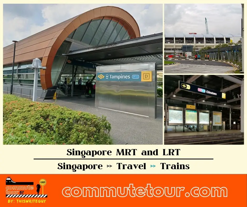
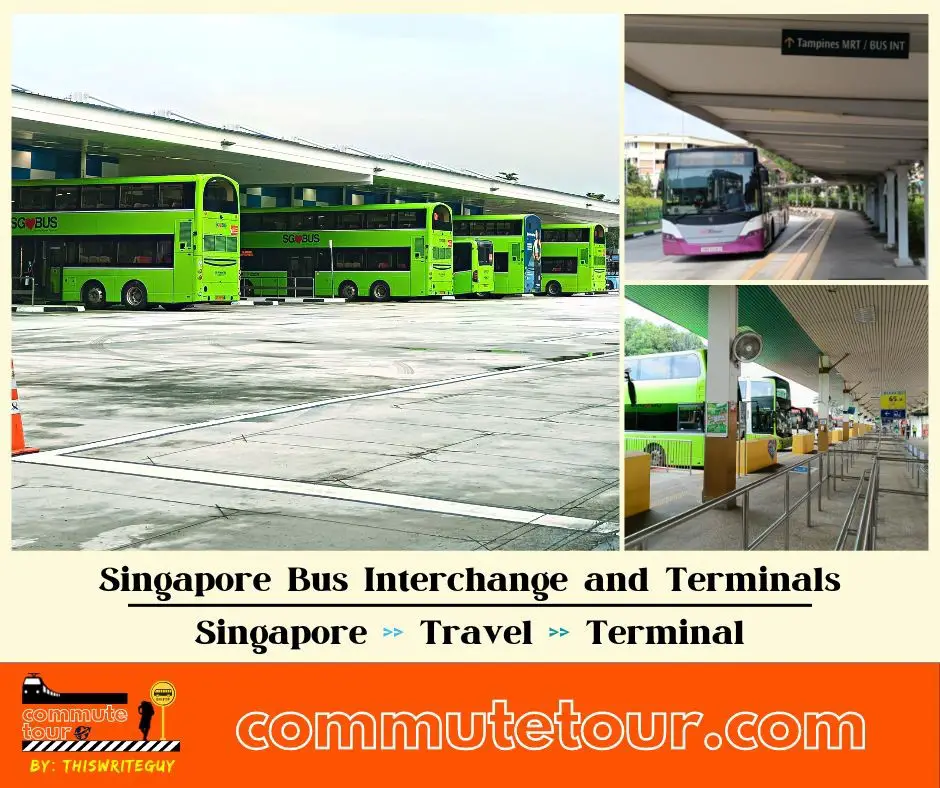
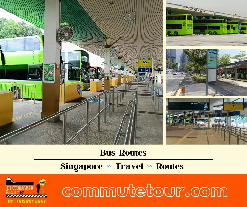
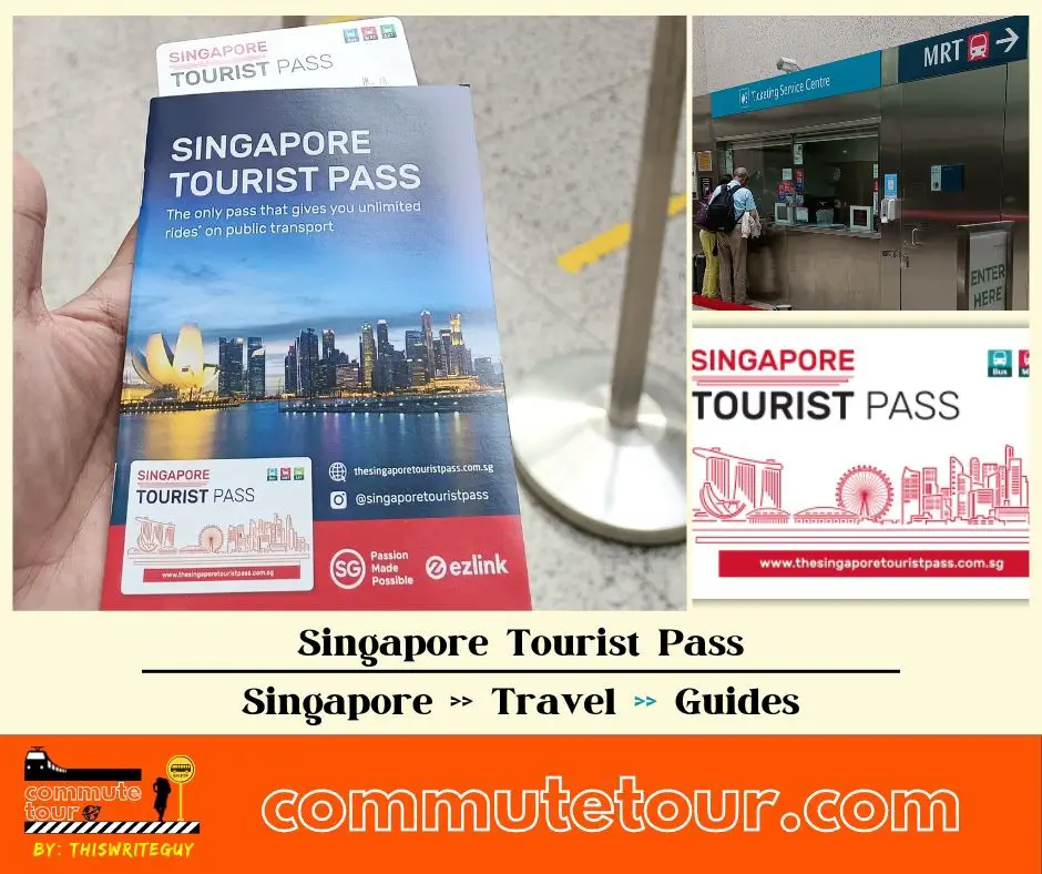
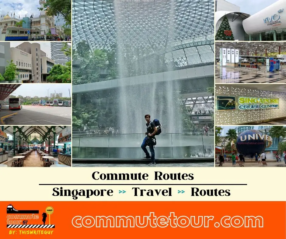
Click the time stamps below