14051 – After Telok Blangah Hts Bus Stop, Routes, Bus Schedule | Singapore
Bus Stop 14051 – After Telok Blangah Hts
Bus Stop 14051 – After Telok Blangah Hts include routes 124, 131, 145, 176, 273
Routes from After Telok Blangah Hts going to Bukit Merah Interchange, Buona Vista Terminal, St. Michael’s Terminal
Travelling today or planning for a commute from Bus Stop Code 14051 – After Telok Blangah Hts? Learn more about Bus Schedule, Route Map and MRT from After Telok Blangah Hts.
NOTICE: The fares and schedules listed here may subject to change without prior notice. Pls check with the companies for the updated details.
CommuteTour is in no way affiliated with any of the buses / trains / tourist spots listed on any of its pages.
Subscribe: youtube.com/@commutetour
14051 – After Telok Blangah Hts Map
Bus Stop 14051 – After Telok Blangah Hts
After Telok Blangah Hts Bus Stop Routes
SBS Transit Bus 124 Details
| Category | Information |
|---|---|
| Bus Route | 124 |
| Operator | SBS Transit |
| Dir 1 # of Stops | 46 |
| Dir 2 # of Stops | 45 |
| Origin | St. Michael’s Terminal |
| Destination | Harbourfront Interchange |
| Direction | Two Way |
Bus 124 Schedule
SBS Transit Bus 124 schedule from St. Michael’s Terminal to HarbourFront Interchange is from 05:30 to 24:00 from Monday to Sunday / Holidays while the bus schedule from HarbourFront Interchange is from 05:30 to 24:00 from Monday to Sunday / Holidays.
| From | Monday to Friday | Saturday | Sunday / Holiday |
|---|---|---|---|
| St. Michael’s Ter | 05:30 to 24:00 | 05:30 to 24:00 | 05:30 to 24:00 |
| HarbourFront Int | 05:30 to 24:00 | 05:30 to 24:00 | 05:30 to 24:00 |
| Frequency | Before 8:30 | 08:31 – 16:59 | 17:00 – 19:00 | After 19:00 |
|---|---|---|---|---|
| From St. Michael’s Ter | 7 – 9 minutes | 8 – 13 minutes | 7 – 12 minutes | 10 – 12 minutes |
| From HarbourFront | 7 – 8 minutes | 8 – 13 minutes | 8 – 9 minutes | 8 – 13 minutes |
SG Bus 124 Route Map
Bus 124 Route Map
Tap the top right of the map for full screen view. You can return to this page by clicking on the link on the google map description
SBS Transit Bus 124 Bus Stops
The Bus Stops along SBS Transit Bus 124 Route include: Al-Amin Mosque, Balestier Point, Boat Quay, Caribbean At Keppel Bay, Christian Community Chapel, Concorde Hotel Singapore, Env Building, Far East Plaza, Hotel Royal, Keppel Distripark Blk 519, Kim Keat Lane, Melati Blk 2, National Skin Center, New Bridge Center, Newton Life Church, Ngee Ann City, Nkf, Old Hill Street Police Station, Revival Center Church, Royal Plaza On Scotts, Safra Mt Faber, St. Joseph Institution Jnr, St. Teresa’s Church, Stamford Court, Tan Tock Seng Hospital, Telok Blangah Hts, Telok Blangah Market/Fc, The Pearl @ Mt Faber, The Treasury, Winsland House and YMCA.
Bus 124 passes along Blk 104, Blk 105, Blk 114, Blk 25, Blk 27, Blk 29, Blk 40, Blk 48, Blk 50, Blk 59, Blk 70a, Blk 70b, Blk 82, Blk 85, Blk 91a, Blk 92b and Blks 33/34.
MRT Stations along Bus 124 Route include: Bencoolen, Bras Basah, Chinatown, City Hall, Clarke Quay, Dhoby Ghaut, Harbourfront, Newton, Orchard, Outram Park, Somerset, Vivo City and connects with Harbourfront Interchange, Kampong Bahru Terminal, St. Michael’s Terminal.
St. Michael’s Terminal (52499)
Road: Whampoa Road
Terminal: St. Michael’s TerminalBlk 114 (52451)
Road: Whampoa RoadBlk 29 (52129)
Road: Jalan BahagiaBetween Blks 33/34 (52109)
Road: Jalan BahagiaOpposite Nkf (52099)
Road: Kim Keat RoadBefore Kim Keat Lane (50159)
Road: Kim Keat RoadOpposite Balestier Point (50211)
Road: Balestier RoadBefore Blk 104 (50221)
Road: Balestier RoadOpposite Tan Tock Seng Hospital (50129)
Road: Moulmein RoadSt. Joseph Institution Jnr (50119)
Road: Moulmein RoadHotel Royal (50069)
Road: Newton RoadNewton Life Church (40129)
Road: Newton RoadEnv Building (40179)
Road: Scotts RoadFar East Plaza (09219)
Road: Scotts RoadOrchard Station/Tang Plaza (09047)
Road: Orchard Road
Station Code: NS22 TE14
Train Line/s: North-South Line MRT Thomson-East Coast Line MRTBefore Cairnhill Road (09037)
Road: Orchard Road
Station Code: NS22 TE14
Train Line/s: North-South Line MRT Thomson-East Coast Line MRTConcorde Hotel Singapore (08138)
Road: Orchard RoadDhoby Ghaut Station (08057)
Road: Orchard Road
Station Code: CC1 NE6 NS24
Train Line/s: Circle Line MRT North East Line MRT North-South Line MRTBencoolen Station Exit B (08069)
Road: Bras Basah Road
Station Code: DT21
Train Line/s: Downtown Line MRTCity Hall Station Exit B (04167)
Road: North Bridge Road
Station Code: EW13 NS25
Train Line/s: East-West Line MRT North-South Line MRTOpposite The Treasury (04249)
Road: North Bridge RoadBoat Quay (05029)
Road: South Bridge RoadOpposite Hong Lim Complex (05131)
Road: Upper Cross Street
Station Code: DT19 NE4
Train Line/s: Downtown Line MRT North East Line MRTNew Bridge Center (05039)
Road: New Bridge RoadAfter Duxton Plain Park (05019)
Road: New Bridge Road
Station Code: EW16 NE3 TE17
Train Line/s: East-West Line MRT North East Line MRT Thomson-East Coast Line MRTOutram Park Station Exit H (05069)
Road: New Bridge Road
Station Code: EW16 NE3 TE17
Train Line/s: East-West Line MRT North East Line MRT Thomson-East Coast Line MRTBefore Neil Road (10011)
Road: New Bridge RoadBefore Kampong Bahru Terminal (10041)
Road: Kampong Bahru Road
Terminal: Kampong Bahru TerminalMelati Blk 2 (10399)
Road: Kampong Bahru RoadOpposite St. Teresa’s Church (14221)
Road: Kampong Bahru RoadKeppel Distripark Blk 519 (14231)
Road: Kampong Bahru RoadThe Pearl @ Mt Faber (14021)
Road: Lower Delta RoadBlk 40 (14379)
Road: Lower Delta RoadBlk 27 (14291)
Road: Telok Blangah WayAl-Amin Mosque (14271)
Road: Telok Blangah WaySafra Mt Faber (14281)
Road: Telok Blangah WayBefore Telok Blangah Hts (14059)
Road: Henderson RoadBlk 59 (14349)
Road: Telok Blangah HtsBlk 70a (14339)
Road: Telok Blangah HtsBlk 85 (14399)
Road: Telok Blangah HtsBlk 92b (14509)
Road: Telok Blangah Street 31Telok Blangah Market/Fc (14499)
Road: Telok Blangah DriveBlk 50 (14359)
Road: Telok Blangah DriveBefore Christian Community Chapel (14159)
Road: Telok Blangah RoadBefore Seah Im Road (14139)
Road: Telok Blangah RoadHarbourfront Interchange (14009)
Road: Seah Im Road
Station Code: CC29 NE1 S1
Train Line/s: Circle Line MRT North East Line MRT Sentosa Express Monorail
Terminal: Harbourfront Interchange
Harbourfront Interchange (14009)
Road: Seah Im Road
Station Code: CC29 NE1 S1
Train Line/s: Circle Line MRT North East Line MRT Sentosa Express Monorail
Terminal: Harbourfront InterchangeCaribbean At Keppel Bay (14131)
Road: Telok Blangah RoadOpposite Christian Community Chapel (14151)
Road: Telok Blangah RoadAfter Blk 48 (14351)
Road: Telok Blangah DriveOpposite Telok Blangah Market/Fc (14491)
Road: Telok Blangah DriveOpposite Blk 91a (14501)
Road: Telok Blangah Street 31Opposite Blk 85 (14391)
Road: Telok Blangah HtsOpposite Blk 70b (14331)
Road: Telok Blangah HtsOpposite Blk 59 (14341)
Road: Telok Blangah HtsAfter Telok Blangah Hts (14051)
Road: Henderson RoadBlk 25 (14279)
Road: Telok Blangah WayOpposite Blk 27 (14299)
Road: Telok Blangah WayBlk 105 (14029)
Road: Lower Delta RoadOpposite Keppel Distripark Blk 519 (14239)
Road: Kampong Bahru RoadSt. Teresa’s Church (14229)
Road: Kampong Bahru RoadOpposite Melati Blk 2 (10391)
Road: Kampong Bahru RoadOpposite Kampong Bahru Terminal (10049)
Road: Kampong Bahru Road
Terminal: Kampong Bahru TerminalAfter Hospital Drive (10017)
Road: Eu Tong Sen Street
Station Code: EW16 NE3 TE17
Train Line/s: East-West Line MRT North East Line MRT Thomson-East Coast Line MRTOutram Park Station Exit F/Sgh (10018)
Road: Eu Tong Sen Street
Station Code: EW16 NE3 TE17
Train Line/s: East-West Line MRT North East Line MRT Thomson-East Coast Line MRTBefore Pearl’s Hill Terrace (05012)
Road: Eu Tong Sen Street
Station Code: EW16 NE3 TE17
Train Line/s: East-West Line MRT North East Line MRT Thomson-East Coast Line MRTAfter Chinatown Station Exit D (05022)
Road: Eu Tong Sen Street
Station Code: DT19 NE4
Train Line/s: Downtown Line MRT North East Line MRTClarke Quay Station Exit E (04222)
Road: Eu Tong Sen Street
Station Code: NE5
Train Line/s: North East Line MRTOld Hill Street Police Station (04223)
Road: Hill StreetStamford Court (04143)
Road: Hill StreetSMU (04121)
Road: Stamford Road
Station Code: CC2
Train Line/s: Circle Line MRTYMCA (08041)
Road: Orchard RoadDhoby Ghaut Station Exit B (08031)
Road: Penang Road
Station Code: CC1 NE6 NS24
Train Line/s: Circle Line MRT North East Line MRT North-South Line MRTWinsland House (08111)
Road: Penang RoadSomerset Station (08121)
Road: Somerset Road
Station Code: NS23
Train Line/s: North-South Line MRTOpposite Ngee Ann City (09011)
Road: Orchard TurnOpposite Orchard Station/Ion (09023)
Road: Orchard Turn
Station Code: NS22 TE14
Train Line/s: North-South Line MRT Thomson-East Coast Line MRTRoyal Plaza On Scotts (09212)
Road: Scotts RoadOpposite Env Building (40171)
Road: Scotts RoadNewton Station Exit A (40181)
Road: Scotts Road
Station Code: DT11 NS21
Train Line/s: Downtown Line MRT North-South Line MRTOpposite Newton Life Church (40121)
Road: Newton RoadOpposite Hotel Royal (50061)
Road: Newton RoadRevival Center Church (50111)
Road: Moulmein RoadNational Skin Center (50121)
Road: Moulmein RoadOpposite Blk 104 (50229)
Road: Balestier RoadBlk 82 (50991)
Road: Whampoa DriveBlk 29 (52129)
Road: Jalan BahagiaBetween Blks 33/34 (52109)
Road: Jalan BahagiaSt. Michael’s Terminal (52499)
Road: Whampoa Road
Terminal: St. Michael’s Terminal
Feel Free to click any of the Terminal, Transport links above
SBS Transit Bus 131 Details
| Category | Information |
|---|---|
| Bus Route | 131 |
| Operator | SBS Transit |
| Dir 1 # of Stops | 50 |
| Dir 2 # of Stops | 49 |
| Origin | St. Michael’s Terminal |
| Destination | Bukit Merah Interchange |
| Direction | Two Way |
Bus 131 Schedule
SBS Transit Bus 131 schedule from St. Michael’s Terminal to Bukit Merah Interchange is from 05:45 to 23:30 from Monday to Sunday / Holidays while the bus schedule from Bukit Merah Interchange is from 05:45 to 24:00 from Monday to Sunday / Holidays.
| From | Monday to Friday | Saturday | Sunday / Holiday |
|---|---|---|---|
| St. Michael’s Ter | 05:45 to 23:30 | 05:45 to 23:30 | 05:45 to 23:30 |
| Bt Merah Int | 05:45 to 24:00 | 05:45 to 24:00 | 05:45 to 24:00 |
| Frequency | Before 8:30 | 08:31 – 16:59 | 17:00 – 19:00 | After 19:00 |
|---|---|---|---|---|
| From St. Michael’s Ter | 6 – 11 minutes | 9 – 14 minutes | 9 – 12 minutes | 11 – 14 minutes |
| From Bukit Merah | 8 – 11 minutes | 9 – 14 minutes | 9 – 16 minutes | 11 – 16 minutes |
SG Bus 131 Route Map
Bus 131 Route Map
Tap the top right of the map for full screen view. You can return to this page by clicking on the link on the google map description
SBS Transit Bus 131 Bus Stops
The Bus Stops along SBS Transit Bus 131 Route include: Al-Amin Mosque, Balestier Plaza, Balestier Point, Caribbean At Keppel Bay, Cendex Center, Christian Community Chapel, Customs Port Br Headquarters, Esplanade Bridge, Farrer Park Tennis Center, Former Railway Station, Gb Building, Jalan Dusun, Kentish Green, Kentish Lodge, Keppel Distripark Blk 517, Keppel Workshop, Kim Keat Lane, Kk Women & Child Hospital, Nafa Campus 3, Nkf, Novena Lodge, One Raffles Quay, Peace Center, Pek Kio Market, Prudential Tower, Public Mansion, Raffles Hotel, Safra Mt Faber, School of The Arts, Selegie Center, Shaw Plaza, St. Theresa’s Convent, Tanjong Pagar Distripark Blk F5, Tekka Center, Telok Blangah Hts, Thomson Medical Center, United Square and Zhongshan Mall.
Bus 131 passes along Blk 109, Blk 114, Blk 119, Blk 120, Blk 25, Blk 27, Blk 29, Blk 51/Opposite Pek Kio Market, Blk 54, Blk 55, Blk 82 and Blks 33/34.
MRT Stations along Bus 131 Route include: Bencoolen, Bras Basah, City Hall, Esplanade, Farrer Park, Harbourfront, Little India, Novena, Raffles Place, Rochor, Shenton Way, Tanjong Pagar, Vivo City and connects with Bukit Merah Interchange, Harbourfront Interchange, St. Michael’s Terminal.
St. Michael’s Terminal (52499)
Road: Whampoa Road
Terminal: St. Michael’s TerminalBlk 114 (52451)
Road: Whampoa RoadBlk 29 (52129)
Road: Jalan BahagiaBetween Blks 33/34 (52109)
Road: Jalan BahagiaOpposite Nkf (52099)
Road: Kim Keat RoadBefore Kim Keat Lane (50159)
Road: Kim Keat RoadAfter Pegu Road (50209)
Road: Balestier RoadOpposite Shaw Plaza (50199)
Road: Balestier RoadOpposite Public Mansion (50189)
Road: Balestier RoadOpposite Zhongshan Mall (50179)
Road: Balestier RoadAfter Irrawaddy Road (50169)
Road: Balestier RoadOpposite Thomson Medical Center (50059)
Road: Thomson RoadOpposite Novena Lodge (50049)
Road: Thomson RoadNovena Station (50038)
Road: Thomson Road
Station Code: NS20
Train Line/s: North-South Line MRTOpposite United Square (50029)
Road: Thomson RoadOpposite Carlisle Road (50079)
Road: Norfolk RoadBlk 51/Opposite Pek Kio Market (50089)
Road: Owen RoadAfter Gloucester Road (50321)
Road: Dorset RoadFarrer Park Tennis Center (50351)
Road: Dorset RoadOpposite Kk Women & Child Hospital (40109)
Road: Kampong Java RoadLittle India Station (40019)
Road: Bukit Timah Road
Station Code: DT12 NE7
Train Line/s: Downtown Line MRT North East Line MRTOpposite Rochor Station (07539)
Road: Sungei Road
Station Code: DT13
Train Line/s: Downtown Line MRTOpposite Nafa Campus 3 (07518)
Road: Bencoolen StreetOpposite Bencoolen Station Exit B (04019)
Road: Bencoolen Street
Station Code: DT21
Train Line/s: Downtown Line MRTAfter Bras Basah Station Exit A (04179)
Road: Bras Basah Road
Station Code: CC2
Train Line/s: Circle Line MRTRaffles Hotel (02049)
Road: Bras Basah RoadAfter Esplanade Station Exit D (02029)
Road: Esplanade Drive
Station Code: CC3
Train Line/s: Circle Line MRTOue Bayfront (03019)
Road: Collyer Quay
Station Code: EW14 NS26
Train Line/s: East-West Line MRT North-South Line MRTOne Raffles Quay (03059)
Road: Raffles QuayUIC Building (03129)
Road: Shenton Way
Station Code: TE19
Train Line/s: Thomson-East Coast Line MRTOpposite AXA Tower (03217)
Road: Shenton Way
Station Code: EW15
Train Line/s: East-West Line MRTOpposite Customs Port Br Headquarters (05649)
Road: Keppel RoadOpposite Former Railway Station (14061)
Road: Keppel RoadKeppel Workshop (14071)
Road: Keppel RoadTanjong Pagar Distripark Blk F5 (14081)
Road: Keppel RoadOpposite Keppel Distripark Blk 517 (14101)
Road: Keppel RoadHarbourfront Station/Vivocity (14141)
Road: Telok Blangah Road
Station Code: CC29 NE1 S1
Train Line/s: Circle Line MRT North East Line MRT Sentosa Express MonorailOpposite Harbourfront Interchange (14121)
Road: Telok Blangah Road
Station Code: CC29 NE1 S1
Train Line/s: Circle Line MRT North East Line MRT Sentosa Express Monorail
Terminal: Harbourfront InterchangeCaribbean At Keppel Bay (14131)
Road: Telok Blangah RoadOpposite Christian Community Chapel (14151)
Road: Telok Blangah RoadBlk 54 (14041)
Road: Henderson RoadAfter Telok Blangah Hts (14051)
Road: Henderson RoadBlk 25 (14279)
Road: Telok Blangah WayOpposite Blk 27 (14299)
Road: Telok Blangah WayOpposite Blk 109 (14389)
Road: Bukit Purmei AvenueBlk 109 (14381)
Road: Bukit Purmei AvenueSt. Theresa’s Convent (14031)
Road: Lower Delta RoadCendex Center (10361)
Road: Lower Delta RoadOpposite Blk 120 (10081)
Road: Jalan Bukit MerahBukit Merah Interchange (10009)
Road: Bukit Merah Central
Terminal: Bukit Merah Interchange
Bukit Merah Interchange (10009)
Road: Bukit Merah Central
Terminal: Bukit Merah InterchangeBlk 119 (10089)
Road: Jalan Bukit MerahOpposite Cendex Center (10369)
Road: Lower Delta RoadOpposite St. Theresa’s Convent (14039)
Road: Lower Delta RoadOpposite Blk 109 (14389)
Road: Bukit Purmei AvenueBlk 109 (14381)
Road: Bukit Purmei AvenueBlk 27 (14291)
Road: Telok Blangah WayAl-Amin Mosque (14271)
Road: Telok Blangah WaySafra Mt Faber (14281)
Road: Telok Blangah WayBefore Telok Blangah Hts (14059)
Road: Henderson RoadOpposite Blk 55 (14049)
Road: Henderson RoadBefore Christian Community Chapel (14159)
Road: Telok Blangah RoadBefore Seah Im Road (14139)
Road: Telok Blangah RoadHarbourfront Station Exit A (14129)
Road: Telok Blangah Road
Station Code: CC29 NE1 S1
Train Line/s: Circle Line MRT North East Line MRT Sentosa Express MonorailOpposite Vivocity (14119)
Road: Telok Blangah Road
Station Code: CC29 NE1 S1
Train Line/s: Circle Line MRT North East Line MRT Sentosa Express MonorailKeppel Distripark Blk 517 (14109)
Road: Keppel RoadOpposite Tanjong Pagar Distripark Blk F5 (14089)
Road: Keppel RoadFormer Railway Station (14069)
Road: Keppel RoadBefore Cantonment Road (05641)
Road: Keppel RoadTanjong Pagar Station Exit C (03223)
Road: Anson Road
Station Code: EW15
Train Line/s: East-West Line MRTOpposite Gb Building (03151)
Road: Cecil StreetPrudential Tower (03021)
Road: Cecil StreetFullerton Square (03011)
Road: Fullerton Road
Station Code: EW14 NS26
Train Line/s: East-West Line MRT North-South Line MRTEsplanade Bridge (02111)
Road: Esplanade DriveCapitol Building (04111)
Road: Stamford Road
Station Code: EW13 NS25
Train Line/s: East-West Line MRT North-South Line MRTSMU (04121)
Road: Stamford Road
Station Code: CC2
Train Line/s: Circle Line MRTSchool of The Arts (08079)
Road: Prinsep StreetPeace Center (07011)
Road: Selegie RoadSelegie Center (07021)
Road: Selegie RoadTekka Center (07031)
Road: Serangoon RoadBroadway Hotel (07111)
Road: Serangoon RoadFarrer Park Station Exit A (50251)
Road: Rangoon Road
Station Code: NE8
Train Line/s: North East Line MRTKentish Lodge (50261)
Road: Rangoon RoadKentish Green (50301)
Road: Kent RoadPek Kio Market (50081)
Road: Owen RoadBefore Carlisle Road (50071)
Road: Norfolk RoadUnited Sq/Before Novena Station (50021)
Road: Thomson Road
Station Code: NS20
Train Line/s: North-South Line MRTOpposite Novena Church (50031)
Road: Thomson Road
Station Code: NS20
Train Line/s: North-South Line MRTNovena Lodge (50041)
Road: Thomson RoadBefore Jalan Dusun (50161)
Road: Balestier RoadZhongshan Mall (50171)
Road: Balestier RoadBefore Balestier Plaza (50191)
Road: Balestier RoadShaw Plaza (50201)
Road: Balestier RoadOpposite Balestier Point (50211)
Road: Balestier RoadBlk 82 (50991)
Road: Whampoa DriveBlk 29 (52129)
Road: Jalan BahagiaBetween Blks 33/34 (52109)
Road: Jalan BahagiaSt. Michael’s Terminal (52499)
Road: Whampoa Road
Terminal: St. Michael’s Terminal
Feel Free to click any of the Terminal, Transport links above
SBS Transit Bus 145 Details
| Category | Information |
|---|---|
| Bus Route | 145 |
| Operator | SBS Transit |
| Dir 1 # of Stops | 55 |
| Dir 2 # of Stops | 54 |
| Origin | Toa Payoh Interchange |
| Destination | Buona Vista Terminal |
| Direction | Two Way |
Bus 145 Schedule
SBS Transit Bus 145 schedule from Toa Payoh Interchange to Buona Vista Terminal is from 05:30 to 24:00 from Monday to Sunday / Holidays while the bus schedule from Buona Vista Terminal is from 05:30 to 23:30 from Monday to Friday, 05:30 to 24:00 on Saturdays, and 06:00 to 23:30 every Sunday / Holiday.
| From | Monday to Friday | Saturday | Sunday / Holiday |
|---|---|---|---|
| Toa Payoh Int | 05:30 to 24:00 | 05:30 to 24:00 | 05:30 to 24:00 |
| Buona Vista Ter | 05:30 to 23:30 | 05:30 to 24:00 | 06:00 to 23:30 |
| Frequency | Before 8:30 | 08:31 – 16:59 | 17:00 – 19:00 | After 19:00 |
|---|---|---|---|---|
| From Toa Payoh | 6 – 8 minutes | 6 – 14 minutes | 9 – 11 minutes | 12 – 14 minutes |
| From Buona Vista Ter | 8 – 9 minutes | 6 – 11 minutes | 7 – 12 minutes | 12 – 14 minutes |
SG Bus 145 Route Map
Bus 145 Route Map
Tap the top right of the map for full screen view. You can return to this page by clicking on the link on the google map description
SBS Transit Bus 145 Bus Stops
The Bus Stops along SBS Transit Bus 145 Route include: Ar-Rabitah Mosque, Arc 380, Balestier Plaza, Balestier Point, Boat Quay, Bugis Cube, Bukit Merah Central, Caribbean At Keppel Bay, Christian Community Chapel, Church of Our Saviour, Crawford Bridge, Customs Port Br Headquarters, Delta Swim Complex, Fairfield Meth Church, Former Railway Station, Fuji Xerox Towers, Hong Lim Complex, Jalan Dusun, Kallang Bahru, Keppel Distripark Blk 517, Keppel Workshop, National Library, Northlight School, Old Hill Street Police Station, Parkview Square, Public Mansion, Queens Condominium, Shaw Plaza, Singapore Indian Assn, Singapore Khalsa Assn, Sis Building, St. Joseph’s Church, Stamford Primary School, Sultan Mosque, Tan Tong Meng Tower, Tanjong Pagar Distripark Blk F5, Tanjong Pagar Plaza, Telok Blangah Hts, The Amara, The Treasury, Tower 15, Trellis Towers and Zhongshan Mall.
Bus 145 passes along Blk 1, Blk 104, Blk 104a, Blk 116, Blk 333, Blk 42, Blk 43, Blk 46, Blk 461, Blk 53a, Blk 54, Blk 55, Blk 78, Blk 7b and Blk 8.
MRT Stations along Bus 145 Route include: Bugis, Chinatown, City Hall, Clarke Quay, Commonwealth, Harbourfront, Lavender, Maxwell, Queenstown, Redhill, Toa Payoh, Vivo City and connects with Buona Vista Terminal, Harbourfront Interchange, Toa Payoh Interchange.
Toa Payoh Interchange (52009)
Road: Lorong 6 Toa Payoh
Station Code: NS19
Train Line/s: North-South Line MRT
Terminal: Toa Payoh InterchangeOpposite Trellis Towers (52079)
Road: Jalan Toa PayohBefore Jalan Dusun (50161)
Road: Balestier RoadZhongshan Mall (50171)
Road: Balestier RoadBefore Balestier Plaza (50191)
Road: Balestier RoadShaw Plaza (50201)
Road: Balestier RoadOpposite Balestier Point (50211)
Road: Balestier RoadBefore Blk 104 (50221)
Road: Balestier RoadNorthlight School (50231)
Road: Balestier RoadOpposite Singapore Khalsa Assn (50241)
Road: Balestier RoadAfter Kempas Road (07249)
Road: Lavender StreetOpposite Arc 380 (07359)
Road: Lavender StreetAfter Kallang Bahru (07369)
Road: Lavender StreetAperia/Before Kallang Road (07379)
Road: Lavender StreetBefore Crawford Bridge (01339)
Road: Crawford StreetBlk 8 (01329)
Road: North Bridge RoadBefore Sultan Mosque (01229)
Road: North Bridge RoadParkview Square (01139)
Road: North Bridge RoadBugis Cube (01039)
Road: North Bridge RoadOpposite National Library (01029)
Road: North Bridge RoadCity Hall Station Exit B (04167)
Road: North Bridge Road
Station Code: EW13 NS25
Train Line/s: East-West Line MRT North-South Line MRTOpposite The Treasury (04249)
Road: North Bridge RoadBoat Quay (05029)
Road: South Bridge RoadOpposite Hong Lim Complex (05199)
Road: South Bridge RoadMaxwell Road Fc (05269)
Road: South Bridge Road
Station Code: TE18
Train Line/s: Thomson-East Coast Line MRTBefore Craig Road (05429)
Road: Tanjong Pagar RoadThe Amara (05419)
Road: Tanjong Pagar RoadTower 15 (05431)
Road: Hoe Chiang RoadOpposite Customs Port Br Headquarters (05649)
Road: Keppel RoadOpposite Former Railway Station (14061)
Road: Keppel RoadKeppel Workshop (14071)
Road: Keppel RoadTanjong Pagar Distripark Blk F5 (14081)
Road: Keppel RoadOpposite Keppel Distripark Blk 517 (14101)
Road: Keppel RoadHarbourfront Station/Vivocity (14141)
Road: Telok Blangah Road
Station Code: CC29 NE1 S1
Train Line/s: Circle Line MRT North East Line MRT Sentosa Express MonorailOpposite Harbourfront Interchange (14121)
Road: Telok Blangah Road
Station Code: CC29 NE1 S1
Train Line/s: Circle Line MRT North East Line MRT Sentosa Express Monorail
Terminal: Harbourfront InterchangeCaribbean At Keppel Bay (14131)
Road: Telok Blangah RoadOpposite Christian Community Chapel (14151)
Road: Telok Blangah RoadBlk 54 (14041)
Road: Henderson RoadAfter Telok Blangah Hts (14051)
Road: Henderson RoadOpposite Blk 1 (14241)
Road: Henderson RoadBefore Bukit Merah Central (10331)
Road: Henderson RoadOpposite Blk 116 (10341)
Road: Henderson RoadBefore Tiong Bahru Road (10351)
Road: Henderson RoadBefore Ar-Rabitah Mosque (10181)
Road: Tiong Bahru RoadBlk 78 (10191)
Road: Tiong Bahru RoadOpposite Redhill Station (10201)
Road: Tiong Bahru Road
Station Code: EW18
Train Line/s: East-West Line MRTSis Building (10281)
Road: Alexandra RoadBefore Dawson Road (10291)
Road: Alexandra RoadQueens Condominium (11131)
Road: Commonwealth AvenueQueenstown Station Exit A/D (11141)
Road: Commonwealth Avenue
Station Code: EW19
Train Line/s: East-West Line MRTBlk 42 (11151)
Road: Commonwealth AvenueCommonwealth Station Exit A/D (11161)
Road: Commonwealth Avenue
Station Code: EW20
Train Line/s: East-West Line MRTOpposite Blk 7b (11171)
Road: Commonwealth AvenueBlk 46 (11389)
Road: Holland DriveBuona Vista Terminal (11379)
Road: North Buona Vista Road
Terminal: Buona Vista Terminal
Buona Vista Terminal (11379)
Road: North Buona Vista Road
Terminal: Buona Vista TerminalBlk 43 (11189)
Road: Commonwealth AvenueBlk 8 (11179)
Road: Commonwealth AvenueCommonwealth Station Exit B/C (11169)
Road: Commonwealth Avenue
Station Code: EW20
Train Line/s: East-West Line MRTAfter Church of Our Saviour (11159)
Road: Commonwealth AvenueQueenstown Station Exit B/C (11149)
Road: Commonwealth Avenue
Station Code: EW19
Train Line/s: East-West Line MRTBlk 53a Carpark (11139)
Road: Commonwealth AvenueAfter Dawson Road (10299)
Road: Alexandra RoadRedhill Station (10209)
Road: Tiong Bahru Road
Station Code: EW18
Train Line/s: East-West Line MRTDelta Swim Complex (10199)
Road: Tiong Bahru RoadBlk 104a Carpark (10189)
Road: Tiong Bahru RoadAfter Tiong Bahru Road (10359)
Road: Henderson RoadBlk 116 (10349)
Road: Henderson RoadAfter Bukit Merah Central (10339)
Road: Henderson RoadBlk 1 (14249)
Road: Henderson RoadBefore Telok Blangah Hts (14059)
Road: Henderson RoadOpposite Blk 55 (14049)
Road: Henderson RoadBefore Christian Community Chapel (14159)
Road: Telok Blangah RoadBefore Seah Im Road (14139)
Road: Telok Blangah RoadHarbourfront Station Exit A (14129)
Road: Telok Blangah Road
Station Code: CC29 NE1 S1
Train Line/s: Circle Line MRT North East Line MRT Sentosa Express MonorailOpposite Vivocity (14119)
Road: Telok Blangah Road
Station Code: CC29 NE1 S1
Train Line/s: Circle Line MRT North East Line MRT Sentosa Express MonorailKeppel Distripark Blk 517 (14109)
Road: Keppel RoadOpposite Tanjong Pagar Distripark Blk F5 (14089)
Road: Keppel RoadFormer Railway Station (14069)
Road: Keppel RoadBefore Cantonment Road (05641)
Road: Keppel RoadOpposite Fuji Xerox Towers (05651)
Road: Tanjong Pagar RoadTanjong Pagar Plaza (05411)
Road: Tanjong Pagar RoadAfter Craig Road (05421)
Road: Tanjong Pagar RoadOpposite Fairfield Meth Church (05271)
Road: Tanjong Pagar RoadOpposite Blk 333 (05241)
Road: Kreta Ayer Road
Station Code: TE18
Train Line/s: Thomson-East Coast Line MRTAfter Chinatown Station Exit D (05022)
Road: Eu Tong Sen Street
Station Code: DT19 NE4
Train Line/s: Downtown Line MRT North East Line MRTClarke Quay Station Exit E (04222)
Road: Eu Tong Sen Street
Station Code: NE5
Train Line/s: North East Line MRTOld Hill Street Police Station (04223)
Road: Hill StreetCath of The Good Shepherd (04151)
Road: Victoria Street
Station Code: EW13 NS25
Train Line/s: East-West Line MRT North-South Line MRTSt. Joseph’s Church (01013)
Road: Victoria StreetBugis Station Exit A (01113)
Road: Victoria Street
Station Code: EW12 DT14
Train Line/s: East-West Line MRT Downtown Line MRTStamford Primary School (01121)
Road: Victoria StreetOpposite Blk 461 (01211)
Road: Victoria StreetLavender Station Exit B (01311)
Road: Kallang Road
Station Code: EW11
Train Line/s: East-West Line MRTAfter Kallang Road (07371)
Road: Lavender StreetBefore Kallang Bahru (07361)
Road: Lavender StreetArc 380 (07351)
Road: Lavender StreetBefore Serangoon Road (07241)
Road: Lavender StreetSingapore Khalsa Assn (50249)
Road: Balestier RoadSingapore Indian Assn (50239)
Road: Balestier RoadOpposite Blk 104 (50229)
Road: Balestier RoadAfter Pegu Road (50209)
Road: Balestier RoadOpposite Shaw Plaza (50199)
Road: Balestier RoadOpposite Public Mansion (50189)
Road: Balestier RoadOpposite Zhongshan Mall (50179)
Road: Balestier RoadAfter Irrawaddy Road (50169)
Road: Balestier RoadOpposite Tan Tong Meng Tower (51011)
Road: Thomson RoadTrellis Towers (52071)
Road: Jalan Toa PayohToa Payoh Interchange (52009)
Road: Lorong 6 Toa Payoh
Station Code: NS19
Train Line/s: North-South Line MRT
Terminal: Toa Payoh Interchange
Feel Free to click any of the Terminal, Transport links above
SMRT Bus 176 Details
Bus 176 Schedule
SMRT Bus 176 schedule from Bukit Panjang Interchange to Bukit Merah Interchange is from 05:30 to 23:35 from Monday to Saturday, and 05:45 to 23:35 every Sunday and Holidays while the bus schedule from Bukit Merah Interchange is from 05:45 to 23:30 from Monday to Sunday / Holidays.
| From | Monday to Friday | Saturday | Sunday / Holiday |
|---|---|---|---|
| Bt Panjang Int | 05:30 to 23:35 | 05:30 to 23:35 | 05:45 to 23:35 |
| Bt Merah Int | 05:45 to 23:30 | 05:45 to 23:30 | 05:45 to 23:30 |
| Frequency | Before 8:30 | 08:31 – 16:59 | 17:00 – 19:00 | After 19:00 |
|---|---|---|---|---|
| From Bukit Panjang | 6 – 9 minutes | 6 – 11 minutes | 10 – 11 minutes | 9 – 15 minutes |
| From Bukit Merah | 8 – 9 minutes | 7 – 12 minutes | 7 – 8 minutes | 8 – 13 minutes |
SG Bus 176 Route Map
Bus 176 Route Map
Tap the top right of the map for full screen view. You can return to this page by clicking on the link on the google map description
SMRT Bus 176 Bus Stops
The Bus Stops along SMRT Bus 176 Route include: Angliss Building, Assumption Eng School, Assumption Pathway School, Bukit Batok Polyclinic, Bukit Merah Central, Commonwealth Secondary School, German Center, Glendale Park Condominium, Harbourside Building 2, Hazel Park Terrace, Hillbrooks, Hillington Green Condominium, Hillview Apts, Hillview Hts, International Business Park, Jurong East Library, Jurong Town Hall, Mapletree Business City, Min of Defence, Pandan Gardens, Pasir View Park, Seventh-Day Advent Church, Singapore Food Industries Building, Telok Blangah Hts, The Japanese Secondary School, The Linear, The Petals Condominium, Tien Wah Press Building, West Coast Link, West Coast Park, West Coast View, Wharves Building, Wholesale Center and Yeo’s Building.
Bus 176 passes along Blk 1, Blk 109, Blk 124, Blk 127, Blk 134, Blk 144, Blk 146, Blk 183, Blk 185, Blk 190, Blk 207, Blk 209, Blk 240, Blk 241, Blk 242, Blk 258, Blk 266, Blk 298, Blk 408, Blk 411, Blk 503, Blk 518, Blk 54, Blk 55, Blk 628, Blk 705, Blk 716 and Blk 801c.
MRT Stations along Bus 176 Route include: Bukit Batok, Bukit Panjang, Cashew, Haw Par Villa, Hillview, Labrador Park, Pasir Panjang, Telok Blangah and connects with Bukit Merah Interchange, Bukit Panjang Interchange.
Bukit Panjang Interchange (45009)
Road: Petir Road
Station Code: DT1 BP6
Train Line/s: Downtown Line MRT Bukit Panjang LRT
Terminal: Bukit Panjang InterchangeBlk 183 (44259)
Road: Bukit Panjang RoadBukit Panjang Station Exit A/LRT (44029)
Road: Upper Bukit Timah Road
Station Code: DT1 BP6
Train Line/s: Downtown Line MRT Bukit Panjang LRTThe Linear (44019)
Road: Upper Bukit Timah RoadBefore Hazel Park Terrace (43119)
Road: Upper Bukit Timah RoadCashew Station (43109)
Road: Upper Bukit Timah Road
Station Code: DT2
Train Line/s: Downtown Line MRTAssumption Pathway School (43099)
Road: Upper Bukit Timah RoadAfter Assumption Eng School (43089)
Road: Upper Bukit Timah RoadAfter Hillview Station (43279)
Road: Hillview Road
Station Code: DT3
Train Line/s: Downtown Line MRTHillington Green Condominium (43268)
Road: Hillview AvenueOpposite Hillbrooks (43259)
Road: Hillview AvenueHillview Apts (43249)
Road: Hillview AvenueThe Petals Condominium (43239)
Road: Hillview AvenueBlk 258 (43449)
Road: Bukit Batok East Avenue 2Blk 242 (43439)
Road: Bukit Batok East Avenue 2Blk 240 (43429)
Road: Bukit Batok East Avenue 2After Bukit Batok Station/Blk 628 (43419)
Road: Bukit Batok Central
Station Code: NS2
Train Line/s: North-South Line MRTBukit Batok Polyclinic (43401)
Road: Bukit Batok West Avenue 3Opposite Blk 144 (43321)
Road: Bukit Batok West Avenue 6Blk 109 (43371)
Road: Bukit Batok West Avenue 6Blk 298 (43699)
Road: Bukit Batok Avenue 1Blk 266 (28629)
Road: Jurong East CentralBlk 207 (28319)
Road: Jurong East CentralBefore Seventh-Day Advent Church (28449)
Road: Jurong East CentralBlk 134 (28431)
Road: Jurong East CentralJurong East Library (28249)
Road: Jurong Town Hall RoadOpposite Jurong Town Hall (28239)
Road: Jurong Town Hall RoadGerman Center (28229)
Road: Jurong Town Hall RoadBefore Pandan Gardens (20269)
Road: Jurong Town Hall RoadCommonwealth Secondary School (20259)
Road: Jurong Town Hall RoadBlk 411 (20159)
Road: West Coast RoadBlk 408 (20149)
Road: West Coast RoadOpposite Angliss Building (20139)
Road: West Coast RoadThe Japanese Secondary School (20289)
Road: West Coast HighwayBlk 518 (17339)
Road: West Coast HighwayBlk 705 (17329)
Road: West Coast HighwayBlk 716 (17319)
Road: West Coast HighwayAfter West Coast Link (17369)
Road: West Coast HighwayWest Coast View (17309)
Road: West Coast HighwayBefore Clementi Road (17359)
Road: West Coast HighwayOpposite West Coast Park (17299)
Road: West Coast HighwayBefore Wholesale Center (16249)
Road: West Coast HighwayOpposite Wholesale Center (16239)
Road: West Coast HighwayHaw Par Villa Station (16229)
Road: West Coast Highway
Station Code: CC25
Train Line/s: Circle Line MRTOpposite Wharves Building (16219)
Road: West Coast HighwayPasir View Park (15219)
Road: Pasir Panjang RoadBefore Pasir Panjang Station (15209)
Road: Pasir Panjang Road
Station Code: CC26
Train Line/s: Circle Line MRTOpposite Currency House (15199)
Road: Pasir Panjang Road
Station Code: CC26
Train Line/s: Circle Line MRTHarbourside Building 2 (15169)
Road: Pasir Panjang RoadMapletree Business City (15159)
Road: Pasir Panjang RoadOpposite Labrador Park Station (15149)
Road: Pasir Panjang Road
Station Code: CC27
Train Line/s: Circle Line MRTAfter Alexandra Road (14189)
Road: Telok Blangah RoadYeo’s Building (14179)
Road: Telok Blangah RoadOpposite Telok Blangah Station (14169)
Road: Telok Blangah Road
Station Code: CC28
Train Line/s: Circle Line MRTBlk 54 (14041)
Road: Henderson RoadAfter Telok Blangah Hts (14051)
Road: Henderson RoadOpposite Blk 1 (14241)
Road: Henderson RoadBefore Bukit Merah Central (10331)
Road: Henderson RoadBukit Merah Interchange (10009)
Road: Bukit Merah Central
Terminal: Bukit Merah Interchange
Bukit Merah Interchange (10009)
Road: Bukit Merah Central
Terminal: Bukit Merah InterchangeAfter Bukit Merah Central (10339)
Road: Henderson RoadBlk 1 (14249)
Road: Henderson RoadBefore Telok Blangah Hts (14059)
Road: Henderson RoadOpposite Blk 55 (14049)
Road: Henderson RoadTelok Blangah Station (14161)
Road: Telok Blangah Road
Station Code: CC28
Train Line/s: Circle Line MRTOpposite Yeo’s Building (14171)
Road: Telok Blangah RoadLabrador Park Station (15141)
Road: Pasir Panjang Road
Station Code: CC27
Train Line/s: Circle Line MRTOpposite Mapletree Business City (15151)
Road: Pasir Panjang RoadOpposite Harbourside Building 2 (15161)
Road: Pasir Panjang RoadPasir Panjang Station/Fc (15191)
Road: Pasir Panjang Road
Station Code: CC26
Train Line/s: Circle Line MRTAfter Pasir Panjang Station (15201)
Road: Pasir Panjang Road
Station Code: CC26
Train Line/s: Circle Line MRTOpposite Pasir View Park (15211)
Road: Pasir Panjang RoadWharves Building (16211)
Road: West Coast HighwayOpposite Haw Par Villa Station (16221)
Road: West Coast Highway
Station Code: CC25
Train Line/s: Circle Line MRTWholesale Center (16231)
Road: West Coast HighwayBefore West Coast Park (16241)
Road: West Coast HighwayWest Coast Park (17291)
Road: West Coast HighwayAfter Clementi Road (17351)
Road: West Coast HighwayOpposite West Coast View (17301)
Road: West Coast HighwayOpposite West Coast Link (17361)
Road: West Coast HighwayOpposite Blk 801c (17311)
Road: West Coast HighwayTien Wah Press Building (17321)
Road: West Coast HighwayOpposite Blk 518 (17331)
Road: West Coast HighwayOpposite The Japanese Secondary School (20281)
Road: West Coast HighwaySingapore Food Industries Building (20131)
Road: West Coast RoadOpposite Blk 408 (20141)
Road: West Coast RoadOpposite Blk 411 (20151)
Road: West Coast RoadBefore Teban Gardens Road (20251)
Road: Jurong Town Hall RoadAfter Pandan Gardens (20261)
Road: Jurong Town Hall RoadOpposite German Center (20271)
Road: Jurong Town Hall RoadOpposite International Business Park (28221)
Road: Jurong Town Hall RoadJurong Town Hall (28231)
Road: Jurong Town Hall RoadOpposite Jurong East Library (28241)
Road: Jurong Town Hall RoadBlk 124 (28439)
Road: Jurong East CentralSeventh-Day Advent Church (28441)
Road: Jurong East CentralBlk 209 (28311)
Road: Jurong East CentralBlk 241 (28621)
Road: Jurong East CentralBlk 190 (43691)
Road: Bukit Batok Avenue 1Blk 185 (43379)
Road: Bukit Batok West Avenue 6Blk 146 (43329)
Road: Bukit Batok West Avenue 6Opposite Blk 127 (43409)
Road: Bukit Batok West Avenue 3Opposite Blk 628 (43411)
Road: Bukit Batok Central
Station Code: NS2
Train Line/s: North-South Line MRTBlk 503 (43421)
Road: Bukit Batok East Avenue 2Opposite Blk 242 (43431)
Road: Bukit Batok East Avenue 2Opposite Blk 258 (43441)
Road: Bukit Batok East Avenue 2Opposite The Petals Condominium (43231)
Road: Hillview AvenueOpposite Hillview Apts (43241)
Road: Hillview AvenueHillbrooks (43251)
Road: Hillview AvenueOpposite Hillview Hts (43261)
Road: Hillview AvenueGlendale Park Condominium (43271)
Road: Hillview RoadHillview Station (43061)
Road: Upper Bukit Timah Road
Station Code: DT3
Train Line/s: Downtown Line MRTOpposite Dairy Farm Road (43071)
Road: Upper Bukit Timah RoadOpposite Assumption Eng School (43081)
Road: Upper Bukit Timah RoadBefore Cashew Station (43091)
Road: Upper Bukit Timah Road
Station Code: DT2
Train Line/s: Downtown Line MRTMin of Defence (43111)
Road: Upper Bukit Timah RoadOpposite The Linear (44011)
Road: Upper Bukit Timah RoadBukit Panjang Station Exit B (44021)
Road: Upper Bukit Timah Road
Station Code: DT1 BP6
Train Line/s: Downtown Line MRT Bukit Panjang LRTBukit Panjang Station/Blk 604 (44251)
Road: Bukit Panjang Road
Station Code: DT1 BP6
Train Line/s: Downtown Line MRT Bukit Panjang LRTBukit Panjang Interchange (45009)
Road: Petir Road
Station Code: DT1 BP6
Train Line/s: Downtown Line MRT Bukit Panjang LRT
Terminal: Bukit Panjang Interchange
Feel Free to click any of the Terminal, Transport links above
SBS Transit Bus 273 Details
| Category | Information |
|---|---|
| Bus Route | 273 |
| Operator | SBS Transit |
| Dir 1 # of Stops | 14 |
| Origin | Bukit Merah Interchange |
| Destination | Henderson Road |
| Direction | Loop |
Bus 273 Schedule
SBS Transit Bus 273 schedule from Bukit Merah Interchange to Henderson Road is from 05:45 to 24:00 from Monday to Saturday, and 06:00 to 24:00 every Sunday and Holidays.
| From | Monday to Friday | Saturday | Sunday / Holiday |
|---|---|---|---|
| Bt Merah Int | 05:45 to 24:00 | 05:45 to 24:00 | 06:00 to 24:00 |
| Frequency | Before 8:30 | 08:31 – 16:59 | 17:00 – 19:00 | After 19:00 |
|---|---|---|---|---|
| From Bukit Merah | 6 – 9 minutes | 7 – 11 minutes | 7 – 10 minutes | 7 – 12 minutes |
SG Bus 273 Route Map
Bus 273 Route Map
Tap the top right of the map for full screen view. You can return to this page by clicking on the link on the google map description
SBS Transit Bus 273 Bus Stops
The Bus Stops along SBS Transit Bus 273 Route include: Bukit Merah Central and Telok Blangah Hts.
Bus 273 passes along Blk 1, Blk 50, Blk 54, Blk 59, Blk 67, Blk 70a and Blk 85.
Bus 273 Route does not connect with any MRT or LRT Line but connects with terminal: Bukit Merah Interchange
Bukit Merah Interchange (10009)
Road: Bukit Merah Central
Terminal: Bukit Merah InterchangeAfter Bukit Merah Central (10339)
Road: Henderson RoadBlk 1 (14249)
Road: Henderson RoadBefore Telok Blangah Hts (14059)
Road: Henderson RoadBlk 59 (14349)
Road: Telok Blangah HtsBlk 70a (14339)
Road: Telok Blangah HtsBlk 85 (14399)
Road: Telok Blangah HtsBlk 67 (14329)
Road: Telok Blangah Street 32Blk 50 (14359)
Road: Telok Blangah DriveBlk 54 (14041)
Road: Henderson RoadAfter Telok Blangah Hts (14051)
Road: Henderson RoadOpposite Blk 1 (14241)
Road: Henderson RoadBefore Bukit Merah Central (10331)
Road: Henderson RoadBukit Merah Interchange (10009)
Road: Bukit Merah Central
Terminal: Bukit Merah Interchange
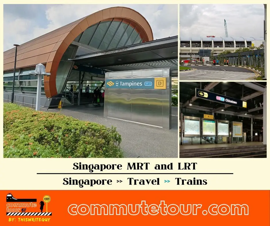
Singapore MRT / LRT Map
Singapore MRT / LRT Map. You can remove the other lines by tapping the top left corner of the map with arrow and unchecking the box/es.
Click here to search for MRT / LRT Station
Singapore MRT / LRT Map
Click the MRT / LRT Line below for more details.
MRT
LRT
Monorail
Cross Border
Featured
Click the time stamps below