07231 – Before Tai Hoe Hotel Bus Stop, Routes, Bus Schedule | Singapore
Bus Stop 07231 – Before Tai Hoe Hotel
Bus Stop 07231 – Before Tai Hoe Hotel include routes 21, 125, 130, 141
Routes from Before Tai Hoe Hotel going to Ang Mo Kio Interchange, St. Michael’s Terminal, Toa Payoh Interchange
Travelling today or planning for a commute from Bus Stop Code 07231 – Before Tai Hoe Hotel? Learn more about Bus Schedule, Route Map and MRT from Before Tai Hoe Hotel.
NOTICE: The fares and schedules listed here may subject to change without prior notice. Pls check with the companies for the updated details.
CommuteTour is in no way affiliated with any of the buses / trains / tourist spots listed on any of its pages.
Subscribe: youtube.com/@commutetour
07231 – Before Tai Hoe Hotel Map
Bus Stop 07231 – Before Tai Hoe Hotel
Before Tai Hoe Hotel Bus Stop Routes
SBS Transit Bus 21 Details
| Category | Information |
|---|---|
| Bus Route | 21 |
| Operator | SBS Transit |
| Dir 1 # of Stops | 68 |
| Dir 2 # of Stops | 67 |
| Origin | Pasir Ris Interchange |
| Destination | St. Michael’s Terminal |
| Direction | Two Way |
Bus 21 Schedule
SBS Transit Bus 21 schedule from Pasir Ris Interchange to St. Michael’s Terminal is from 05:30 to 24:00 from Monday to Sunday / Holidays while the bus schedule from St. Michael’s Terminal is from 05:30 to 24:00 from Monday to Sunday / Holidays.
| From | Monday to Friday | Saturday | Sunday / Holiday |
|---|---|---|---|
| Pasir Ris Int | 05:30 to 24:00 | 05:30 to 24:00 | 05:30 to 24:00 |
| St. Michael’s Ter | 05:30 to 24:00 | 05:30 to 24:00 | 05:30 to 24:00 |
| Frequency | Before 8:30 | 08:31 – 16:59 | 17:00 – 19:00 | After 19:00 |
|---|---|---|---|---|
| From Pasir Ris | 07 – 12 minutes | 11 – 14 minutes | 12 – 16 minutes | 14 – 16 minutes |
| From St. Michael’s Ter | 10 – 13 minutes | 08 – 14 minutes | 08 – 16 minutes | 12 – 16 minutes |
SG Bus 21 Route Map
Bus 21 Route Map
Tap the top right of the map for full screen view. You can return to this page by clicking on the link on the google map description
SBS Transit Bus 21 Bus Stops
The Bus Stops along SBS Transit Bus 21 Route include: Balestier Plaza, Balestier Point, Bedok Industrial Park C, Bedok Reform Training Center, Century Square, City Plaza, Downtown East, Hoa Nam Building, Jalan Dusun, Joo Chiat Complex, Kallang Place, Kim Keat Lane, Lavender Street, Lorong 1 Geylang, Lorong 106 Changi, Lorong 18 Geylang, Lorong 23 Geylang, Lorong 28 Geylang, Lorong 34 Geylang, Lorong 39 Geylang, Mohd Salleh Mosque, National Skin Center, Nkf, Northlight School, Novena Lodge, Public Mansion, Revival Center Church, Shaw Plaza, Sims Ville, Sims Way, Singapore Indian Assn, Singapore Khalsa Assn, Sri Vadapathira K Temple, St. Joseph Institution Jnr, Tai Hoe Hotel, Tan Tock Seng Hospital, The Clearwater Condominium, Thomson Medical Center, Uob Tampines Center, Waterfront Isle, Waterfront Key, Waterfront Waves, White Sands Primary School, Yi Xiu Factory Building and Zhongshan Mall.
Bus 21 passes along Blk 104, Blk 107, Blk 114, Blk 121, Blk 122, Blk 133, Blk 134, Blk 14 Market/Fc, Blk 140, Blk 147, Blk 149a, Blk 156, Blk 16, Blk 17, Blk 182, Blk 187, Blk 19, Blk 191, Blk 230e, Blk 233, Blk 269a, Blk 29, Blk 322, Blk 370, Blk 390, Blk 405, Blk 416, Blk 423, Blk 429, Blk 442, Blk 446, Blk 449, Blk 467, Blk 497d, Blk 609, Blk 629, Blk 646, Blk 65, Blk 701, Blk 703, Blk 713, Blk 716, Blk 745, Blk 82 and Blk 938.
SBS Transit Bus 21 Route also connects with the following stations: Aljunied, Boon Keng, Eunos, Farrer Park, Kallang, Novena, Pasir Ris, Paya Lebar, Tampines, Tampines East, Tampines West and terminals: Pasir Ris Interchange, St. Michael’s Terminal, Tampines Interchange
Pasir Ris Interchange (77009)
Road: Pasir Ris Drive 3
Station Code: EW1
Train Line/s: East-West Line MRT
Terminal: Pasir Ris InterchangeDowntown East (78109)
Road: Pasir Ris Drive 3Blk 467 (78081)
Road: Pasir Ris Drive 6Blk 446 (78071)
Road: Pasir Ris Drive 6Blk 442 (78069)
Road: Pasir Ris Drive 1Before Blk 187 (78181)
Road: Pasir Ris Street 11After Blk 182 (78191)
Road: Pasir Ris Street 11Blk 269a (98099)
Road: Pasir Ris Drive 1Opposite Blk 149a (98019)
Road: Loyang AvenueBlk 370 (76249)
Road: Tampines Avenue 7Blk 390 (76239)
Road: Tampines Avenue 7Opposite Tampines East Station (76229)
Road: Tampines Avenue 7
Station Code: DT33
Train Line/s: Downtown Line MRTBlk 230e (76219)
Road: Tampines Avenue 7Blk 233 (76209)
Road: Tampines Avenue 7Opposite Tampines Station/Interchange (76149)
Road: Tampines Avenue 4
Station Code: EW2 DT32
Train Line/s: East-West Line MRT Downtown Line MRT
Terminal: Tampines InterchangeOpposite Century Square (76139)
Road: Tampines Avenue 4Blk 147 (76069)
Road: Tampines Avenue 5Before Tampines West Station (75059)
Road: Tampines Avenue 1
Station Code: DT31
Train Line/s: Downtown Line MRTBedok Reform Training Center (75069)
Road: Bedok Reservoir RoadThe Clearwater Condominium (75349)
Road: Bedok Reservoir RoadWaterfront Key (84609)
Road: Bedok Reservoir RoadAfter Waterfront Waves (84639)
Road: Bedok Reservoir RoadWaterfront Isle (84619)
Road: Bedok Reservoir RoadBlk 716 (84629)
Road: Bedok Reservoir RoadBlk 713 (84479)
Road: Bedok Reservoir RoadBlk 703 (84469)
Road: Bedok Reservoir RoadAfter Bedok Industrial Park C (84481)
Road: Bedok Reservoir RoadBlk 629 (84491)
Road: Bedok Reservoir RoadBlk 609 (72079)
Road: Bedok Reservoir RoadBlk 121 (72069)
Road: Bedok Reservoir RoadOpposite Blk 646 (72029)
Road: Bedok Reservoir RoadOpposite Blk 322 (72019)
Road: Jalan EunosOpposite Blk 16 (83119)
Road: Jalan EunosOpposite Eunos Station (83109)
Road: Jalan Eunos
Station Code: EW7
Train Line/s: East-West Line MRTAfter Lorong 106 Changi (82069)
Road: Changi RoadJoo Chiat Complex (82049)
Road: Changi RoadBlk 14 Market/Fc (82029)
Road: Geylang RoadCity Plaza (82109)
Road: Geylang RoadOpposite Lorong 39 Geylang (81069)
Road: Geylang RoadAfter Lorong 34 Geylang (81049)
Road: Geylang RoadAfter Lorong 28 Geylang (81029)
Road: Geylang RoadBefore Lorong 18 Geylang (80089)
Road: Geylang RoadOpposite Mohd Salleh Mosque (80069)
Road: Geylang RoadAfter Sims Way (80049)
Road: Geylang RoadKallang Station/Opposite Blk 2c (80101)
Road: Lorong 1 Geylang
Station Code: EW10
Train Line/s: East-West Line MRTOpposite Kallang Place (60051)
Road: Boon Keng RoadBefore Lavender Street (60099)
Road: Bendemeer RoadHoa Nam Building (07329)
Road: Jalan BesarBefore Tai Hoe Hotel (07231)
Road: Kitchener RoadAfter Farrer Park Station Exit G (07211)
Road: Serangoon Road
Station Code: NE8
Train Line/s: North East Line MRTSri Vadapathira K Temple (07221)
Road: Serangoon RoadSingapore Khalsa Assn (50249)
Road: Balestier RoadSingapore Indian Assn (50239)
Road: Balestier RoadOpposite Tan Tock Seng Hospital (50129)
Road: Moulmein RoadSt. Joseph Institution Jnr (50119)
Road: Moulmein RoadOpposite Novena Church (50031)
Road: Thomson Road
Station Code: NS20
Train Line/s: North-South Line MRTNovena Lodge (50041)
Road: Thomson RoadBefore Jalan Dusun (50161)
Road: Balestier RoadZhongshan Mall (50171)
Road: Balestier RoadBefore Balestier Plaza (50191)
Road: Balestier RoadShaw Plaza (50201)
Road: Balestier RoadOpposite Balestier Point (50211)
Road: Balestier RoadBlk 82 (50991)
Road: Whampoa DriveBlk 29 (52129)
Road: Jalan BahagiaBlk 19 (52049)
Road: Jalan TenteramOpposite Blk 65 (52119)
Road: Jalan TenteramSt. Michael’s Terminal (52499)
Road: Whampoa Road
Terminal: St. Michael’s Terminal
St. Michael’s Terminal (52499)
Road: Whampoa Road
Terminal: St. Michael’s TerminalBlk 114 (52451)
Road: Whampoa RoadBlk 29 (52129)
Road: Jalan BahagiaBlk 19 (52049)
Road: Jalan TenteramOpposite Blk 65 (52119)
Road: Jalan TenteramOpposite Nkf (52099)
Road: Kim Keat RoadBefore Kim Keat Lane (50159)
Road: Kim Keat RoadAfter Pegu Road (50209)
Road: Balestier RoadOpposite Shaw Plaza (50199)
Road: Balestier RoadOpposite Public Mansion (50189)
Road: Balestier RoadOpposite Zhongshan Mall (50179)
Road: Balestier RoadAfter Irrawaddy Road (50169)
Road: Balestier RoadOpposite Thomson Medical Center (50059)
Road: Thomson RoadOpposite Novena Lodge (50049)
Road: Thomson RoadNovena Station (50038)
Road: Thomson Road
Station Code: NS20
Train Line/s: North-South Line MRTRevival Center Church (50111)
Road: Moulmein RoadNational Skin Center (50121)
Road: Moulmein RoadNorthlight School (50231)
Road: Balestier RoadBlk 122 (50331)
Road: Mcnair RoadBlk 107 (50349)
Road: Towner RoadBoon Keng Station/Blk 22 (60199)
Road: Boon Keng Road
Station Code: NE9
Train Line/s: North East Line MRTBefore Kallang Place (60059)
Road: Boon Keng RoadOpposite Kallang Station/Blk 2c (80109)
Road: Lorong 1 Geylang
Station Code: EW10
Train Line/s: East-West Line MRTAfter Lorong 1 Geylang (80051)
Road: Sims AvenueYi Xiu Factory Building (80071)
Road: Sims AvenueBefore Lorong 23 Geylang (80091)
Road: Sims AvenueAfter Aljunied Station (81011)
Road: Sims Avenue
Station Code: EW9
Train Line/s: East-West Line MRTBlk 134 (81031)
Road: Sims AvenueSims Ville (81051)
Road: Sims AvenueAfter Paya Lebar Quarter (82011)
Road: Sims Avenue
Station Code: EW8 CC9
Train Line/s: East-West Line MRT Circle Line MRTBlk 416 (82032)
Road: Sims AvenueEunos Station/Interchange (82061)
Road: Sims Avenue
Station Code: EW7
Train Line/s: East-West Line MRTEunos Station (83101)
Road: Jalan Eunos
Station Code: EW7
Train Line/s: East-West Line MRTBlk 17 (83111)
Road: Jalan EunosBlk 322 (72011)
Road: Jalan EunosBlk 646 (72021)
Road: Bedok Reservoir RoadBlk 122 (72061)
Road: Bedok Reservoir RoadBlk 133 (72071)
Road: Bedok Reservoir RoadBlk 140 (84499)
Road: Bedok Reservoir RoadOpposite Bedok Industrial Park C (84489)
Road: Bedok Reservoir RoadOpposite Blk 701 (84461)
Road: Bedok Reservoir RoadBlk 745 (84471)
Road: Bedok Reservoir RoadOpposite Blk 716 (84621)
Road: Bedok Reservoir RoadOpposite Waterfront Isle (84611)
Road: Bedok Reservoir RoadOpposite Waterfront Waves (84631)
Road: Bedok Reservoir RoadOpposite Waterfront Key (84601)
Road: Bedok Reservoir RoadOpposite The Clearwater Condominium (75341)
Road: Bedok Reservoir RoadOpposite Bedok Reform Training Center (75061)
Road: Bedok Reservoir RoadTampines West Station Exit B (75051)
Road: Tampines Avenue 1
Station Code: DT31
Train Line/s: Downtown Line MRTBlk 938 (76061)
Road: Tampines Avenue 5Uob Tampines Center (76131)
Road: Tampines Avenue 4Tampines Station/Interchange (76141)
Road: Tampines Avenue 4
Station Code: EW2 DT32
Train Line/s: East-West Line MRT Downtown Line MRT
Terminal: Tampines InterchangeBlk 423 (76201)
Road: Tampines Avenue 7Blk 449 (76211)
Road: Tampines Avenue 7Tampines East Station Exit A (76221)
Road: Tampines Avenue 7
Station Code: DT33
Train Line/s: Downtown Line MRTOpposite Blk 390 (76231)
Road: Tampines Avenue 7Blk 497d (76241)
Road: Tampines Avenue 7Blk 149a (98011)
Road: Loyang AvenueBlk 156 (98091)
Road: Pasir Ris Drive 1Opposite White Sands Primary School (78199)
Road: Pasir Ris Street 11Opposite Blk 187 (78189)
Road: Pasir Ris Street 11Blk 104 (78061)
Road: Pasir Ris Drive 1Blk 429 (78079)
Road: Pasir Ris Drive 6Blk 405 (78089)
Road: Pasir Ris Drive 6Opposite Downtown East (78101)
Road: Pasir Ris Drive 3Pasir Ris Interchange (77009)
Road: Pasir Ris Drive 3
Station Code: EW1
Train Line/s: East-West Line MRT
Terminal: Pasir Ris Interchange
Feel Free to click any of the Terminal, Transport links above
SBS Transit Bus 125 Details
| Category | Information |
|---|---|
| Bus Route | 125 |
| Operator | SBS Transit |
| Dir 1 # of Stops | 48 |
| Origin | St. Michael’s Terminal |
| Destination | Sims Drive |
| Direction | Loop |
Bus 125 Schedule
SBS Transit Bus 125 schedule from St. Michael’s Terminal to Sims Drive is from 06:00 to 23:00 from Monday to Sunday / Holidays.
| From | Monday to Friday | Saturday | Sunday / Holiday |
|---|---|---|---|
| St. Michael’s Ter | 06:00 to 23:00 | 06:00 to 23:00 | 06:00 to 23:00 |
| Frequency | Before 8:30 | 08:31 – 16:59 | 17:00 – 19:00 | After 19:00 |
|---|---|---|---|---|
| From St. Michael’s Ter | 11 – 12 minutes | 10 – 18 minutes | 10 – 16 minutes | 15 – 18 minutes |
SG Bus 125 Route Map
Bus 125 Route Map
Tap the top right of the map for full screen view. You can return to this page by clicking on the link on the google map description
SBS Transit Bus 125 Bus Stops
The Bus Stops along SBS Transit Bus 125 Route include: Balestier Point, Bendemeer Primary School, Genting Lane, Genting Link, Hoa Nam Building, Kallang Sector, Kallang Way 1, Kallang Way 2, Kallang Way 4, Kim Keat Lane, Kwong Wai Shiu Hospital, Lavender Street, Lorong 23 Geylang, Lorong Bakar Batu, Mom Svcs Center, Nkf, Northlight School, Siemens Center, Sims Urban Oasis, Singapore Indian Assn, Singapore Khalsa Assn, Sri Vadapathira K Temple, St. Michael’s Place, Tai Hoe Hotel, Tai Thong Crescent and Tannery Blk.
Bus 125 passes along Blk 104, Blk 114, Blk 125, Blk 29, Blk 44, Blk 45, Blk 53, Blk 54, Blk 82 and Blks 33/34.
SBS Transit Bus 125 Route also connects with the following stations: Aljunied, Boon Keng, Farrer Park and terminal: St. Michael’s Terminal
St. Michael’s Terminal (52499)
Road: Whampoa Road
Terminal: St. Michael’s TerminalBlk 114 (52451)
Road: Whampoa RoadBlk 29 (52129)
Road: Jalan BahagiaBetween Blks 33/34 (52109)
Road: Jalan BahagiaOpposite Nkf (52099)
Road: Kim Keat RoadBefore Kim Keat Lane (50159)
Road: Kim Keat RoadOpposite Balestier Point (50211)
Road: Balestier RoadBefore Blk 104 (50221)
Road: Balestier RoadNorthlight School (50231)
Road: Balestier RoadOpposite Singapore Khalsa Assn (50241)
Road: Balestier RoadKwong Wai Shiu Hospital (60101)
Road: Serangoon RoadBoon Keng Station/Blk 102 (60121)
Road: Serangoon Road
Station Code: NE9
Train Line/s: North East Line MRTOpposite Bendemeer Primary School (60141)
Road: Serangoon RoadSt. Michael’s Place (60161)
Road: Serangoon RoadAfter Tai Thong Crescent (60211)
Road: MacPherson RoadBefore Genting Link (70361)
Road: Genting LaneTannery Blk (70341)
Road: Tannery RoadAfter Kallang Way 1 (70321)
Road: Kallang WayAfter Genting Lane (70311)
Road: Kallang WayBlk 125 (70019)
Road: Aljunied RoadBefore Blk 53 (80239)
Road: Sims DriveBlk 45 (80229)
Road: Sims DriveBefore Sims Avenue (80269)
Road: Lorong 17 GeylangBefore Lorong 23 Geylang (80091)
Road: Sims AvenueOpposite Aljunied Station (81081)
Road: Aljunied Road
Station Code: EW9
Train Line/s: East-West Line MRTSims Urban Oasis (81091)
Road: Aljunied RoadOpposite Blk 125 (70011)
Road: Aljunied RoadAfter Kallang Way 4 (70319)
Road: Kallang WayAfter Kallang Way 2 (70329)
Road: Kallang WayBefore Lorong Bakar Batu (70349)
Road: Tannery RoadAfter Kallang Sector (70359)
Road: Lorong Bakar BatuBefore Siemens Center (60219)
Road: MacPherson RoadMom Svcs Center (60179)
Road: Bendemeer RoadBlk 54 (60159)
Road: Bendemeer RoadBlk 44 (60139)
Road: Bendemeer RoadOpposite Boon Keng Station (60119)
Road: Bendemeer Road
Station Code: NE9
Train Line/s: North East Line MRTBefore Lavender Street (60099)
Road: Bendemeer RoadHoa Nam Building (07329)
Road: Jalan BesarBefore Tai Hoe Hotel (07231)
Road: Kitchener RoadAfter Farrer Park Station Exit G (07211)
Road: Serangoon Road
Station Code: NE8
Train Line/s: North East Line MRTSri Vadapathira K Temple (07221)
Road: Serangoon RoadSingapore Khalsa Assn (50249)
Road: Balestier RoadSingapore Indian Assn (50239)
Road: Balestier RoadOpposite Blk 104 (50229)
Road: Balestier RoadBlk 82 (50991)
Road: Whampoa DriveBlk 29 (52129)
Road: Jalan BahagiaBetween Blks 33/34 (52109)
Road: Jalan BahagiaSt. Michael’s Terminal (52499)
Road: Whampoa Road
Terminal: St. Michael’s Terminal
SBS Transit Bus 130 Details
| Category | Information |
|---|---|
| Bus Route | 130 |
| Operator | SBS Transit |
| Dir 1 # of Stops | 42 |
| Dir 2 # of Stops | 41 |
| Origin | Ang Mo Kio Interchange |
| Destination | Shenton Way Terminal |
| Direction | Two Way |
Bus 130 Schedule
SBS Transit Bus 130 schedule from Ang Mo Kio Interchange to Shenton Way Terminal is from 05:30 to 23:30 from Monday to Sunday / Holidays while the bus schedule from Shenton Way Terminal is from 06:00 to 23:30 from Monday to Sunday / Holidays.
| From | Monday to Friday | Saturday | Sunday / Holiday |
|---|---|---|---|
| Ang Mo Kio Int | 05:30 to 23:30 | 05:30 to 23:30 | 05:30 to 23:30 |
| Shenton Way Ter | 06:00 to 23:30 | 06:00 to 23:30 | 06:00 to 23:30 |
| Frequency | Before 8:30 | 08:31 – 16:59 | 17:00 – 19:00 | After 19:00 |
|---|---|---|---|---|
| From Ang Mo Kio | 8 – 11 minutes | 9 – 16 minutes | 11 – 14 minutes | 16 – 17 minutes |
| From Shenton Way Ter | 13 – 14 minutes | 11 – 15 minutes | 11 minutes | 14 – 15 minutes |
SG Bus 130 Route Map
Bus 130 Route Map
Tap the top right of the map for full screen view. You can return to this page by clicking on the link on the google map description
SBS Transit Bus 130 Bus Stops
The Bus Stops along SBS Transit Bus 130 Route include: Amtech Building, Balestier Plaza, Balestier Point, Bras Basah Complex, Capital Tower, Church of Our Lady of Lourdes, Esplanade Bridge, Eunoia Junior College (JC), Hoa Nam Building, Hub Synergy Point, Jalan Dusun, Lavender Street, Macritchie Resvr, Mt Alvernia Hospital, Nea Reg Off, Northlight School, Old Police Acad, One Raffles Quay, Public Mansion, Raffles Hotel, Shaw Plaza, Shunfu Estate, Sin Ming Plaza, Singapore Indian Assn, Singapore Khalsa Assn, Singapore Polo Club, Slf Complex, Sri Vadapathira K Temple, St. Joseph’s Church, St. Theresa’s Home, Stamford Primary School, Tai Hoe Hotel, Tan Tong Meng Tower, Thomson Community Club (Cc), Thomson Flyover, Toa Payoh Rise and Zhongshan Mall.
Bus 130 passes along Blk 104, Blk 207, Blk 22a, Blk 23, Blk 25, Blk 254, Blk 307a, Blk 324, Blk 7 Industrial Estate and Blk 700b.
MRT Stations along Bus 130 Route include: Ang Mo Kio, Boon Keng, Bugis, City Hall, Esplanade, Farrer Park, Jalan Besar, Raffles Place, Shenton Way, Tanjong Pagar and connects with Ang Mo Kio Interchange, Shenton Way Terminal.
Ang Mo Kio Interchange (54009)
Road: Ang Mo Kio Avenue 8
Station Code: NS16
Train Line/s: North-South Line MRT
Terminal: Ang Mo Kio InterchangeBlk 324 (54248)
Road: Ang Mo Kio Avenue 3Blk 307a (54019)
Road: Ang Mo Kio Avenue 6Opposite Eunoia Junior College (JC) (53321)
Road: Sin Ming AvenueAfter Nea Reg Off (53209)
Road: Sin Ming DriveBlk 22a Carpark (53199)
Road: Sin Ming RoadBlk 25 (53189)
Road: Sin Ming RoadSin Ming Plaza (53179)
Road: Sin Ming RoadThomson Community Club (Cc) (53039)
Road: Upper Thomson RoadShunfu Estate (53029)
Road: Upper Thomson RoadOpposite St. Theresa’s Home (53019)
Road: Upper Thomson RoadMt Alvernia Hospital (51069)
Road: Thomson RoadAfter Toa Payoh Rise (51059)
Road: Thomson RoadSlf Complex (51049)
Road: Thomson RoadOpposite Singapore Polo Club (51039)
Road: Thomson RoadOpposite Old Police Acad (51029)
Road: Thomson RoadThomson Flyover (51019)
Road: Thomson RoadBefore Jalan Dusun (50161)
Road: Balestier RoadZhongshan Mall (50171)
Road: Balestier RoadBefore Balestier Plaza (50191)
Road: Balestier RoadShaw Plaza (50201)
Road: Balestier RoadOpposite Balestier Point (50211)
Road: Balestier RoadBefore Blk 104 (50221)
Road: Balestier RoadNorthlight School (50231)
Road: Balestier RoadOpposite Singapore Khalsa Assn (50241)
Road: Balestier RoadBoon Keng Station/Blk 22 (60199)
Road: Boon Keng Road
Station Code: NE9
Train Line/s: North East Line MRTBefore Lavender Street (60099)
Road: Bendemeer RoadHoa Nam Building (07329)
Road: Jalan BesarAfter Allenby Road (07319)
Road: Jalan BesarOpposite Veerasamy Road (07419)
Road: Jalan BesarJalan Besar Station Exit A (07529)
Road: Jalan Besar
Station Code: DT22
Train Line/s: Downtown Line MRTChurch of Our Lady of Lourdes (07589)
Road: Ophir RoadBugis Station Exit B (01059)
Road: Victoria Street
Station Code: EW12 DT14
Train Line/s: East-West Line MRT Downtown Line MRTAfter Bugis Station Exit C (01119)
Road: Victoria Street
Station Code: EW12 DT14
Train Line/s: East-West Line MRT Downtown Line MRTBras Basah Complex (01019)
Road: Victoria StreetRaffles Hotel (02049)
Road: Bras Basah RoadAfter Esplanade Station Exit D (02029)
Road: Esplanade Drive
Station Code: CC3
Train Line/s: Circle Line MRTOue Bayfront (03019)
Road: Collyer Quay
Station Code: EW14 NS26
Train Line/s: East-West Line MRT North-South Line MRTOne Raffles Quay (03059)
Road: Raffles QuayUIC Building (03129)
Road: Shenton Way
Station Code: TE19
Train Line/s: Thomson-East Coast Line MRTOpposite MAS Building (03218)
Road: Shenton Way
Station Code: EW15
Train Line/s: East-West Line MRTShenton Way Terminal (03239)
Road: Shenton Way
Terminal: Shenton Way Terminal
Shenton Way Terminal (03239)
Road: Shenton Way
Terminal: Shenton Way TerminalHub Synergy Point (03222)
Road: Anson RoadAfter Capital Tower (03111)
Road: Robinson RoadRaffles Place Station Exit F (03031)
Road: Robinson Road
Station Code: EW14 NS26
Train Line/s: East-West Line MRT North-South Line MRTFullerton Square (03011)
Road: Fullerton Road
Station Code: EW14 NS26
Train Line/s: East-West Line MRT North-South Line MRTEsplanade Bridge (02111)
Road: Esplanade DriveCath of The Good Shepherd (04151)
Road: Victoria Street
Station Code: EW13 NS25
Train Line/s: East-West Line MRT North-South Line MRTSt. Joseph’s Church (01013)
Road: Victoria StreetBugis Station Exit A (01113)
Road: Victoria Street
Station Code: EW12 DT14
Train Line/s: East-West Line MRT Downtown Line MRTStamford Primary School (01121)
Road: Victoria StreetAfter King George’s Avenue (07331)
Road: Kitchener RoadBefore Tai Hoe Hotel (07231)
Road: Kitchener RoadAfter Farrer Park Station Exit G (07211)
Road: Serangoon Road
Station Code: NE8
Train Line/s: North East Line MRTSri Vadapathira K Temple (07221)
Road: Serangoon RoadSingapore Khalsa Assn (50249)
Road: Balestier RoadSingapore Indian Assn (50239)
Road: Balestier RoadOpposite Blk 104 (50229)
Road: Balestier RoadAfter Pegu Road (50209)
Road: Balestier RoadOpposite Shaw Plaza (50199)
Road: Balestier RoadOpposite Public Mansion (50189)
Road: Balestier RoadOpposite Zhongshan Mall (50179)
Road: Balestier RoadAfter Irrawaddy Road (50169)
Road: Balestier RoadOpposite Tan Tong Meng Tower (51011)
Road: Thomson RoadOld Police Acad (51021)
Road: Thomson RoadSingapore Polo Club (51031)
Road: Thomson RoadAfter Andrew Road (51051)
Road: Thomson RoadMacritchie Resvr (51071)
Road: Thomson RoadSt. Theresa’s Home (53011)
Road: Upper Thomson RoadOpposite Shunfu Estate (53021)
Road: Upper Thomson RoadBlk 23 (53171)
Road: Sin Ming RoadAmtech Building (53181)
Road: Sin Ming RoadBlk 7 Industrial Estate (53191)
Road: Sin Ming RoadOpposite Nea Reg Off (53201)
Road: Sin Ming DriveEunoia Junior College (JC) (53329)
Road: Sin Ming AvenueOpposite Blk 254 (53161)
Road: Marymount RoadBlk 207 (54011)
Road: Ang Mo Kio Avenue 6Blk 700b (54241)
Road: Ang Mo Kio Avenue 3Ang Mo Kio Interchange (54009)
Road: Ang Mo Kio Avenue 8
Station Code: NS16
Train Line/s: North-South Line MRT
Terminal: Ang Mo Kio Interchange
Feel Free to click any of the Terminal, Transport links above
SBS Transit Bus 141 Details
| Category | Information |
|---|---|
| Bus Route | 141 |
| Operator | SBS Transit |
| Dir 1 # of Stops | 26 |
| Dir 2 # of Stops | 25 |
| Origin | Lorong 1 Geylang Terminal |
| Destination | Toa Payoh Interchange |
| Direction | Two Way |
Bus 141 Schedule
SBS Transit Bus 141 schedule from Lorong 1 Geylang Terminal to Toa Payoh Interchange is from 06:00 to 23:30 from Monday to Sunday / Holidays while the bus schedule from Toa Payoh Interchange is from 06:00 to 23:45 from Monday to Sunday / Holidays.
| From | Monday to Friday | Saturday | Sunday / Holiday |
|---|---|---|---|
| Lor 1 Geylang Ter | 06:00 to 23:30 | 06:00 to 23:30 | 06:00 to 23:30 |
| Toa Payoh Int | 06:00 to 23:45 | 06:00 to 23:45 | 06:00 to 23:45 |
| Frequency | Before 8:30 | 08:31 – 16:59 | 17:00 – 19:00 | After 19:00 |
|---|---|---|---|---|
| From Lorong 1 Geylang Ter | 12 – 14 minutes | 14 – 16 minutes | 15 minutes | 13 – 23 minutes |
| From Toa Payoh | 12 minutes | 11 – 16 minutes | 11 – 16 minutes | 15 – 25 minutes |
SG Bus 141 Route Map
Bus 141 Route Map
Tap the top right of the map for full screen view. You can return to this page by clicking on the link on the google map description
SBS Transit Bus 141 Bus Stops
The Bus Stops along SBS Transit Bus 141 Route include: Arc 380, Hoa Nam Building, Kallang Bahru, Kampong Bugis, Kentish Green, Kentish Lodge, Lighthouse School, Novena Lodge, Old Police Acad, Oleander Towers, Padang Jeringau, Pek Kio Market, Singapore Polo Club, Slf Complex, Tai Hoe Hotel, Tan Tong Meng Tower, Thomson Flyover, Thomson Medical Center, Toa Payoh Rise and United Square.
Bus 141 passes along Blk 128, Blk 131, Blk 139a, Blk 163 and Blk 51/Opposite Pek Kio Market.
MRT Stations along Bus 141 Route include: Caldecott, Farrer Park, Kallang, Novena, Toa Payoh and connects with Lorong 1 Geylang Terminal, Toa Payoh Interchange.
Lorong 1 Geylang Terminal (80009)
Road: Lorong 1 Geylang
Station Code: EW10
Train Line/s: East-West Line MRT
Terminal: Lor 1 Geylang TerminalBefore Kampong Bugis (80029)
Road: Kallang RoadAfter Kallang Road (07371)
Road: Lavender StreetBefore Kallang Bahru (07361)
Road: Lavender StreetArc 380 (07351)
Road: Lavender StreetHoa Nam Building (07329)
Road: Jalan BesarBefore Tai Hoe Hotel (07231)
Road: Kitchener RoadFarrer Park Station Exit A (50251)
Road: Rangoon Road
Station Code: NE8
Train Line/s: North East Line MRTKentish Lodge (50261)
Road: Rangoon RoadKentish Green (50301)
Road: Kent RoadPek Kio Market (50081)
Road: Owen RoadBefore Carlisle Road (50071)
Road: Norfolk RoadUnited Sq/Before Novena Station (50021)
Road: Thomson Road
Station Code: NS20
Train Line/s: North-South Line MRTOpposite Novena Church (50031)
Road: Thomson Road
Station Code: NS20
Train Line/s: North-South Line MRTNovena Lodge (50041)
Road: Thomson RoadThomson Medical Center (50051)
Road: Thomson RoadOpposite Tan Tong Meng Tower (51011)
Road: Thomson RoadOld Police Acad (51021)
Road: Thomson RoadSingapore Polo Club (51031)
Road: Thomson RoadAfter Andrew Road (51051)
Road: Thomson RoadBefore Caldecott Station/Savh (52241)
Road: Toa Payoh Rise
Station Code: CC17 TE9
Train Line/s: Circle Line MRT Thomson-East Coast Line MRTLighthouse School (52211)
Road: Toa Payoh RiseBlk 128 (52159)
Road: Lorong 1 Toa PayohBlk 139a (52149)
Road: Lorong 1 Toa PayohOleander Towers (52139)
Road: Lorong 1 Toa PayohToa Payoh Interchange (52009)
Road: Lorong 6 Toa Payoh
Station Code: NS19
Train Line/s: North-South Line MRT
Terminal: Toa Payoh Interchange
Toa Payoh Interchange (52009)
Road: Lorong 6 Toa Payoh
Station Code: NS19
Train Line/s: North-South Line MRT
Terminal: Toa Payoh InterchangeBlk 163 (52131)
Road: Lorong 1 Toa PayohOpposite Blk 139a (52141)
Road: Lorong 1 Toa PayohBlk 131 (52151)
Road: Lorong 1 Toa PayohBefore Caldecott Station Exit 3 (52219)
Road: Toa Payoh Rise
Station Code: CC17 TE9
Train Line/s: Circle Line MRT Thomson-East Coast Line MRTAfter Caldecott Station (52249)
Road: Toa Payoh Rise
Station Code: CC17 TE9
Train Line/s: Circle Line MRT Thomson-East Coast Line MRTAfter Toa Payoh Rise (51059)
Road: Thomson RoadSlf Complex (51049)
Road: Thomson RoadOpposite Singapore Polo Club (51039)
Road: Thomson RoadOpposite Old Police Acad (51029)
Road: Thomson RoadThomson Flyover (51019)
Road: Thomson RoadOpposite Thomson Medical Center (50059)
Road: Thomson RoadOpposite Novena Lodge (50049)
Road: Thomson RoadNovena Station (50038)
Road: Thomson Road
Station Code: NS20
Train Line/s: North-South Line MRTOpposite United Square (50029)
Road: Thomson RoadOpposite Carlisle Road (50079)
Road: Norfolk RoadBlk 51/Opposite Pek Kio Market (50089)
Road: Owen RoadFarrer Park Station Exit D (50279)
Road: Gloucester Road
Station Code: NE8
Train Line/s: North East Line MRTOpposite Farrer Park Station (50259)
Road: Rangoon Road
Station Code: NE8
Train Line/s: North East Line MRTAfter Farrer Park Station Exit G (07211)
Road: Serangoon Road
Station Code: NE8
Train Line/s: North East Line MRTAfter Kempas Road (07249)
Road: Lavender StreetOpposite Arc 380 (07359)
Road: Lavender StreetAfter Kallang Bahru (07369)
Road: Lavender StreetAperia/Before Kallang Road (07379)
Road: Lavender StreetAfter Padang Jeringau (80011)
Road: Kallang RoadLorong 1 Geylang Terminal (80009)
Road: Lorong 1 Geylang
Station Code: EW10
Train Line/s: East-West Line MRT
Terminal: Lor 1 Geylang Terminal
Feel Free to click any of the Terminal, Transport links above
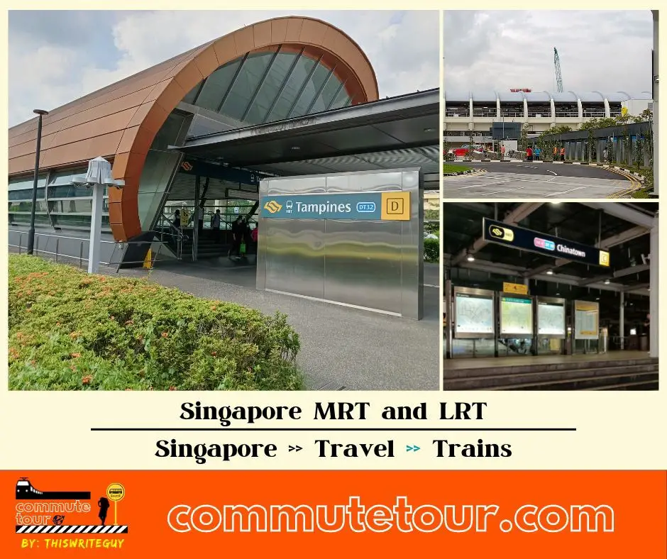
Singapore MRT / LRT Map
Singapore MRT / LRT Map. You can remove the other lines by tapping the top left corner of the map with arrow and unchecking the box/es.
Click here to search for MRT / LRT Station
Singapore MRT / LRT Map
Click the MRT / LRT Line below for more details.
MRT
LRT
Monorail
Cross Border
Featured
Click the time stamps below