52109 – Between Blks 33/34 Bus Stop, Routes, Bus Schedule | Singapore
Bus Stop 52109 – Between Blks 33/34
Bus Stop 52109 – Between Blks 33/34 include routes 124, 125, 131, 139, 186
Routes from Between Blks 33/34 going to Shenton Way Terminal, St. Michael’s Terminal, Toa Payoh Interchange
Other routes from Between Blks 33/34 include Lorong 23 Geylang
Travelling today or planning for a commute from Bus Stop Code 52109 – Between Blks 33/34? Learn more about Bus Schedule, Route Map and MRT from Between Blks 33/34.
NOTICE: The fares and schedules listed here may subject to change without prior notice. Pls check with the companies for the updated details.
CommuteTour is in no way affiliated with any of the buses / trains / tourist spots listed on any of its pages.
Subscribe: youtube.com/@commutetour
52109 – Between Blks 33/34 Map
Bus Stop 52109 – Between Blks 33/34
Between Blks 33/34 Bus Stop Routes
SBS Transit Bus 124 Details
| Category | Information |
|---|---|
| Bus Route | 124 |
| Operator | SBS Transit |
| Dir 1 # of Stops | 46 |
| Dir 2 # of Stops | 45 |
| Origin | St. Michael’s Terminal |
| Destination | Harbourfront Interchange |
| Direction | Two Way |
Bus 124 Schedule
SBS Transit Bus 124 schedule from St. Michael’s Terminal to HarbourFront Interchange is from 05:30 to 24:00 from Monday to Sunday / Holidays while the bus schedule from HarbourFront Interchange is from 05:30 to 24:00 from Monday to Sunday / Holidays.
| From | Monday to Friday | Saturday | Sunday / Holiday |
|---|---|---|---|
| St. Michael’s Ter | 05:30 to 24:00 | 05:30 to 24:00 | 05:30 to 24:00 |
| HarbourFront Int | 05:30 to 24:00 | 05:30 to 24:00 | 05:30 to 24:00 |
| Frequency | Before 8:30 | 08:31 – 16:59 | 17:00 – 19:00 | After 19:00 |
|---|---|---|---|---|
| From St. Michael’s Ter | 7 – 9 minutes | 8 – 13 minutes | 7 – 12 minutes | 10 – 12 minutes |
| From HarbourFront | 7 – 8 minutes | 8 – 13 minutes | 8 – 9 minutes | 8 – 13 minutes |
SG Bus 124 Route Map
Bus 124 Route Map
Tap the top right of the map for full screen view. You can return to this page by clicking on the link on the google map description
SBS Transit Bus 124 Bus Stops
The Bus Stops along SBS Transit Bus 124 Route include: Al-Amin Mosque, Balestier Point, Boat Quay, Caribbean At Keppel Bay, Christian Community Chapel, Concorde Hotel Singapore, Env Building, Far East Plaza, Hotel Royal, Keppel Distripark Blk 519, Kim Keat Lane, Melati Blk 2, National Skin Center, New Bridge Center, Newton Life Church, Ngee Ann City, Nkf, Old Hill Street Police Station, Revival Center Church, Royal Plaza On Scotts, Safra Mt Faber, St. Joseph Institution Jnr, St. Teresa’s Church, Stamford Court, Tan Tock Seng Hospital, Telok Blangah Hts, Telok Blangah Market/Fc, The Pearl @ Mt Faber, The Treasury, Winsland House and YMCA.
Bus 124 passes along Blk 104, Blk 105, Blk 114, Blk 25, Blk 27, Blk 29, Blk 40, Blk 48, Blk 50, Blk 59, Blk 70a, Blk 70b, Blk 82, Blk 85, Blk 91a, Blk 92b and Blks 33/34.
MRT Stations along Bus 124 Route include: Bencoolen, Bras Basah, Chinatown, City Hall, Clarke Quay, Dhoby Ghaut, Harbourfront, Newton, Orchard, Outram Park, Somerset, Vivo City and connects with Harbourfront Interchange, Kampong Bahru Terminal, St. Michael’s Terminal.
St. Michael’s Terminal (52499)
Road: Whampoa Road
Terminal: St. Michael’s TerminalBlk 114 (52451)
Road: Whampoa RoadBlk 29 (52129)
Road: Jalan BahagiaBetween Blks 33/34 (52109)
Road: Jalan BahagiaOpposite Nkf (52099)
Road: Kim Keat RoadBefore Kim Keat Lane (50159)
Road: Kim Keat RoadOpposite Balestier Point (50211)
Road: Balestier RoadBefore Blk 104 (50221)
Road: Balestier RoadOpposite Tan Tock Seng Hospital (50129)
Road: Moulmein RoadSt. Joseph Institution Jnr (50119)
Road: Moulmein RoadHotel Royal (50069)
Road: Newton RoadNewton Life Church (40129)
Road: Newton RoadEnv Building (40179)
Road: Scotts RoadFar East Plaza (09219)
Road: Scotts RoadOrchard Station/Tang Plaza (09047)
Road: Orchard Road
Station Code: NS22 TE14
Train Line/s: North-South Line MRT Thomson-East Coast Line MRTBefore Cairnhill Road (09037)
Road: Orchard Road
Station Code: NS22 TE14
Train Line/s: North-South Line MRT Thomson-East Coast Line MRTConcorde Hotel Singapore (08138)
Road: Orchard RoadDhoby Ghaut Station (08057)
Road: Orchard Road
Station Code: CC1 NE6 NS24
Train Line/s: Circle Line MRT North East Line MRT North-South Line MRTBencoolen Station Exit B (08069)
Road: Bras Basah Road
Station Code: DT21
Train Line/s: Downtown Line MRTCity Hall Station Exit B (04167)
Road: North Bridge Road
Station Code: EW13 NS25
Train Line/s: East-West Line MRT North-South Line MRTOpposite The Treasury (04249)
Road: North Bridge RoadBoat Quay (05029)
Road: South Bridge RoadOpposite Hong Lim Complex (05131)
Road: Upper Cross Street
Station Code: DT19 NE4
Train Line/s: Downtown Line MRT North East Line MRTNew Bridge Center (05039)
Road: New Bridge RoadAfter Duxton Plain Park (05019)
Road: New Bridge Road
Station Code: EW16 NE3 TE17
Train Line/s: East-West Line MRT North East Line MRT Thomson-East Coast Line MRTOutram Park Station Exit H (05069)
Road: New Bridge Road
Station Code: EW16 NE3 TE17
Train Line/s: East-West Line MRT North East Line MRT Thomson-East Coast Line MRTBefore Neil Road (10011)
Road: New Bridge RoadBefore Kampong Bahru Terminal (10041)
Road: Kampong Bahru Road
Terminal: Kampong Bahru TerminalMelati Blk 2 (10399)
Road: Kampong Bahru RoadOpposite St. Teresa’s Church (14221)
Road: Kampong Bahru RoadKeppel Distripark Blk 519 (14231)
Road: Kampong Bahru RoadThe Pearl @ Mt Faber (14021)
Road: Lower Delta RoadBlk 40 (14379)
Road: Lower Delta RoadBlk 27 (14291)
Road: Telok Blangah WayAl-Amin Mosque (14271)
Road: Telok Blangah WaySafra Mt Faber (14281)
Road: Telok Blangah WayBefore Telok Blangah Hts (14059)
Road: Henderson RoadBlk 59 (14349)
Road: Telok Blangah HtsBlk 70a (14339)
Road: Telok Blangah HtsBlk 85 (14399)
Road: Telok Blangah HtsBlk 92b (14509)
Road: Telok Blangah Street 31Telok Blangah Market/Fc (14499)
Road: Telok Blangah DriveBlk 50 (14359)
Road: Telok Blangah DriveBefore Christian Community Chapel (14159)
Road: Telok Blangah RoadBefore Seah Im Road (14139)
Road: Telok Blangah RoadHarbourfront Interchange (14009)
Road: Seah Im Road
Station Code: CC29 NE1 S1
Train Line/s: Circle Line MRT North East Line MRT Sentosa Express Monorail
Terminal: Harbourfront Interchange
Harbourfront Interchange (14009)
Road: Seah Im Road
Station Code: CC29 NE1 S1
Train Line/s: Circle Line MRT North East Line MRT Sentosa Express Monorail
Terminal: Harbourfront InterchangeCaribbean At Keppel Bay (14131)
Road: Telok Blangah RoadOpposite Christian Community Chapel (14151)
Road: Telok Blangah RoadAfter Blk 48 (14351)
Road: Telok Blangah DriveOpposite Telok Blangah Market/Fc (14491)
Road: Telok Blangah DriveOpposite Blk 91a (14501)
Road: Telok Blangah Street 31Opposite Blk 85 (14391)
Road: Telok Blangah HtsOpposite Blk 70b (14331)
Road: Telok Blangah HtsOpposite Blk 59 (14341)
Road: Telok Blangah HtsAfter Telok Blangah Hts (14051)
Road: Henderson RoadBlk 25 (14279)
Road: Telok Blangah WayOpposite Blk 27 (14299)
Road: Telok Blangah WayBlk 105 (14029)
Road: Lower Delta RoadOpposite Keppel Distripark Blk 519 (14239)
Road: Kampong Bahru RoadSt. Teresa’s Church (14229)
Road: Kampong Bahru RoadOpposite Melati Blk 2 (10391)
Road: Kampong Bahru RoadOpposite Kampong Bahru Terminal (10049)
Road: Kampong Bahru Road
Terminal: Kampong Bahru TerminalAfter Hospital Drive (10017)
Road: Eu Tong Sen Street
Station Code: EW16 NE3 TE17
Train Line/s: East-West Line MRT North East Line MRT Thomson-East Coast Line MRTOutram Park Station Exit F/Sgh (10018)
Road: Eu Tong Sen Street
Station Code: EW16 NE3 TE17
Train Line/s: East-West Line MRT North East Line MRT Thomson-East Coast Line MRTBefore Pearl’s Hill Terrace (05012)
Road: Eu Tong Sen Street
Station Code: EW16 NE3 TE17
Train Line/s: East-West Line MRT North East Line MRT Thomson-East Coast Line MRTAfter Chinatown Station Exit D (05022)
Road: Eu Tong Sen Street
Station Code: DT19 NE4
Train Line/s: Downtown Line MRT North East Line MRTClarke Quay Station Exit E (04222)
Road: Eu Tong Sen Street
Station Code: NE5
Train Line/s: North East Line MRTOld Hill Street Police Station (04223)
Road: Hill StreetStamford Court (04143)
Road: Hill StreetSMU (04121)
Road: Stamford Road
Station Code: CC2
Train Line/s: Circle Line MRTYMCA (08041)
Road: Orchard RoadDhoby Ghaut Station Exit B (08031)
Road: Penang Road
Station Code: CC1 NE6 NS24
Train Line/s: Circle Line MRT North East Line MRT North-South Line MRTWinsland House (08111)
Road: Penang RoadSomerset Station (08121)
Road: Somerset Road
Station Code: NS23
Train Line/s: North-South Line MRTOpposite Ngee Ann City (09011)
Road: Orchard TurnOpposite Orchard Station/Ion (09023)
Road: Orchard Turn
Station Code: NS22 TE14
Train Line/s: North-South Line MRT Thomson-East Coast Line MRTRoyal Plaza On Scotts (09212)
Road: Scotts RoadOpposite Env Building (40171)
Road: Scotts RoadNewton Station Exit A (40181)
Road: Scotts Road
Station Code: DT11 NS21
Train Line/s: Downtown Line MRT North-South Line MRTOpposite Newton Life Church (40121)
Road: Newton RoadOpposite Hotel Royal (50061)
Road: Newton RoadRevival Center Church (50111)
Road: Moulmein RoadNational Skin Center (50121)
Road: Moulmein RoadOpposite Blk 104 (50229)
Road: Balestier RoadBlk 82 (50991)
Road: Whampoa DriveBlk 29 (52129)
Road: Jalan BahagiaBetween Blks 33/34 (52109)
Road: Jalan BahagiaSt. Michael’s Terminal (52499)
Road: Whampoa Road
Terminal: St. Michael’s Terminal
Feel Free to click any of the Terminal, Transport links above
SBS Transit Bus 125 Details
| Category | Information |
|---|---|
| Bus Route | 125 |
| Operator | SBS Transit |
| Dir 1 # of Stops | 48 |
| Origin | St. Michael’s Terminal |
| Destination | Sims Drive |
| Direction | Loop |
Bus 125 Schedule
SBS Transit Bus 125 schedule from St. Michael’s Terminal to Sims Drive is from 06:00 to 23:00 from Monday to Sunday / Holidays.
| From | Monday to Friday | Saturday | Sunday / Holiday |
|---|---|---|---|
| St. Michael’s Ter | 06:00 to 23:00 | 06:00 to 23:00 | 06:00 to 23:00 |
| Frequency | Before 8:30 | 08:31 – 16:59 | 17:00 – 19:00 | After 19:00 |
|---|---|---|---|---|
| From St. Michael’s Ter | 11 – 12 minutes | 10 – 18 minutes | 10 – 16 minutes | 15 – 18 minutes |
SG Bus 125 Route Map
Bus 125 Route Map
Tap the top right of the map for full screen view. You can return to this page by clicking on the link on the google map description
SBS Transit Bus 125 Bus Stops
The Bus Stops along SBS Transit Bus 125 Route include: Balestier Point, Bendemeer Primary School, Genting Lane, Genting Link, Hoa Nam Building, Kallang Sector, Kallang Way 1, Kallang Way 2, Kallang Way 4, Kim Keat Lane, Kwong Wai Shiu Hospital, Lavender Street, Lorong 23 Geylang, Lorong Bakar Batu, Mom Svcs Center, Nkf, Northlight School, Siemens Center, Sims Urban Oasis, Singapore Indian Assn, Singapore Khalsa Assn, Sri Vadapathira K Temple, St. Michael’s Place, Tai Hoe Hotel, Tai Thong Crescent and Tannery Blk.
Bus 125 passes along Blk 104, Blk 114, Blk 125, Blk 29, Blk 44, Blk 45, Blk 53, Blk 54, Blk 82 and Blks 33/34.
SBS Transit Bus 125 Route also connects with the following stations: Aljunied, Boon Keng, Farrer Park and terminal: St. Michael’s Terminal
St. Michael’s Terminal (52499)
Road: Whampoa Road
Terminal: St. Michael’s TerminalBlk 114 (52451)
Road: Whampoa RoadBlk 29 (52129)
Road: Jalan BahagiaBetween Blks 33/34 (52109)
Road: Jalan BahagiaOpposite Nkf (52099)
Road: Kim Keat RoadBefore Kim Keat Lane (50159)
Road: Kim Keat RoadOpposite Balestier Point (50211)
Road: Balestier RoadBefore Blk 104 (50221)
Road: Balestier RoadNorthlight School (50231)
Road: Balestier RoadOpposite Singapore Khalsa Assn (50241)
Road: Balestier RoadKwong Wai Shiu Hospital (60101)
Road: Serangoon RoadBoon Keng Station/Blk 102 (60121)
Road: Serangoon Road
Station Code: NE9
Train Line/s: North East Line MRTOpposite Bendemeer Primary School (60141)
Road: Serangoon RoadSt. Michael’s Place (60161)
Road: Serangoon RoadAfter Tai Thong Crescent (60211)
Road: MacPherson RoadBefore Genting Link (70361)
Road: Genting LaneTannery Blk (70341)
Road: Tannery RoadAfter Kallang Way 1 (70321)
Road: Kallang WayAfter Genting Lane (70311)
Road: Kallang WayBlk 125 (70019)
Road: Aljunied RoadBefore Blk 53 (80239)
Road: Sims DriveBlk 45 (80229)
Road: Sims DriveBefore Sims Avenue (80269)
Road: Lorong 17 GeylangBefore Lorong 23 Geylang (80091)
Road: Sims AvenueOpposite Aljunied Station (81081)
Road: Aljunied Road
Station Code: EW9
Train Line/s: East-West Line MRTSims Urban Oasis (81091)
Road: Aljunied RoadOpposite Blk 125 (70011)
Road: Aljunied RoadAfter Kallang Way 4 (70319)
Road: Kallang WayAfter Kallang Way 2 (70329)
Road: Kallang WayBefore Lorong Bakar Batu (70349)
Road: Tannery RoadAfter Kallang Sector (70359)
Road: Lorong Bakar BatuBefore Siemens Center (60219)
Road: MacPherson RoadMom Svcs Center (60179)
Road: Bendemeer RoadBlk 54 (60159)
Road: Bendemeer RoadBlk 44 (60139)
Road: Bendemeer RoadOpposite Boon Keng Station (60119)
Road: Bendemeer Road
Station Code: NE9
Train Line/s: North East Line MRTBefore Lavender Street (60099)
Road: Bendemeer RoadHoa Nam Building (07329)
Road: Jalan BesarBefore Tai Hoe Hotel (07231)
Road: Kitchener RoadAfter Farrer Park Station Exit G (07211)
Road: Serangoon Road
Station Code: NE8
Train Line/s: North East Line MRTSri Vadapathira K Temple (07221)
Road: Serangoon RoadSingapore Khalsa Assn (50249)
Road: Balestier RoadSingapore Indian Assn (50239)
Road: Balestier RoadOpposite Blk 104 (50229)
Road: Balestier RoadBlk 82 (50991)
Road: Whampoa DriveBlk 29 (52129)
Road: Jalan BahagiaBetween Blks 33/34 (52109)
Road: Jalan BahagiaSt. Michael’s Terminal (52499)
Road: Whampoa Road
Terminal: St. Michael’s Terminal
SBS Transit Bus 131 Details
| Category | Information |
|---|---|
| Bus Route | 131 |
| Operator | SBS Transit |
| Dir 1 # of Stops | 50 |
| Dir 2 # of Stops | 49 |
| Origin | St. Michael’s Terminal |
| Destination | Bukit Merah Interchange |
| Direction | Two Way |
Bus 131 Schedule
SBS Transit Bus 131 schedule from St. Michael’s Terminal to Bukit Merah Interchange is from 05:45 to 23:30 from Monday to Sunday / Holidays while the bus schedule from Bukit Merah Interchange is from 05:45 to 24:00 from Monday to Sunday / Holidays.
| From | Monday to Friday | Saturday | Sunday / Holiday |
|---|---|---|---|
| St. Michael’s Ter | 05:45 to 23:30 | 05:45 to 23:30 | 05:45 to 23:30 |
| Bt Merah Int | 05:45 to 24:00 | 05:45 to 24:00 | 05:45 to 24:00 |
| Frequency | Before 8:30 | 08:31 – 16:59 | 17:00 – 19:00 | After 19:00 |
|---|---|---|---|---|
| From St. Michael’s Ter | 6 – 11 minutes | 9 – 14 minutes | 9 – 12 minutes | 11 – 14 minutes |
| From Bukit Merah | 8 – 11 minutes | 9 – 14 minutes | 9 – 16 minutes | 11 – 16 minutes |
SG Bus 131 Route Map
Bus 131 Route Map
Tap the top right of the map for full screen view. You can return to this page by clicking on the link on the google map description
SBS Transit Bus 131 Bus Stops
The Bus Stops along SBS Transit Bus 131 Route include: Al-Amin Mosque, Balestier Plaza, Balestier Point, Caribbean At Keppel Bay, Cendex Center, Christian Community Chapel, Customs Port Br Headquarters, Esplanade Bridge, Farrer Park Tennis Center, Former Railway Station, Gb Building, Jalan Dusun, Kentish Green, Kentish Lodge, Keppel Distripark Blk 517, Keppel Workshop, Kim Keat Lane, Kk Women & Child Hospital, Nafa Campus 3, Nkf, Novena Lodge, One Raffles Quay, Peace Center, Pek Kio Market, Prudential Tower, Public Mansion, Raffles Hotel, Safra Mt Faber, School of The Arts, Selegie Center, Shaw Plaza, St. Theresa’s Convent, Tanjong Pagar Distripark Blk F5, Tekka Center, Telok Blangah Hts, Thomson Medical Center, United Square and Zhongshan Mall.
Bus 131 passes along Blk 109, Blk 114, Blk 119, Blk 120, Blk 25, Blk 27, Blk 29, Blk 51/Opposite Pek Kio Market, Blk 54, Blk 55, Blk 82 and Blks 33/34.
MRT Stations along Bus 131 Route include: Bencoolen, Bras Basah, City Hall, Esplanade, Farrer Park, Harbourfront, Little India, Novena, Raffles Place, Rochor, Shenton Way, Tanjong Pagar, Vivo City and connects with Bukit Merah Interchange, Harbourfront Interchange, St. Michael’s Terminal.
St. Michael’s Terminal (52499)
Road: Whampoa Road
Terminal: St. Michael’s TerminalBlk 114 (52451)
Road: Whampoa RoadBlk 29 (52129)
Road: Jalan BahagiaBetween Blks 33/34 (52109)
Road: Jalan BahagiaOpposite Nkf (52099)
Road: Kim Keat RoadBefore Kim Keat Lane (50159)
Road: Kim Keat RoadAfter Pegu Road (50209)
Road: Balestier RoadOpposite Shaw Plaza (50199)
Road: Balestier RoadOpposite Public Mansion (50189)
Road: Balestier RoadOpposite Zhongshan Mall (50179)
Road: Balestier RoadAfter Irrawaddy Road (50169)
Road: Balestier RoadOpposite Thomson Medical Center (50059)
Road: Thomson RoadOpposite Novena Lodge (50049)
Road: Thomson RoadNovena Station (50038)
Road: Thomson Road
Station Code: NS20
Train Line/s: North-South Line MRTOpposite United Square (50029)
Road: Thomson RoadOpposite Carlisle Road (50079)
Road: Norfolk RoadBlk 51/Opposite Pek Kio Market (50089)
Road: Owen RoadAfter Gloucester Road (50321)
Road: Dorset RoadFarrer Park Tennis Center (50351)
Road: Dorset RoadOpposite Kk Women & Child Hospital (40109)
Road: Kampong Java RoadLittle India Station (40019)
Road: Bukit Timah Road
Station Code: DT12 NE7
Train Line/s: Downtown Line MRT North East Line MRTOpposite Rochor Station (07539)
Road: Sungei Road
Station Code: DT13
Train Line/s: Downtown Line MRTOpposite Nafa Campus 3 (07518)
Road: Bencoolen StreetOpposite Bencoolen Station Exit B (04019)
Road: Bencoolen Street
Station Code: DT21
Train Line/s: Downtown Line MRTAfter Bras Basah Station Exit A (04179)
Road: Bras Basah Road
Station Code: CC2
Train Line/s: Circle Line MRTRaffles Hotel (02049)
Road: Bras Basah RoadAfter Esplanade Station Exit D (02029)
Road: Esplanade Drive
Station Code: CC3
Train Line/s: Circle Line MRTOue Bayfront (03019)
Road: Collyer Quay
Station Code: EW14 NS26
Train Line/s: East-West Line MRT North-South Line MRTOne Raffles Quay (03059)
Road: Raffles QuayUIC Building (03129)
Road: Shenton Way
Station Code: TE19
Train Line/s: Thomson-East Coast Line MRTOpposite AXA Tower (03217)
Road: Shenton Way
Station Code: EW15
Train Line/s: East-West Line MRTOpposite Customs Port Br Headquarters (05649)
Road: Keppel RoadOpposite Former Railway Station (14061)
Road: Keppel RoadKeppel Workshop (14071)
Road: Keppel RoadTanjong Pagar Distripark Blk F5 (14081)
Road: Keppel RoadOpposite Keppel Distripark Blk 517 (14101)
Road: Keppel RoadHarbourfront Station/Vivocity (14141)
Road: Telok Blangah Road
Station Code: CC29 NE1 S1
Train Line/s: Circle Line MRT North East Line MRT Sentosa Express MonorailOpposite Harbourfront Interchange (14121)
Road: Telok Blangah Road
Station Code: CC29 NE1 S1
Train Line/s: Circle Line MRT North East Line MRT Sentosa Express Monorail
Terminal: Harbourfront InterchangeCaribbean At Keppel Bay (14131)
Road: Telok Blangah RoadOpposite Christian Community Chapel (14151)
Road: Telok Blangah RoadBlk 54 (14041)
Road: Henderson RoadAfter Telok Blangah Hts (14051)
Road: Henderson RoadBlk 25 (14279)
Road: Telok Blangah WayOpposite Blk 27 (14299)
Road: Telok Blangah WayOpposite Blk 109 (14389)
Road: Bukit Purmei AvenueBlk 109 (14381)
Road: Bukit Purmei AvenueSt. Theresa’s Convent (14031)
Road: Lower Delta RoadCendex Center (10361)
Road: Lower Delta RoadOpposite Blk 120 (10081)
Road: Jalan Bukit MerahBukit Merah Interchange (10009)
Road: Bukit Merah Central
Terminal: Bukit Merah Interchange
Bukit Merah Interchange (10009)
Road: Bukit Merah Central
Terminal: Bukit Merah InterchangeBlk 119 (10089)
Road: Jalan Bukit MerahOpposite Cendex Center (10369)
Road: Lower Delta RoadOpposite St. Theresa’s Convent (14039)
Road: Lower Delta RoadOpposite Blk 109 (14389)
Road: Bukit Purmei AvenueBlk 109 (14381)
Road: Bukit Purmei AvenueBlk 27 (14291)
Road: Telok Blangah WayAl-Amin Mosque (14271)
Road: Telok Blangah WaySafra Mt Faber (14281)
Road: Telok Blangah WayBefore Telok Blangah Hts (14059)
Road: Henderson RoadOpposite Blk 55 (14049)
Road: Henderson RoadBefore Christian Community Chapel (14159)
Road: Telok Blangah RoadBefore Seah Im Road (14139)
Road: Telok Blangah RoadHarbourfront Station Exit A (14129)
Road: Telok Blangah Road
Station Code: CC29 NE1 S1
Train Line/s: Circle Line MRT North East Line MRT Sentosa Express MonorailOpposite Vivocity (14119)
Road: Telok Blangah Road
Station Code: CC29 NE1 S1
Train Line/s: Circle Line MRT North East Line MRT Sentosa Express MonorailKeppel Distripark Blk 517 (14109)
Road: Keppel RoadOpposite Tanjong Pagar Distripark Blk F5 (14089)
Road: Keppel RoadFormer Railway Station (14069)
Road: Keppel RoadBefore Cantonment Road (05641)
Road: Keppel RoadTanjong Pagar Station Exit C (03223)
Road: Anson Road
Station Code: EW15
Train Line/s: East-West Line MRTOpposite Gb Building (03151)
Road: Cecil StreetPrudential Tower (03021)
Road: Cecil StreetFullerton Square (03011)
Road: Fullerton Road
Station Code: EW14 NS26
Train Line/s: East-West Line MRT North-South Line MRTEsplanade Bridge (02111)
Road: Esplanade DriveCapitol Building (04111)
Road: Stamford Road
Station Code: EW13 NS25
Train Line/s: East-West Line MRT North-South Line MRTSMU (04121)
Road: Stamford Road
Station Code: CC2
Train Line/s: Circle Line MRTSchool of The Arts (08079)
Road: Prinsep StreetPeace Center (07011)
Road: Selegie RoadSelegie Center (07021)
Road: Selegie RoadTekka Center (07031)
Road: Serangoon RoadBroadway Hotel (07111)
Road: Serangoon RoadFarrer Park Station Exit A (50251)
Road: Rangoon Road
Station Code: NE8
Train Line/s: North East Line MRTKentish Lodge (50261)
Road: Rangoon RoadKentish Green (50301)
Road: Kent RoadPek Kio Market (50081)
Road: Owen RoadBefore Carlisle Road (50071)
Road: Norfolk RoadUnited Sq/Before Novena Station (50021)
Road: Thomson Road
Station Code: NS20
Train Line/s: North-South Line MRTOpposite Novena Church (50031)
Road: Thomson Road
Station Code: NS20
Train Line/s: North-South Line MRTNovena Lodge (50041)
Road: Thomson RoadBefore Jalan Dusun (50161)
Road: Balestier RoadZhongshan Mall (50171)
Road: Balestier RoadBefore Balestier Plaza (50191)
Road: Balestier RoadShaw Plaza (50201)
Road: Balestier RoadOpposite Balestier Point (50211)
Road: Balestier RoadBlk 82 (50991)
Road: Whampoa DriveBlk 29 (52129)
Road: Jalan BahagiaBetween Blks 33/34 (52109)
Road: Jalan BahagiaSt. Michael’s Terminal (52499)
Road: Whampoa Road
Terminal: St. Michael’s Terminal
Feel Free to click any of the Terminal, Transport links above
SBS Transit Bus 139 Details
| Category | Information |
|---|---|
| Bus Route | 139 |
| Operator | SBS Transit |
| Dir 1 # of Stops | 45 |
| Dir 2 # of Stops | 44 |
| Origin | Toa Payoh Interchange |
| Destination | Bukit Merah Interchange |
| Direction | Two Way |
Bus 139 Schedule
SBS Transit Bus 139 schedule from Toa Payoh Interchange to Bukit Merah Interchange is from 05:30 to 24:00 from Monday to Friday, and 05:40 to 24:00 every Saturday to Sunday / Holidays while the bus schedule from Bukit Merah Interchange is from 05:30 to 24:00 from Monday to Sunday / Holidays.
| From | Monday to Friday | Saturday | Sunday / Holiday |
|---|---|---|---|
| Toa Payoh Int | 05:30 to 24:00 | 05:40 to 24:00 | 05:40 to 24:00 |
| Bt Merah Int | 05:30 to 24:00 | 05:30 to 24:00 | 05:30 to 24:00 |
| Frequency | Before 8:30 | 08:31 – 16:59 | 17:00 – 19:00 | After 19:00 |
|---|---|---|---|---|
| From Toa Payoh | 9 – 10 minutes | 12 – 15 minutes | 10 – 12 minutes | 14 – 17 minutes |
| From Bukit Merah | 9 – 12 minutes | 9 – 15 minutes | 8 – 14 minutes | 13 – 17 minutes |
SG Bus 139 Route Map
Bus 139 Route Map
Tap the top right of the map for full screen view. You can return to this page by clicking on the link on the google map description
SBS Transit Bus 139 Bus Stops
The Bus Stops along SBS Transit Bus 139 Route include: Balestier Point, Bukit Merah Secondary School, Curtin Singapore, Delta Sports Hall, Easb, Enabling Village, Gan Eng Seng Secondary School, Haw Par Glass Tower, Hoa Nam Building, Ibis Singapore On Bencoolen, Jalan Dusun, Kim Keat Lane, Lavender Street, Motor Image, Nkf, Northlight School, Pacific Tech Center, Peace Center, Porsche Center Singapore, Rv Residences, School of The Arts, Selegie Center, Singapore Indian Assn, Singapore Khalsa Assn, Sis Building, Sri Vadapathira K Temple, St. Thomas Walk, Stellar Rv, Tan Tong Meng Tower, Tanglin View, Tekka Center, Trellis Towers, Valley Point, YMCA and Zhongshan Mall.
Bus 139 passes along Blk 1003, Blk 102, Blk 104, Blk 105, Blk 107, Blk 114, Blk 122, Blk 161, Blk 29, Blk 4, Blk 44, Blk 54, Blk 63b, Blk 82 and Blks 33/34.
MRT Stations along Bus 139 Route include: Bencoolen, Boon Keng, Dhoby Ghaut, Farrer Park, Great World, Jalan Besar, Toa Payoh and connects with Bukit Merah Interchange, Toa Payoh Interchange.
Toa Payoh Interchange (52009)
Road: Lorong 6 Toa Payoh
Station Code: NS19
Train Line/s: North-South Line MRT
Terminal: Toa Payoh InterchangeOpposite Trellis Towers (52079)
Road: Jalan Toa PayohBefore Jalan Dusun (50161)
Road: Balestier RoadZhongshan Mall (50171)
Road: Balestier RoadBlk 102 (52401)
Road: Jalan RajahBlk 105 (52411)
Road: Jalan RajahBlk 114 (52451)
Road: Whampoa RoadBlk 29 (52129)
Road: Jalan BahagiaBetween Blks 33/34 (52109)
Road: Jalan BahagiaOpposite Nkf (52099)
Road: Kim Keat RoadBefore Kim Keat Lane (50159)
Road: Kim Keat RoadOpposite Balestier Point (50211)
Road: Balestier RoadBefore Blk 104 (50221)
Road: Balestier RoadNorthlight School (50231)
Road: Balestier RoadBlk 122 (50331)
Road: Mcnair RoadBlk 107 (50349)
Road: Towner RoadBoon Keng Station/Blk 22 (60199)
Road: Boon Keng Road
Station Code: NE9
Train Line/s: North East Line MRTBefore Lavender Street (60099)
Road: Bendemeer RoadHoa Nam Building (07329)
Road: Jalan BesarAfter Allenby Road (07319)
Road: Jalan BesarOpposite Veerasamy Road (07419)
Road: Jalan BesarJalan Besar Station Exit A (07529)
Road: Jalan Besar
Station Code: DT22
Train Line/s: Downtown Line MRTIbis Singapore On Bencoolen (07517)
Road: Bencoolen StreetBefore Bencoolen Station Exit A (04029)
Road: Bencoolen Street
Station Code: DT21
Train Line/s: Downtown Line MRTYMCA (08041)
Road: Orchard RoadAfter Haw Par Glass Tower (08019)
Road: Clemenceau AvenueUE Sq/Before Mohd Sultan Road (13109)
Road: River Valley RoadBefore Kim Yam Road (13099)
Road: River Valley RoadOpposite St. Thomas Walk (13089)
Road: River Valley RoadThe Cosmopolitan (13079)
Road: River Valley Road
Station Code: TE15
Train Line/s: Thomson-East Coast Line MRTRv Residences (13069)
Road: River Valley RoadValley Point (13059)
Road: River Valley RoadBlk 4 (10519)
Road: Delta RoadGan Eng Seng Secondary School (10241)
Road: Alexandra RoadDelta Sports Hall (10261)
Road: Alexandra RoadOpposite Tanglin View (10271)
Road: Alexandra RoadSis Building (10281)
Road: Alexandra RoadBefore Dawson Road (10291)
Road: Alexandra RoadOpposite Motor Image (10219)
Road: Leng Kee RoadBlk 63b (10421)
Road: Lengkok BahruEnabling Village (10431)
Road: Lengkok BahruOpposite Blk 44 (10441)
Road: Lengkok BahruOpposite Pacific Tech Center (10119)
Road: Jalan Bukit MerahBlk 161 (10651)
Road: Bukit Merah CentralBukit Merah Interchange (10009)
Road: Bukit Merah Central
Terminal: Bukit Merah Interchange
Bukit Merah Interchange (10009)
Road: Bukit Merah Central
Terminal: Bukit Merah InterchangeBlk 1003 (10659)
Road: Bukit Merah CentralOpposite Bukit Merah Secondary School (10101)
Road: Jalan Bukit MerahBlk 44 (10449)
Road: Lengkok BahruOpposite Enabling Village (10439)
Road: Lengkok BahruBlk 54 (10429)
Road: Lengkok BahruPorsche Center Singapore (10211)
Road: Leng Kee RoadAfter Dawson Road (10299)
Road: Alexandra RoadOpposite Sis Building (10289)
Road: Alexandra RoadTanglin View (10279)
Road: Alexandra RoadOpposite Delta Sports Hall (10269)
Road: Alexandra RoadOpposite Gan Eng Seng Secondary School (10249)
Road: Alexandra RoadOpposite Valley Point (13051)
Road: River Valley RoadStellar Rv (13062)
Road: River Valley RoadRiva Lodge (13071)
Road: River Valley Road
Station Code: TE15
Train Line/s: Thomson-East Coast Line MRTSt. Thomas Walk (13081)
Road: River Valley RoadAfter Kim Yam Road (13091)
Road: River Valley RoadOpposite Mohd Sultan Road (13101)
Road: River Valley RoadAfter River Valley Road (04311)
Road: Clemenceau AvenueOpposite Haw Par Glass Tower (08011)
Road: Clemenceau AvenueAfter Dhoby Ghaut Station (08058)
Road: Orchard Road
Station Code: CC1 NE6 NS24
Train Line/s: Circle Line MRT North East Line MRT North-South Line MRTSchool of The Arts (08079)
Road: Prinsep StreetPeace Center (07011)
Road: Selegie RoadSelegie Center (07021)
Road: Selegie RoadTekka Center (07031)
Road: Serangoon RoadBroadway Hotel (07111)
Road: Serangoon RoadAfter Farrer Park Station Exit G (07211)
Road: Serangoon Road
Station Code: NE8
Train Line/s: North East Line MRTSri Vadapathira K Temple (07221)
Road: Serangoon RoadSingapore Khalsa Assn (50249)
Road: Balestier RoadSingapore Indian Assn (50239)
Road: Balestier RoadOpposite Blk 104 (50229)
Road: Balestier RoadBlk 82 (50991)
Road: Whampoa DriveBlk 29 (52129)
Road: Jalan BahagiaBetween Blks 33/34 (52109)
Road: Jalan BahagiaCurtin Singapore (52419)
Road: Jalan RajahOpposite Blk 102 (52409)
Road: Jalan RajahOpposite Easb (52479)
Road: Ah Hood RoadAfter Irrawaddy Road (50169)
Road: Balestier RoadOpposite Tan Tong Meng Tower (51011)
Road: Thomson RoadTrellis Towers (52071)
Road: Jalan Toa PayohToa Payoh Interchange (52009)
Road: Lorong 6 Toa Payoh
Station Code: NS19
Train Line/s: North-South Line MRT
Terminal: Toa Payoh Interchange
Feel Free to click any of the Terminal, Transport links above
SBS Transit Bus 186 Details
| Category | Information |
|---|---|
| Bus Route | 186 |
| Operator | SBS Transit |
| Dir 1 # of Stops | 43 |
| Dir 2 # of Stops | 42 |
| Origin | Shenton Way Terminal |
| Destination | St. Michael’s Terminal |
| Direction | Two Way |
Bus 186 Schedule
SBS Transit Bus 186 schedule from Shenton Way Terminal to St. Michael’s Terminal is from 06:00 to 24:00 from Monday to Sunday / Holidays while the bus schedule from St. Michael’s Terminal is from 06:00 to 23:45 from Monday to Sunday / Holidays.
| From | Monday to Friday | Saturday | Sunday / Holiday |
|---|---|---|---|
| Shenton Way Ter | 06:00 to 24:00 | 06:00 to 24:00 | 06:00 to 24:00 |
| St. Michael’s Ter | 06:00 to 23:45 | 06:00 to 23:45 | 06:00 to 23:45 |
| Frequency | Before 8:30 | 08:31 – 16:59 | 17:00 – 19:00 | After 19:00 |
|---|---|---|---|---|
| From Shenton Way Ter | 15 – 17 minutes | 11 – 18 minutes | 11 – 14 minutes | 11 – 22 minutes |
| From St. Michael’s Ter | 9 – 14 minutes | 12 – 18 minutes | 13 – 18 minutes | 17 – 25 minutes |
SG Bus 186 Route Map
Bus 186 Route Map
Tap the top right of the map for full screen view. You can return to this page by clicking on the link on the google map description
SBS Transit Bus 186 Bus Stops
The Bus Stops along SBS Transit Bus 186 Route include: Balestier Plaza, Balestier Point, Catholic Junior College (JC), Central Square, Church of Our Saviour, Delta Sports Hall, Gan Eng Seng Secondary School, Ganges Center, Gb Building, Harvest Mansions, Holland Hill Lodge, Hotel Miramar, Jalan Dusun, Kim Keat Lane, Leedon Green, Lutheran Towers, Nkf, Nus Bukit Timah Campus, Old Police Acad, One Raffles Quay, One Upper Pickering, Public Mansion, Queens Condominium, Queensway Secondary School, River Place Condominium, Shaw Plaza, Sis Building, Spanish Village, St. Joseph’s Institution, St. Margaret’s Secondary School, State Court, Tanglin View, Thomson Flyover, Viz Holland and Zhongshan Mall.
Bus 186 passes along Blk 114, Blk 2, Blk 29, Blk 42, Blk 51, Blk 53a, Blk 79, Blk 82, Blk 95, Blk 97 and Blks 33/34.
MRT Stations along Bus 186 Route include: Botanic Gardens, Chinatown, Farrer Road, Havelock, Queenstown, Shenton Way, Stevens, Tanjong Pagar, Telok Ayer and connects with Shenton Way Terminal, St. Michael’s Terminal.
Shenton Way Terminal (03239)
Road: Shenton Way
Terminal: Shenton Way TerminalTanjong Pagar Station Exit C (03223)
Road: Anson Road
Station Code: EW15
Train Line/s: East-West Line MRTOpposite Gb Building (03151)
Road: Cecil StreetTelok Ayer Station Exit A (03041)
Road: Cross Street
Station Code: DT18
Train Line/s: Downtown Line MRTOpposite Hong Lim Complex (05131)
Road: Upper Cross Street
Station Code: DT19 NE4
Train Line/s: Downtown Line MRT North East Line MRTOpposite State Court (06171)
Road: Upper Cross StreetBlk 2 (06161)
Road: Havelock RoadHotel Miramar (06151)
Road: Havelock RoadHoliday Inn Atrium (06141)
Road: Havelock Road
Station Code: TE16
Train Line/s: Thomson-East Coast Line MRTGanges Center (10221)
Road: Ganges AvenueBlk 51 Carpark (10231)
Road: Ganges AvenueGan Eng Seng Secondary School (10241)
Road: Alexandra RoadDelta Sports Hall (10261)
Road: Alexandra RoadOpposite Tanglin View (10271)
Road: Alexandra RoadSis Building (10281)
Road: Alexandra RoadBefore Dawson Road (10291)
Road: Alexandra RoadQueens Condominium (11131)
Road: Commonwealth AvenueQueenstown Station Exit A/D (11141)
Road: Commonwealth Avenue
Station Code: EW19
Train Line/s: East-West Line MRTBlk 42 (11151)
Road: Commonwealth AvenueOpposite Queensway Secondary School (11061)
Road: QueenswayBlk 97 (11071)
Road: QueenswayViz Holland (11081)
Road: QueenswayLeedon Green (11091)
Road: Farrer RoadFarrer Road Market (11101)
Road: Farrer RoadFarrer Road Station Exit B (11111)
Road: Farrer Road
Station Code: CC20
Train Line/s: Circle Line MRTSt. Margaret’s Secondary School (41101)
Road: Farrer RoadLutheran Towers (41111)
Road: Farrer RoadOpposite Botanic Gardens Station (41029)
Road: Dunearn Road
Station Code: DT9 CC19
Train Line/s: Downtown Line MRT Circle Line MRTAfter Kheam Hock Road (41019)
Road: Dunearn RoadAfter Dunkirk Avenue (40099)
Road: Dunearn RoadRaffles Town Club (40231)
Road: Whitley Road
Station Code: DT10 TE11
Train Line/s: Downtown Line MRT Thomson-East Coast Line MRTBefore Thomson Flyover (51101)
Road: PIEThomson Flyover (51019)
Road: Thomson RoadBefore Jalan Dusun (50161)
Road: Balestier RoadZhongshan Mall (50171)
Road: Balestier RoadBefore Balestier Plaza (50191)
Road: Balestier RoadShaw Plaza (50201)
Road: Balestier RoadOpposite Balestier Point (50211)
Road: Balestier RoadBlk 82 (50991)
Road: Whampoa DriveBlk 29 (52129)
Road: Jalan BahagiaBetween Blks 33/34 (52109)
Road: Jalan BahagiaSt. Michael’s Terminal (52499)
Road: Whampoa Road
Terminal: St. Michael’s Terminal
St. Michael’s Terminal (52499)
Road: Whampoa Road
Terminal: St. Michael’s TerminalBlk 114 (52451)
Road: Whampoa RoadBlk 29 (52129)
Road: Jalan BahagiaBetween Blks 33/34 (52109)
Road: Jalan BahagiaOpposite Nkf (52099)
Road: Kim Keat RoadBefore Kim Keat Lane (50159)
Road: Kim Keat RoadAfter Pegu Road (50209)
Road: Balestier RoadOpposite Shaw Plaza (50199)
Road: Balestier RoadOpposite Public Mansion (50189)
Road: Balestier RoadOpposite Zhongshan Mall (50179)
Road: Balestier RoadAfter Irrawaddy Road (50169)
Road: Balestier RoadOpposite Old Police Acad (51109)
Road: Whitley RoadCatholic Junior College (JC) (51099)
Road: Whitley RoadSt. Joseph’s Institution (40249)
Road: Whitley RoadAfter Tanglin Community Club (Cc) (40239)
Road: Whitley Road
Station Code: DT10 TE11
Train Line/s: Downtown Line MRT Thomson-East Coast Line MRTBefore Lewis Road (40091)
Road: Bukit Timah RoadNus Bukit Timah Campus (41011)
Road: Bukit Timah RoadBotanic Gardens Station (41021)
Road: Bukit Timah Road
Station Code: DT9 CC19
Train Line/s: Downtown Line MRT Circle Line MRTOpposite Lutheran Towers (41119)
Road: Farrer RoadOpposite St. Margaret’s Secondary School (41109)
Road: Farrer RoadFarrer Road Station Exit A (11119)
Road: Farrer Road
Station Code: CC20
Train Line/s: Circle Line MRTSpanish Village (11109)
Road: Farrer RoadOpposite Leedon Green (11099)
Road: Farrer RoadOpposite Holland Hill Lodge (11089)
Road: QueenswayOpposite Blk 95 (11079)
Road: QueenswayQueensway Secondary School (11069)
Road: QueenswayAfter Church of Our Saviour (11159)
Road: Commonwealth AvenueQueenstown Station Exit B/C (11149)
Road: Commonwealth Avenue
Station Code: EW19
Train Line/s: East-West Line MRTBlk 53a Carpark (11139)
Road: Commonwealth AvenueAfter Dawson Road (10299)
Road: Alexandra RoadOpposite Sis Building (10289)
Road: Alexandra RoadTanglin View (10279)
Road: Alexandra RoadOpposite Delta Sports Hall (10269)
Road: Alexandra RoadOpposite Gan Eng Seng Secondary School (10249)
Road: Alexandra RoadBlk 79 (10239)
Road: Ganges AvenueOpposite Harvest Mansions (10229)
Road: Ganges AvenueOpposite Holiday Inn Atrium (06149)
Road: Havelock Road
Station Code: TE16
Train Line/s: Thomson-East Coast Line MRTOpposite Hotel Miramar (06159)
Road: Havelock RoadRiver Place Condominium (06169)
Road: Havelock RoadCentral Square (06189)
Road: Havelock RoadOpposite One Upper Pickering (05129)
Road: Upper Pickering StreetOcbc Center (05319)
Road: Church Street
Station Code: DT18
Train Line/s: Downtown Line MRTOne Raffles Quay (03059)
Road: Raffles QuayUIC Building (03129)
Road: Shenton Way
Station Code: TE19
Train Line/s: Thomson-East Coast Line MRTOpposite MAS Building (03218)
Road: Shenton Way
Station Code: EW15
Train Line/s: East-West Line MRTShenton Way Terminal (03239)
Road: Shenton Way
Terminal: Shenton Way Terminal
Feel Free to click any of the Terminal, Transport links above
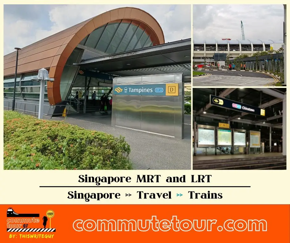
Singapore MRT / LRT Map
Singapore MRT / LRT Map. You can remove the other lines by tapping the top left corner of the map with arrow and unchecking the box/es.
Click here to search for MRT / LRT Station
Singapore MRT / LRT Map
Click the MRT / LRT Line below for more details.
MRT
LRT
Monorail
Cross Border
Featured
Click the time stamps below